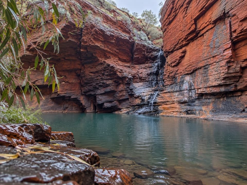
Mount Meharry Summit Walk in Karijini National Park

Karijini National Park, WA

Mount Meharry Summit Walk

A remote 16 km return walk to Western Australia's highest point.

Length
16km
Time
6hr
Elev. change
457m
Difficulty
Challenging
  • No dogs
  • High point 1,239 m
Parkwolf audio tour141 stories across Karijini’s roads

Overview

About Mount Meharry Summit Walk

Why go

  • Reaches Western Australia’s highest summit.
  • Views build across the Pilbara as you climb.

Heads up

  • Land access and a safe starting point need advance confirmation.
  • Long, exposed climb on a rough track with no route facilities.

Map & elevation

The route

Loading the Karijini map
Full map
Elevation782–1,239 m
TrailheadMount Meharry track at Karijini boundary-22.92819, 118.57346
Keep this map with you offline in the Parkwolf app

Plan your hike

Before you go

Parking

No developed lot or fixed visitor trailhead is verified. The 16 km route starts where the Mount Meharry track crosses Karijini’s boundary; the actual stopping point depends on access permission and the vehicle route. The Packsaddle Road pin marks the longer approach, not this walk’s start. Confirm current land access and a safe place to stop with the land manager before travelling.

Safety

This is a remote, exposed climb on a rough vehicle track, with no verified water source on route. Karijini summer temperatures can exceed 40°C. Confirm permission and current access across Juna Downs pastoral/mining land before setting out; carry all water, reliable navigation and emergency gear. Pets are prohibited in the park.

A park ranger sits on a dash-mounted phone, talking, as Parkwolf’s Tour Guide plays “Army Cutworm Moths: A Grizzly Bear Buffet” on Grand Loop Road below Dunraven Pass in Yellowstone
Parkwolf Tour GuideThe highest, rockiest slopes around here are a summer buffet for grizzly bears.

Karijini Tour Guide

Your drive to Mount Meharry Summit Walk, narrated.

Parkwolf is a GPS audio tour guide for Karijini National Park. As you drive, it chimes in with what’s ahead: hidden gems, upcoming stops, history, geology, and wildlife, right through your car’s speakers.

See the Karijini audio tour
  • 141 audio storiesacross Karijini’s roads, triggered by GPS as you drive
  • Wildlife heatmapsfor Dingo, Rock Wallaby, Mulga Snake, and 13 more
  • Works offlinemaps, 22 trails, 30 places, and audio download before you lose signal
  • CarPlay readysimple controls built for the drive
★★★★★
“Fantastic app with many points of information… It’s great to just turn on while you’re driving and it gives you an audio tour of the national Park. We love it!!!!”
JMJamesApp Store review
Download Parkwolf on the App StoreGet Parkwolf on Google Play

4.7 from 8,600+ ratings

Trail guide

Hiking Mount Meharry Summit Walk

The walkMount Meharry Summit Walk is a 16 km out-and-back from Karijini’s boundary to Western…

Mount Meharry Summit Walk is a 16 km out-and-back from Karijini’s boundary to Western Australia’s highest point, following an existing dirt four-wheel-drive track. The mapped walking corridor is about 7.8 km each way; allow around six hours for the return. The climb gains roughly 480 m according to sampled terrain elevations. Choose it if the summit itself matters to you and you’re prepared for a long, rough, remote day; this isn’t a quick lookout stop.

Settle access before travellingThere’s no verified built trailhead or signed visitor car park.

There’s no verified built trailhead or signed visitor car park. The 16 km figure starts where the track crosses Karijini’s boundary. A Packsaddle Road map pin and a 42.7 km return route cover the much longer vehicle approach, while shorter walk figures start farther up the road where visitors can park. Getting to the boundary crosses Juna Downs pastoral and mining land, and current permission and contact details haven’t been confirmed. Check permission and a safe place to stop with the current land manager before driving in. Normal park entry fees apply.

The climbThis is an old vehicle track, not a formed walking path.

This is an old vehicle track, not a formed walking path. The boundary section follows medium-grade dirt before joining a much rougher summit track. Expect a sustained uphill climb on uneven, exposed ground; one walker described the views improving steadily with height. An elevation model suggests about 480 m of ascent from the boundary. Allow for the full boundary-start distance even if another account describes a shorter walk from a more advanced parking spot.

At the topThe goal is the open summit area, where older visitor accounts describe a cairn and a sign.

The goal is the open summit area, where older visitor accounts describe a cairn and a sign. Their current condition isn’t confirmed. On a clear day, the reward is a broad look over the surrounding Pilbara ridges. Clouds and rain can hide that panorama, so the summit achievement is the more dependable payoff than a guaranteed view. There’s no marked viewpoint or separate summit spur in the mapped route.

The name and the high pointThe mountain is also known by the Panyjima name Wirlbiwirlbi.

The mountain is also known by the Panyjima name Wirlbiwirlbi. Its English name honours William Thomas Meharry, Western Australia’s Chief Geodetic Surveyor; surveys identified the peak as the state’s highest in 1967. Published elevations differ: a summit marker has shown 1,248 m, while the Geoscience Australia gazetteer figure is 1,253 m. The terrain model used for this route reads lower at the endpoint, so treat exact heights as survey-dependent.

Ancient ridgesKarijini’s Hamersley Range is known for banded iron formations that began as iron- and…

Karijini’s Hamersley Range is known for banded iron formations that began as iron- and silica-rich sediments on an ancient sea floor more than 2.5 billion years ago. Later compression, folding, uplift and erosion shaped the red ridges around the summit. That’s useful context for the layered rock underfoot, though the park’s geology guide describes the wider range rather than a summit-specific study.

Plan for a remote dayNo food, water, toilets or developed parking were found at this route or a fixed trailhead;…

No food, water, toilets or developed parking were found at this route or a fixed trailhead; services at Karijini’s visitor centre and gorge areas are separate stops. Summer temperatures in the park often exceed 40°C, and the climb is exposed. Carry all water and dependable navigation and emergency gear. Pets aren’t allowed in Karijini National Park.

Wildlife

Wildlife in Karijini

All Karijini wildlife maps

Sighting maps show where each species has been reported across Karijini. Wildlife moves, so no sighting is guaranteed.

Parkwolf’s Karijini ranking

Top-rated trails in Karijini

All 22 trails
  1. 1Bilungunha (Hancock Gorge), Kermits PoolChallenging · 1.5 km
  2. 2Punurrunha Summit (Mount Bruce)Challenging · 9 km
  3. 3Lower Weano Gorge, Handrail PoolChallenging · 1.2 km
  4. 4Dales Gorge LoopModerate · 2.8 km
  5. 5Jubula (Fortescue Falls)Moderate · 0.8 km
  6. 6Jubura (Fern Pool)Moderate · 1.4 km

Take Parkwolf to Karijini.

The audio tour guide for the drive, plus offline maps, trails, and wildlife heatmaps for when the signal drops.

4.7 from 8,600+ ratings

Download Parkwolf on the App StoreGet Parkwolf on Google Play