Download once.
Lose signal happily.
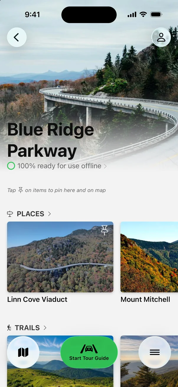
Cell service comes and goes along the Parkway. Save it all before you leave town.
 Parkwolf
4.7
8.6K ratings
Parkwolf
4.7
8.6K ratings

Self-guided GPS audio tour
A self-guided driving tour: stories and insider tips play on their own as each stop comes into view.
★★★★★ 4.7 · 8,600+ ratings Works offline

On your computer? Scan with your iPhone camera to open Parkwolf in the App Store. Also on Google Play.
Hear the guide
This is the real narration from Parkwolf’s Blue Ridge Parkway tour. It starts on its own as you approach each stop, so you never tap or read while driving.
“…For that classic postcard photo of the bridge curving around the mountain, you’ll need to go to the Yonahlossee Overlook, which is just north of the viaduct.”
South of Asheville, narrated
Three real lines from the narration, each with the app’s tip for that stop, in the order you’ll reach them driving south from Asheville past Mount Pisgah.

“While this is the spot for the view, the actual trail to the summit of Looking Glass Rock begins somewhere else, off the Parkway.”
App tip Shoot in late afternoon or after rain for the best look and light.

“For a fantastic and quick reward, take the short trail to Lower Falls; it’s a beautiful spot and a popular swimming hole on warm days.”
App tip Arrive early or on weekdays—parking fills fast and enforcement is strict.

“The path is about a half-mile, mostly paved, and it’ll definitely get your heart rate up, but the payoff is huge.”
App tip If the Parkway is in the clouds, wait for clearing before hiking.
+ 276 more stories along all 469 miles: the Linn Cove Viaduct, Craggy Gardens, Mount Pisgah, Waterrock Knob, Linville Falls, Mabry Mill, Peaks of Otter, Humpback Rocks, the tunnels, when to catch peak fall color and more.
The real app, on a real drive
Every overlook, trailhead and waterfall pullout ahead, so you can signal in time.
Narration plays as you approach, then gets out of the way for quiet stretches.
Always on screen, always counting down. Gas stations are all off the Parkway.
Every overlook, trail and story on the Parkway works with zero bars.
Real screen recording, in real time, on the Blue Ridge Parkway.
No edits, no speed-up: this is what you see and hear driving to Looking Glass Rock Overlook.Self-guided, in your own car
Parkwolf
Beyond the audio tour
Cell service comes and goes along the Parkway. Save it all before you leave town.
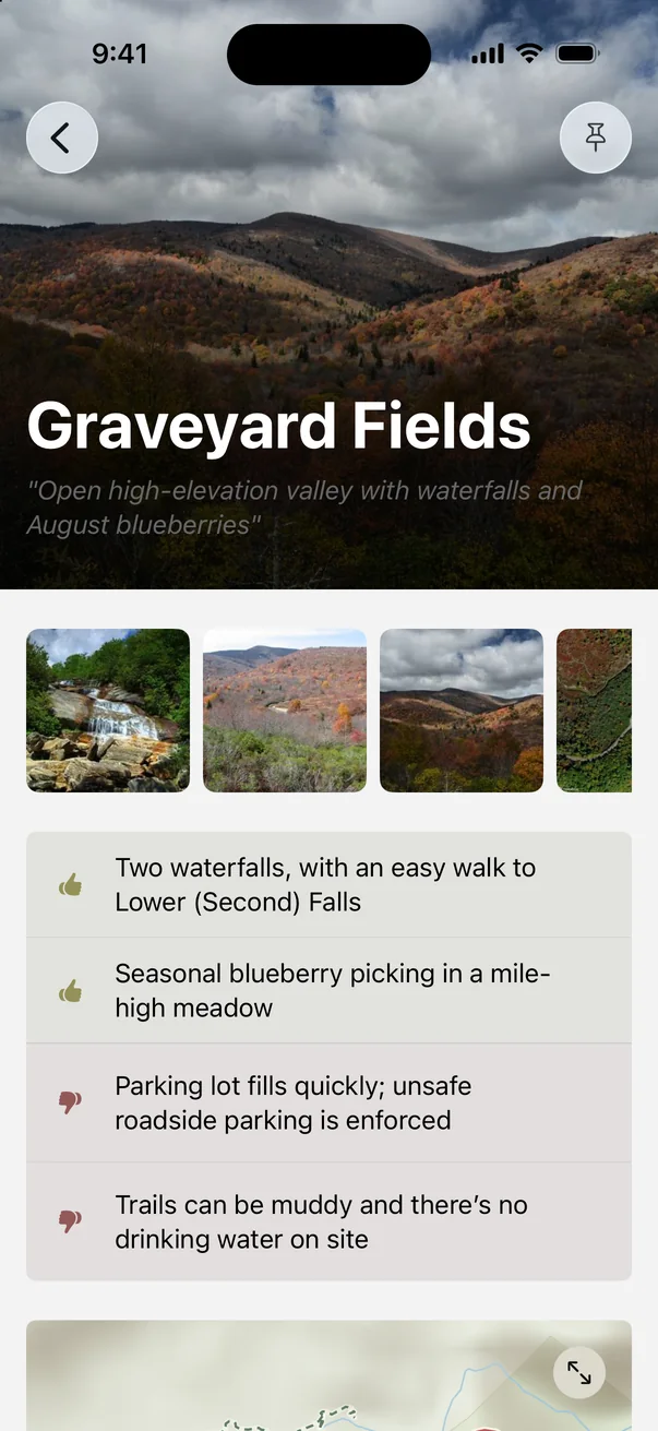
Graveyard Fields’ falls are an easy walk, but the lot fills fast and there’s no water.
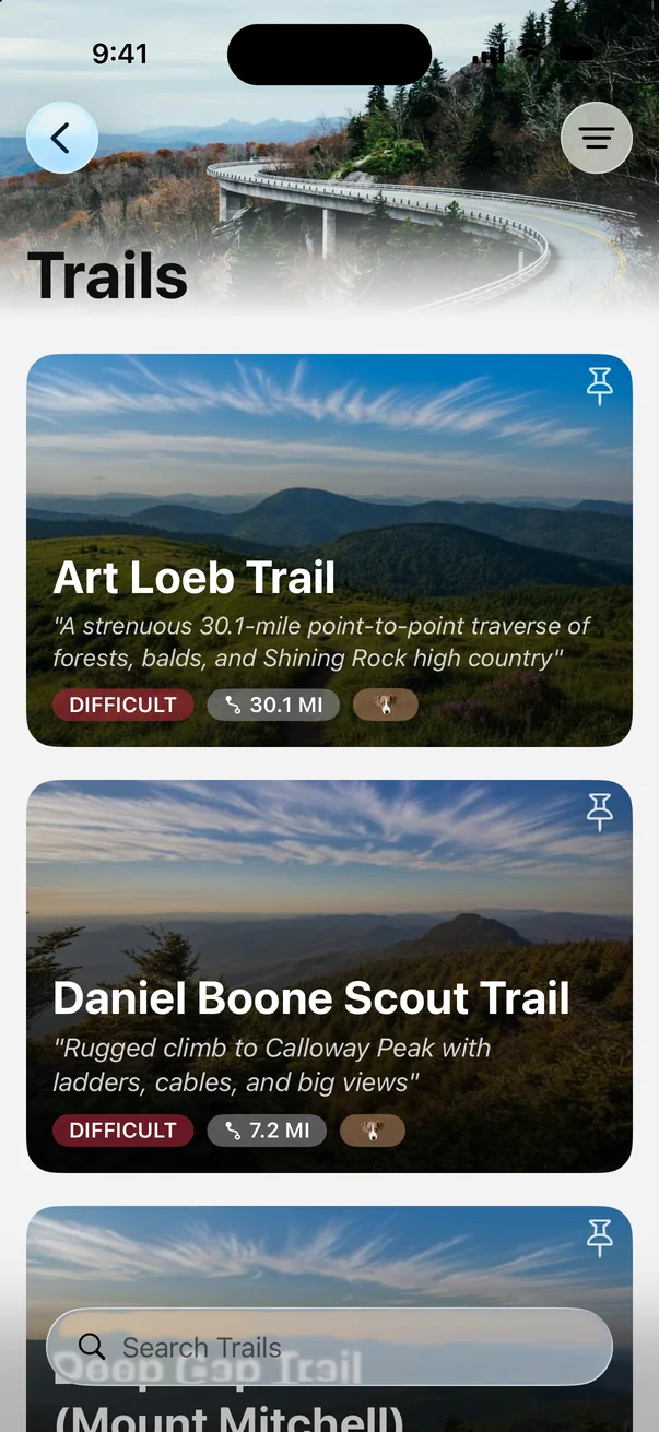
Art Loeb, Daniel Boone Scout, Devil’s Courthouse: difficulty and distance at a glance.
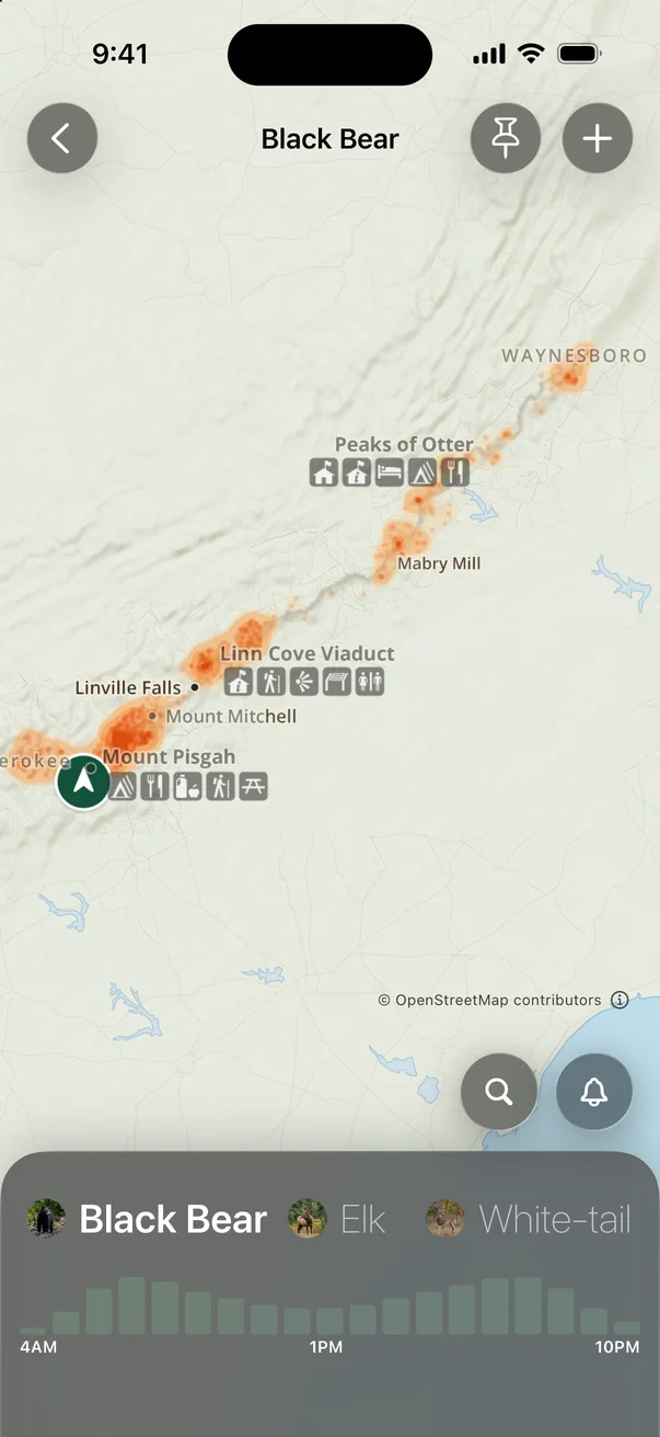
Heatmaps and peak hours for each animal, from black bears to wild turkeys.
Start the tour from your car’s screen. Stories play through your speakers.
Overlooks, waterfalls, lodges and historic mills, each with real tips.
From the App Store
“I got an ad while on my trip in Asheville. We knew we wanted to drive the Blue Ridge Parkway. The narration was impeccably timed… Our phones were in SOS mode and the app worked perfectly.”
“We drove the entire length of the Going-to-the-Sun Road with no cell service for the majority and this app gave us information as we approached areas…”
“It chimes in about sites youre passing and general information about the park. The voice is pleasant to listen to and has the right balance of information and quiet time.”
“We have been using this app offline, and it has been great. The mapping is excellent especially without service. We have been driving around with the audio tour and it has been informational and spot on.”
Good to know
Open Parkwolf, tap Start Tour Guide and drive. Your phone’s GPS triggers each story as you approach an overlook, trailhead, pullout or hidden spot. There’s no set route, so take any road in any order.
Yes. Every overlook and stop has the app’s tips on timing, parking and crowds, and every trail lists its distance, climb and time, so you can plan your Blue Ridge Parkway road trip before you go. Then the guide narrates it as you drive.
Yes. Download the Blue Ridge Parkway before you go and the map, the narration and every tip work offline, even where your phone shows no bars.
All 469 miles of the Parkway, from Afton and Humpback Rocks through Peaks of Otter, Mabry Mill, Doughton Park, the Linn Cove Viaduct, Linville Falls, Craggy Gardens and Asheville to Mount Pisgah, Graveyard Fields, Waterrock Knob and Cherokee: 279 stories in all.
Parkwolf is free to download. The Tour Guide is part of Parkwolf PRO, which starts with a free trial, and one subscription covers everyone listening in your car.
Both. Parkwolf works with Apple CarPlay, and it’s available on Google Play for Android.
Yes. The same guide covers 100+ national parks, state parks and scenic drives, from Yellowstone to the Road to Hana.

Free to download. Your guide starts talking the moment you start driving.
Free on the App StoreGet the Blue Ridge Parkway tourOn Android? Get Parkwolf on Google Play