Download once.
Lose signal happily.
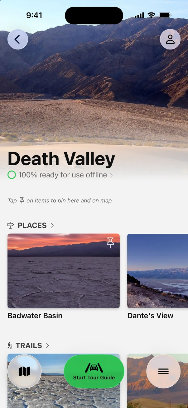
Most of Death Valley has no cell service. Save the whole park before you drive in.
 Parkwolf
4.7
8.6K ratings
Parkwolf
4.7
8.6K ratings

Self-guided GPS audio tour
A self-guided driving tour: stories and insider tips play on their own as each stop comes into view.
★★★★★ 4.7 · 8,600+ ratings Works offline

On your computer? Scan with your iPhone camera to open Parkwolf in the App Store. Also on Google Play.
Hear the guide
This is the real narration from Parkwolf’s Death Valley tour. It starts on its own as you approach each stop, so you never tap or read while driving.
“…to see the really incredible geometric salt polygons, you have to keep walking, sometimes quite a ways out onto the flats, past where most people stop.”
Badwater Road, narrated
Three real lines from the narration, each with the app’s tip for that stop, in the order you’ll reach them heading south from Furnace Creek.

“While many people just check out the main overlook, the real treat is that this is also a trailhead.”
App tip Arrive 30–45 minutes before sunrise to claim a front‑row spot.

“It’s a fun road with lots of twists and dips, so vehicles over 25 feet aren’t allowed.”
App tip Don’t stop at the first viewpoint; continue to the signed lot with the restroom and placard.

“To see the really incredible geometric salt polygons, you have to keep walking, sometimes quite a ways out onto the flats, past where most people stop.”
App tip If the surface looks damp or soft, avoid it; the salt crust can be thin over mud.
+ 129 more stories across Death Valley: Dante’s View, Golden Canyon, Mesquite Flat Sand Dunes, Mosaic Canyon, Ubehebe Crater, the Racetrack, Harmony Borax Works, where to fuel up, and how to handle the heat.
The real app, on a real drive
Every overlook, trailhead and turnoff ahead, so you can signal in time.
Narration plays as you approach, then gets out of the way for quiet stretches.
Always on screen, always counting down. Out here, knowing where the next gas is matters.
Death Valley’s roads, trails and every story work with zero bars.
Real screen recording, in real time, on Highway 190.
No edits, no speed-up: this is what you see and hear driving to Zabriskie Point.Self-guided, in your own car
Parkwolf
Beyond the audio tour
Most of Death Valley has no cell service. Save the whole park before you drive in.
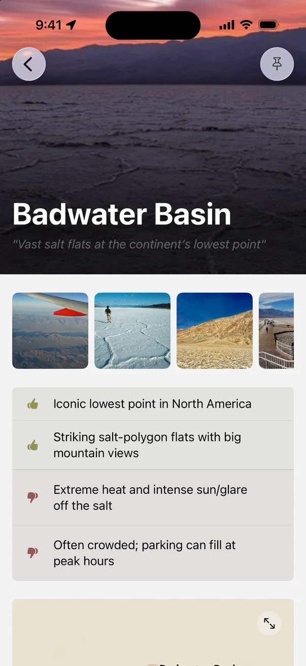
Badwater is iconic, with extreme heat and glare off the salt. Know before you step out.
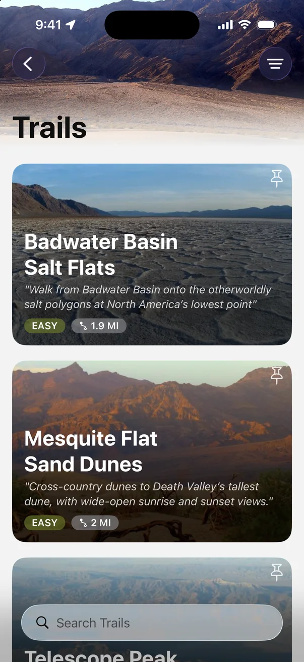
Badwater’s salt flats, the dunes, Telescope Peak: difficulty and distance at a glance.
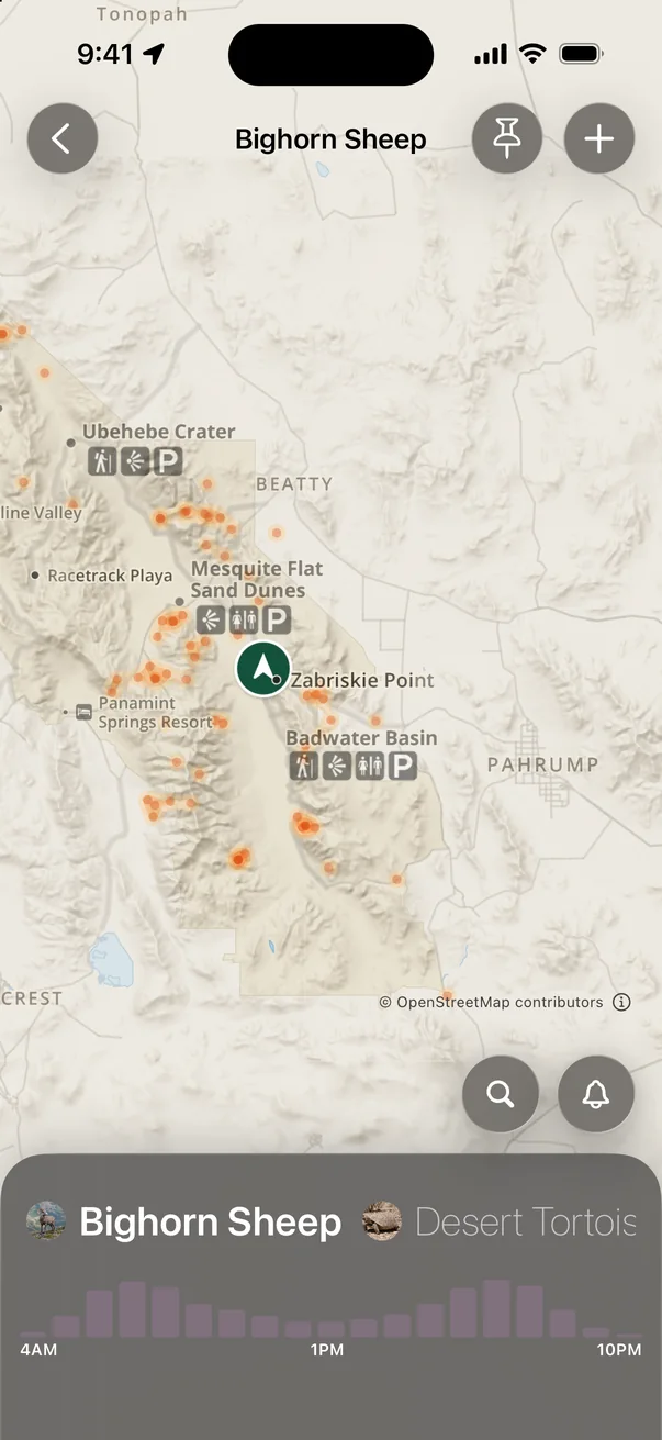
Heatmaps and peak hours for each animal, from bighorn sheep to desert tortoises.
Start the tour from your car’s screen. Stories play through your speakers.
Overlooks, canyons, ghost towns and gas stops, each with real tips.
From the App Store
“We have used the app for Death Valley, Yosemite, Lassen and Crater Lake. We have enjoyed the short audio clips of info from each park and always look forward to the next one.”
“It’s great to just turn on while you’re driving and it gives you an audio tour of the national Park. We love it!!!!”
“It lets you know upcoming features and in time to actually turn in to see them.”
“No cell service for majority of the day but had continuous access to the app - the maps, the tour guide as you drive is amazing.”
Good to know
Open Parkwolf, tap Start Tour Guide and drive. Your phone’s GPS triggers each story as you approach an overlook, trailhead, pullout or hidden spot. There’s no set route, so take any road in any order.
Yes. Many visitors drive in from Las Vegas, about two hours away, so download the park before you leave town. Every stop has the app’s tips on timing, heat and crowds, and every trail lists its distance, climb and time, so you can plan your day. Then the guide narrates it as you drive.
Yes. Download Death Valley before you go and the map, the narration and every tip work offline, even where your phone shows no bars.
Highway 190 and Badwater Road, Furnace Creek, Zabriskie Point, Artists Drive, Stovepipe Wells and the dunes, Panamint Springs, and backcountry routes like Titus Canyon and the Racetrack: 132 stories in all.
Parkwolf is free to download. The Tour Guide is part of Parkwolf PRO, which starts with a free trial, and one subscription covers everyone listening in your car.
Both. Parkwolf works with Apple CarPlay, and it’s available on Google Play for Android.
Yes. The same guide covers 100+ national parks, state parks and scenic drives, from Yellowstone to the Blue Ridge Parkway.

Free to download. Your guide starts talking the moment you start driving.
Free on the App StoreGet the Death Valley tourOn Android? Get Parkwolf on Google Play