
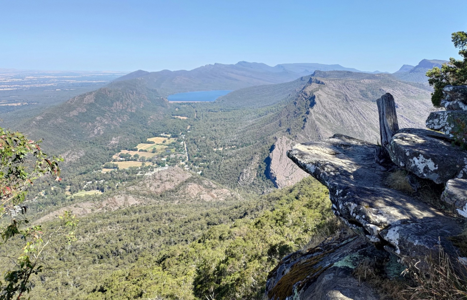
Grampians National Park

Grampians National Park, VIC

Grampians alerts

3 current alerts from the park.

Alerts
3
Closures
3

Hear the audio tour

MacKenzie Falls: Choose Your Walk

ClosureUpdated

Grampians roads and tracks closed or impassable

Several Grampians roads and tracks are closed; check current conditions and obey closure signs before driving. Parks Victoria cites bushfire and weather impacts for temporary road closures.

  • Syphon Road is closed for major roadworks until further notice. Gravel trucks use Red Hill Road and Glenelg River Road between Red Hill Road and Syphon Road to haul gravel into Syphon Road and return; drive cautiously and follow closure and heavy-truck signs.
  • Most seasonal roads are open, but Fields Track; Goats Track (Victoria Range Track to Syphon Track); Launders Track; Matthew Track; Moora Moora Track (Glenelg River Road to Sanders Track); and Mount Cassell Fireline remain closed.
  • Wallaby Rocks Track, between Rose Creek Road and Asses Ears Road, is closed and impassable because sections are wet and boggy. Henham Track South, between Serra Road and Victoria Valley Road, is closed and impassable because of severe washouts.

Check current Grampians road and park conditions before travelling.

ClosureUpdated

Mackenzie Falls precinct closed for construction

The Mackenzie Falls precinct is closed to all visitors and vehicles during construction; do not enter the carpark or precinct walks. Construction is building a new viewing platform at the falls base, upgrading the carpark and Bluff Lookout Walk, and improving tracks and stabilising rock as safety improvements.

  • The closure includes Broken Falls Walk, Mackenzie Falls Walk to the base from the carpark, Bluff Lookout Walk, and parts of Mackenzie Falls River Walk. The carpark is a construction site with large machinery and stored materials; Parks Victoria anticipates the works will finish by the end of 2026.
  • From May 2026 until works are complete, the base of the falls is also inaccessible via the Mackenzie River Walk from Zumsteins Picnic Area. Zumsteins parking is limited, especially for buses and caravans on weekends and holiday periods.
  • The return walk from Zumsteins to Fish Falls remains an option (Grade 3, 1.5–2 hours); walkers should have reasonable fitness, carry water and wear sturdy shoes for rocky, uneven and steep sections. Reeds Lookout, the Balconies, Boroka Lookout, Silverband Falls and walks with large bus parking remain available.

Check current Mackenzie Falls conditions before travelling.

ClosureUpdated

Bushfire-damaged walks and visitor sites closed

Red Gum Walk, The Fortress Walk and hike-in campground, The Chimney Pots Walk, Mafeking Picnic Area and Brownings Loop Walk remain closed because of damage from the 2024/25 summer bushfires. Do not enter these closed sites.

  • Parks Victoria advises visitors seeking alternative walks in the park’s western section to visit Brambuk the National Park and Cultural Centre in Halls Gap or call 03 8427 2058.

Check current Grampians park conditions before travelling.

A park ranger sits on a dash-mounted phone, talking, as Parkwolf’s Tour Guide plays “Army Cutworm Moths: A Grizzly Bear Buffet” on Grand Loop Road below Dunraven Pass in Yellowstone
Parkwolf Tour GuideThe highest, rockiest slopes around here are a summer buffet for grizzly bears.

Grampians Tour Guide

Grampians, narrated.

Parkwolf is a GPS audio tour guide for Grampians National Park. As you drive, it chimes in with what’s ahead: hidden gems, upcoming stops, history, geology, and wildlife, right through your car’s speakers.

See the Grampians audio tour

Recorded for this place

MacKenzie Falls: Choose Your Walk
0:00 / 0:35
“You're coming up on MacKenzie Falls, where water drops over dark rock into a deep pool all year. For the close-up spray, take the base walk, but allow an hour to an hour and a half.”

Plays as you drive up to MacKenzie Falls (Migunang wirab) in the Parkwolf Grampians Tour Guide.

More stories near here in the app

  • A New Way Through the Gorge
  • Smiths Mill: Camp Among the Stringybarks
  • The Diver on the Dead Branch
  • A Bee That Shakes Out the Pollen
  • 233 audio storiesacross Grampians’s roads, triggered by GPS as you drive
  • Wildlife heatmapsfor Short-beaked Echidna, Powerful Owl, Wedge-tailed Eagle, and 13 more
  • Works offlinemaps, 82 trails, 63 places, and audio download before you lose signal
  • CarPlay readysimple controls built for the drive
★★★★★
“Fantastic app with many points of information… It’s great to just turn on while you’re driving and it gives you an audio tour of the national Park. We love it!!!!”
JMJamesApp Store review
Download Parkwolf on the App StoreGet Parkwolf on Google Play

4.7 from 8,600+ ratings

Take Parkwolf to Grampians.

The audio tour guide for the drive, plus offline maps, trails, and wildlife heatmaps for when the signal drops.

4.7 from 8,600+ ratings

Download Parkwolf on the App StoreGet Parkwolf on Google Play