
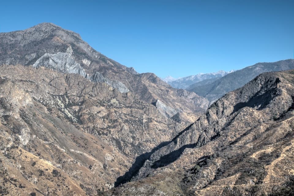
Kings Canyon National Park

Kings Canyon National Park, CA

Kings Canyon alerts

8 current alerts from the park.

Alerts
8
Closures
3
Cautions
5

Hear the audio tour

General Grant Tree and Grant Grove

CautionUpdated

Stage 1 fire restrictions

Stage 1 fire restrictions are active because high fire danger raises the risk of accidental human-caused fires that could threaten visitors and employees.

  • Wood and charcoal fires, including wood-burning stoves, are prohibited in developed campgrounds at 3,000 feet and below (including South Fork, Potwisha, and Buckeye Flat), at Hospital Rock and Ash Mountain/Foothills picnic areas, and in wilderness below 6,000 feet; year-round elevation- and site-specific wilderness restrictions also apply.
  • Smoking below 6,000 feet is prohibited, except inside an enclosed vehicle, in a building where smoking is allowed, in a campground or picnic area where wood and charcoal fires are allowed, or in a designated smoking area.
  • Gas, propane, alcohol, and tablet/cube stoves are permitted.

Check current fire restrictions before traveling.

ClosureUpdated

Grant Grove trails and areas closed for prescribed fire

Some trails and areas around Grant Grove and the General Grant Tree are closed during an active prescribed burn; stay out until crews clear hazards and reopen them.

  • The burn is planned to restore the historical fire-return interval, support giant sequoia regeneration, and reduce catastrophic-wildfire risk. Smoke and flame may be visible; smoke can affect visibility and air quality.
  • Closures include the Grant Grove Day Ride Loop Trail, General Grant Tree Trail, North Grove Loop Trail, Grant Tree Road, and portions of the Sunset Trail. The park says areas will reopen after hazards are cleared and conditions are safe for the public.

Check current park conditions before visiting Grant Grove.

CautionUpdated

Mineral King Road construction closures and delays

Construction on Mineral King Road is causing daily closures and delays, restricting vehicle access to Mineral King through October 28, 2026.

  • Work sites may move day to day and may include campgrounds, trailheads, or private inholdings; visitors must pass through the construction zone to reach the area.
  • Monday–Thursday: delays of up to 30 minutes 7–10 a.m. and 4–7 p.m.; full closure 10 a.m.–4 p.m.
  • Friday–Sunday: no closures or delays 7–8 a.m.; closed 8 a.m.–7 p.m., with vehicle passthroughs at 10 a.m., 1 p.m., and 4 p.m. Be at a closure point at a passthrough time to be guaranteed passage.
  • No closures or delays are scheduled before 7 a.m. or after 7 p.m. The road is scheduled to close for winter on October 28. This work does not affect access through Sequoia’s main entrance near Three Rivers.

Check current road construction information before traveling.

CautionUpdated

Weekday hazard-tree delays on Generals Highway

Hazard-tree removal is causing weekday traffic delays on Generals Highway between Highway 180 and Giant Forest, with up to 30 minutes of delay total.

  • Delays are expected weekdays, 8 a.m.–5 p.m. There are no delays on federal holidays.

Check current road conditions before traveling.

ClosureUpdated

Crystal Cave Road closed for the season

Crystal Cave Road is closed for the season, so vehicles cannot reach the cave trailhead; it is expected to reopen in spring 2027.

  • The road is open only during daytime on dates when cave tours are offered and is always closed at night. When it reopens, drive slowly: sections remain rough after damage from the 2021 KNP Complex Fire and flooding during extreme storms in winter 2022–2023.

Check current road conditions before planning a visit.

ClosureUpdated

South Fork Campground closed; access limited

South Fork Campground is closed, and vehicles cannot reach the old trailhead parking area because past floods and landslides damaged South Fork Road.

  • South Fork Road is open to public access after repairs, but it is unpaved and high-clearance vehicles are recommended.
  • Trails in the South Fork drainage are not currently passable to stock.

Check current road conditions before traveling.

CautionUpdated

North Fork Road rough; high clearance recommended

High-clearance vehicles are strongly recommended on North Fork Road; low-clearance vehicles are not recommended.

  • The last several miles are narrow with many blind curves, and the final section near North Fork Trailhead has deep, wide ruts.

Check current road conditions before traveling.

CautionUpdated

Redwood Mountain Road rough after fire damage

Redwood Mountain Road is open but rough in places because the 2021 KNP Complex wildfire caused tread damage and tree hazards.

  • Temporary repairs are in place. Low-clearance vehicles may park at Quail Flat, and hikers can walk down the road to reach Redwood Canyon Trail.

Check current road conditions before traveling.

A park ranger sits on a dash-mounted phone, talking, as Parkwolf’s Tour Guide plays “Army Cutworm Moths: A Grizzly Bear Buffet” on Grand Loop Road below Dunraven Pass in Yellowstone
Parkwolf Tour GuideThe highest, rockiest slopes around here are a summer buffet for grizzly bears.

Kings Canyon Tour Guide

Kings Canyon, narrated.

Parkwolf is a GPS audio tour guide for Kings Canyon National Park. As you drive, it chimes in with what’s ahead: hidden gems, upcoming stops, history, geology, and wildlife, right through your car’s speakers.

See the Kings Canyon audio tour

Recorded for this place

General Grant Tree and Grant Grove
0:00 / 0:32
“You're approaching Grant Grove's General Grant Tree, the world's second-largest tree by trunk volume. This is a stop I'd keep even on a short visit.”

Plays as you drive up to General Grant Tree in the Parkwolf Kings Canyon Tour Guide.

More stories near here in the app

  • Grant Grove Village
  • North Boundary and Lone Pine Loop
  • The Bird That Plants Pines
  • Panoramic Point
  • 55 audio storiesacross Kings Canyon’s roads, triggered by GPS as you drive
  • Wildlife heatmapsfor Black Bear, Mule Deer, Marmot, and 13 more
  • Works offlinemaps, 77 trails, 61 places, and audio download before you lose signal
  • CarPlay readysimple controls built for the drive
★★★★★
“…The kids and my husband and I all agree that the narration really added to our experience driving through the parks. We learned so much about the history and the flora & fauna.”
JessestblondeApp Store review
Download Parkwolf on the App StoreGet Parkwolf on Google Play

4.7 from 8,600+ ratings

Take Parkwolf to Kings Canyon.

The audio tour guide for the drive, plus offline maps, trails, and wildlife heatmaps for when the signal drops.

4.7 from 8,600+ ratings

Download Parkwolf on the App StoreGet Parkwolf on Google Play