
Place
Easy
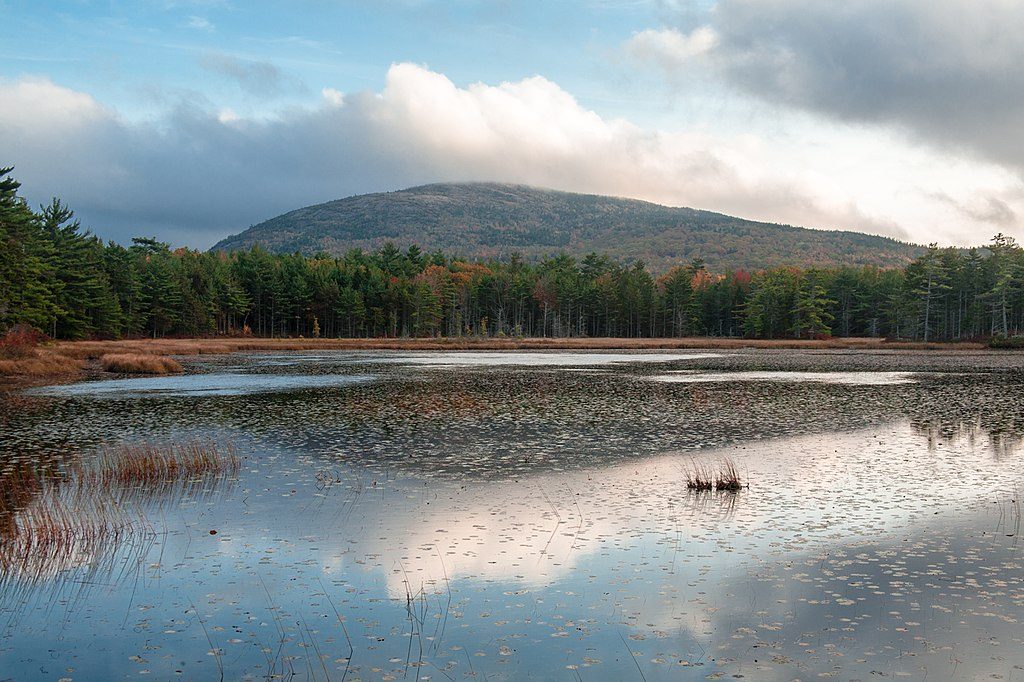
Aunt Betty Pond Trail is really about the carriage-road experience: wide, crushed-stone surfaces, gentle grades, and a calm, woodsy vibe that dodges Acadia’s crowds. The payoff is a secluded, marshy pond ringed by reeds and aquatic vegetation—peaceful more than dramatic.
The main route here is the Aunt Betty Pond Carriage Road, commonly done as a 6.1-mile loop (total). Some visitors instead treat it as roughly a 5-mile out-and-back. Either way, expect easy footing and light multi-use traffic (hikers, bikers, and horses). Grades are gentle overall, though there’s a noticeable climb heading back from the pond—cyclists will feel it.
You’ll move through mixed forest with occasional openings over wetlands and the pond itself. Aunt Betty Pond is shallow and marshy, with a quiet, out-of-the-way feel. It’s more about subtle beauty than grand vistas. Aquatic life here includes brook trout (fishing is generally poor), banded killifish, minnows, ninespine stickleback, golden shiner, American eel, and white sucker.
It’s accessible year-round, but spring through fall is prime. Summer and early fall bring pleasant temps and lush or colorful foliage; spring is fresh and green. Winter travel is possible, but expect snow/ice and tricky footing near the marsh. After rains, the area can be buggy and muddy—pack repellent and waterproof footwear.
Bring a carriage-road map and stitch together loops—Witch Hole Pond and the Eagle Lake area connect nicely. For a shorter day, use the Park Headquarters parking area and nearby shortcuts to reach the pond faster. These roads were built for non-motorized recreation by John D. Rockefeller, Jr. in the early 20th century. The “Aunt Betty” name’s origin remains unclear, and the pond itself is a classic glacial kettle-style basin. Dogs on leash are allowed on carriage roads.
If you’re chasing solitude and a smooth, quiet stroll or ride, yes. If you want big coastal cliffs and surf, look elsewhere. This is an underrated reset button—forest, water, and easy going without the crowds.
Use the Park Headquarters parking area; shortcuts from here can shorten the approach to the pond.
Shared with bikes and horses; expect a climb on the return from the pond. Bugs and mud can be intense after rain, and winter brings snow and ice.
Place
Place
Place
Place
Challenging
Challenging
Easy
Challenging

Parkwolf Tour Guide
