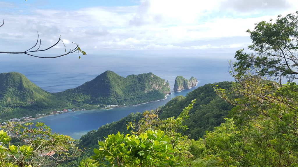
Mount Alava

Ridge hike to the island’s best views above Pago Pago Harbor
Mount Alava, American Samoa National Park
InsideAmerican Samoa National Park

Overview

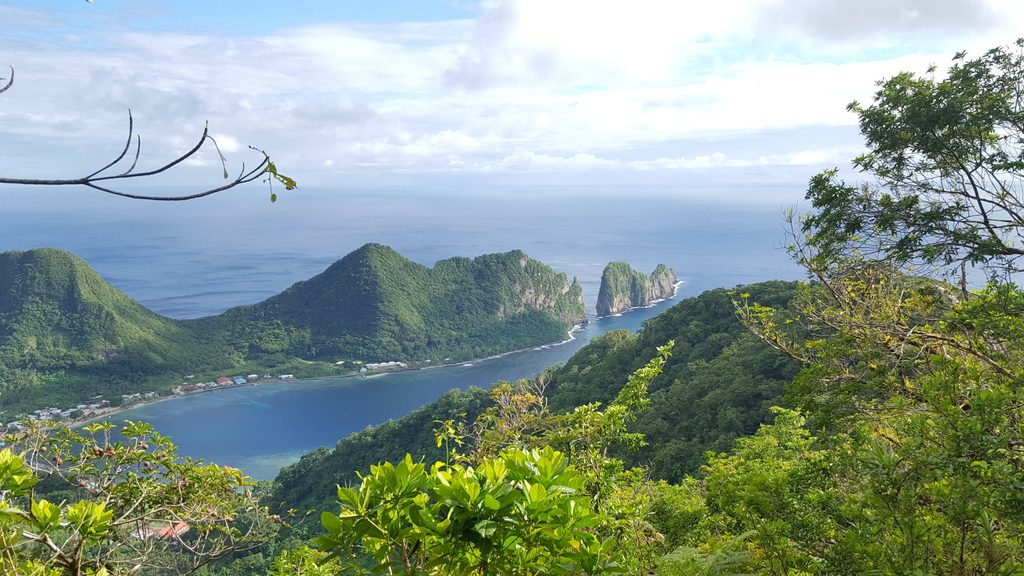
Mount 'Alava rides the ridgeline above Pago Pago and tops out as the highest peak you can summit within the park. It’s beloved for its big island panoramas and a choose-your-own-challenge approach—either a classic ridge hike or a spicy ladder route.

Routes & Difficulty

  • Mount 'Alava Trail (out-and-back): about 7.3 miles and generally takes around 3 hours 55 minutes. It’s challenging and the more social option, with a good chance of seeing other hikers.
  • Mount 'Alava Adventure Trail (loop): about 5.7 miles and rated highly challenging—best for experienced hikers. Expect many ladders (dozens) and steep sections; this side is typically quiet.

Both reach the same summit area, and both are open year‑round. Match the route to your fitness and comfort with exposure and repetitive climbs.

What You’ll See

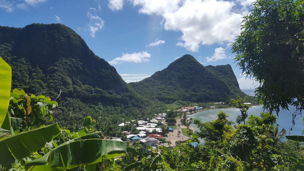
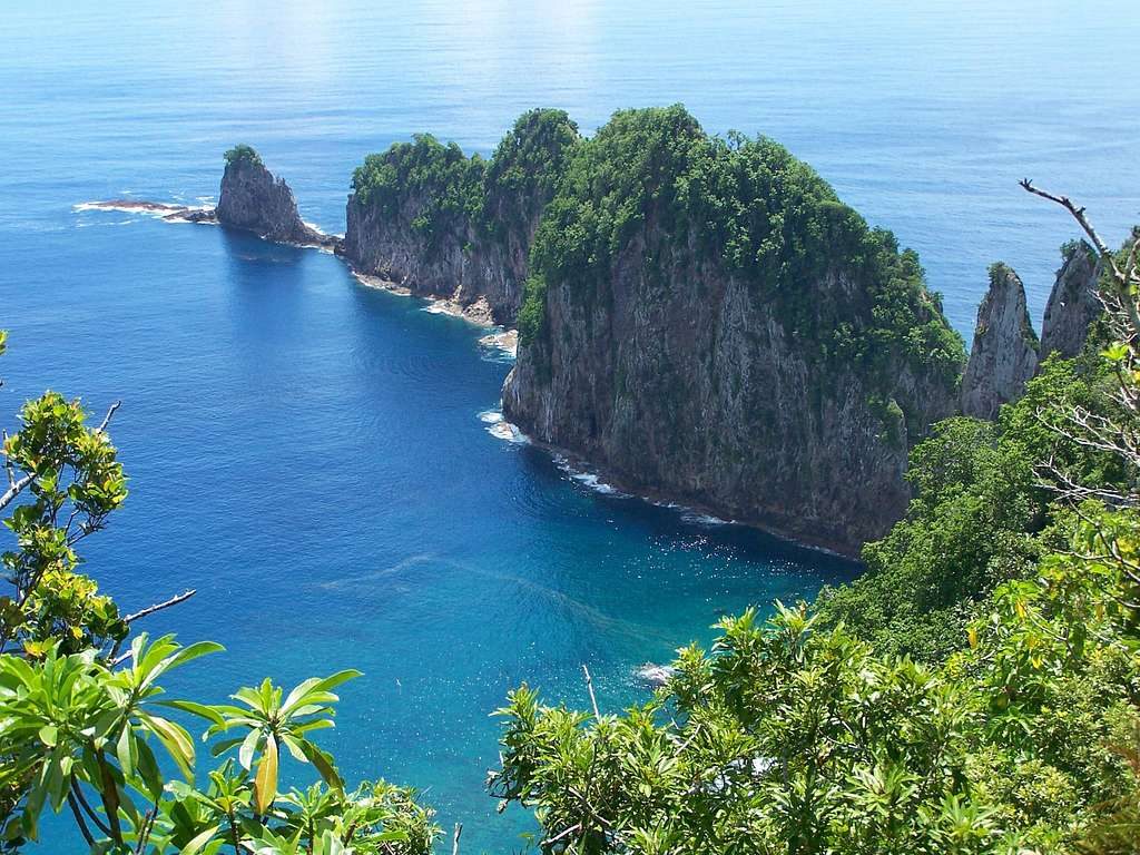
The approach is mostly lush rainforest and ridge walking, with windows of views as the foliage breaks. At the top, you get the postcard look at Pago Pago Harbor and the rugged emerald ridges that define Tutuila. Birding is a consistent highlight along these trails.

What People Love (and Don’t)

Love: The summit panorama and the satisfying sense of adventure—especially if you take the ladder-heavy loop.

Tradeoffs: Dense jungle can limit views until the summit, and the terrain is steeper and tougher than it looks on a map.

Planning & Safety

  • Start early to beat heat and humidity and to maximize clear views.
  • Bring plenty of water and high‑energy snacks—there’s no water on the route.
  • Wear sturdy, grippy footwear; expect mud, slick roots, and ladder rungs. Lightweight gloves can help on the ladders.
  • Trails are generally marked, but vegetation can obscure the path in places—stay attentive at junctions.
  • There are no restrooms, and parking near trailheads is informal and limited; many hikers arrange drop‑offs.

History & Geology

A broadcast station was built on the summit in the 1964 era, and an aerial tramway once linked the summit across Pago Pago Bay. Geologically, the ridge forms part of the caldera rim of the extinct Pago Volcano, which is why the harbor’s view feels so dramatic.

Best Time to Visit

Year‑round works. Go at sunrise or early morning for cooler temps, softer light, and better odds of clear skies. Weekdays are typically quieter on the standard route; the Adventure Trail is usually uncrowded anytime. If you aim for late‑day light, leave enough time to descend before dark.

Pros

  • Sweeping summit views over Pago Pago Harbor and volcanic ridges
  • Two summit routes: popular out-and-back or ladder-filled Adventure Trail

Cons

  • Steep, demanding terrain; Adventure Trail includes many ladders
  • No water or restrooms and parking is limited/informal

Tips

  • Start at sunrise to beat heat and catch the clearest views.
  • Pick the route that fits your ability; the Adventure Trail is experts-only.
  • Carry at least 2 liters of water per person; there’s no water on the trail.
  • Wear grippy footwear and consider light gloves for the ladders.
  • Arrange a drop-off if you can—parking near trailheads is limited and informal.
The Parkwolf tour guide sitting on a phone mounted in a car

Parkwolf Tour Guide

Like a tour guide in your car.

Save the places you found around American Samoa, then let Parkwolf guide the drive between them.Download Parkwolf on the App Store