Pros & cons
PROS
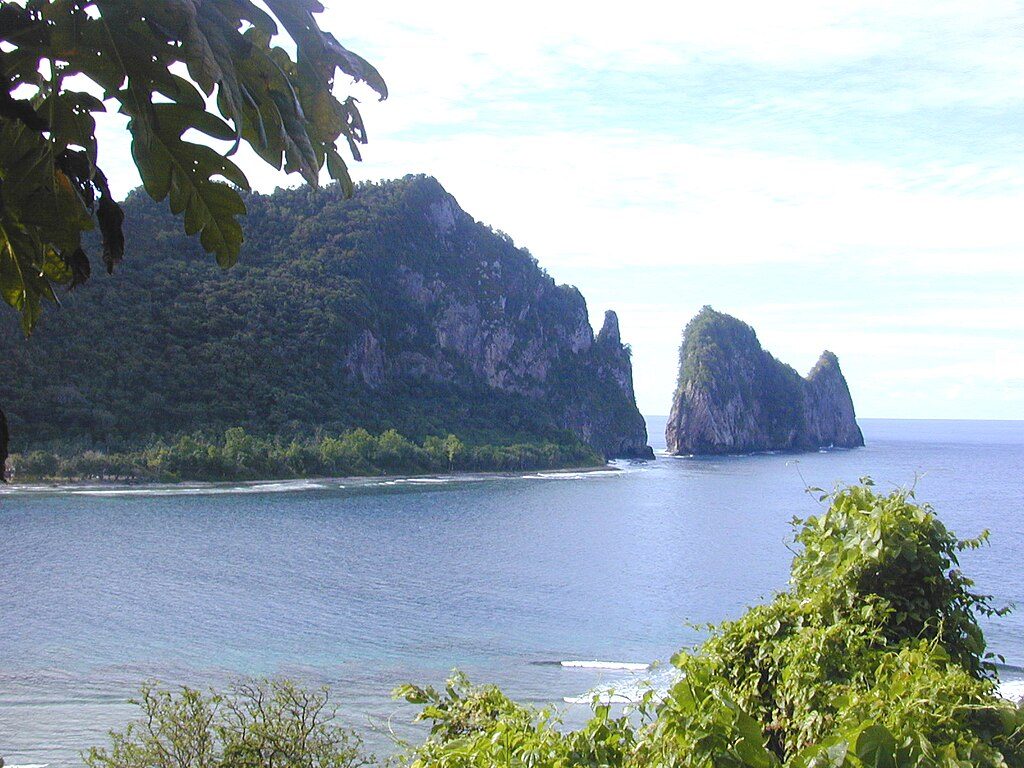
- Iconic cliff-and-sea-stack views of Pola Island
- Reliable seabird watching; fruit bats often overhead
- Short walk from small end-of-road parking area
CONS
- No on-site facilities or services
- Rough, narrow unpaved access road near the end
Overview
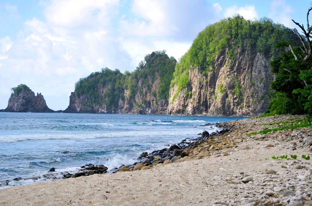
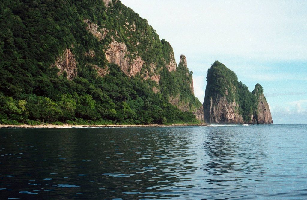
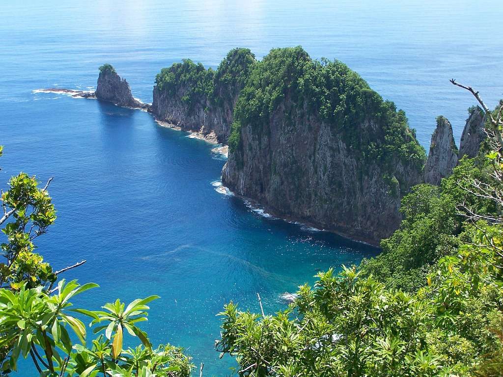
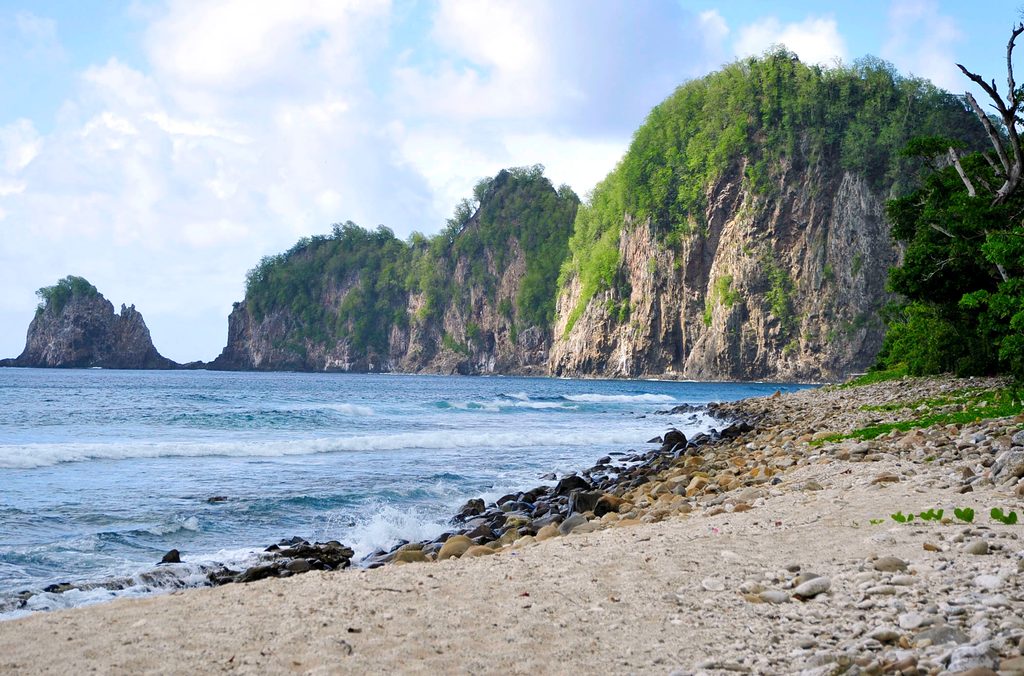
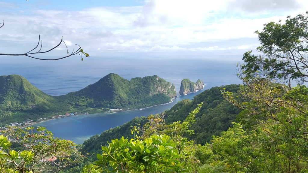
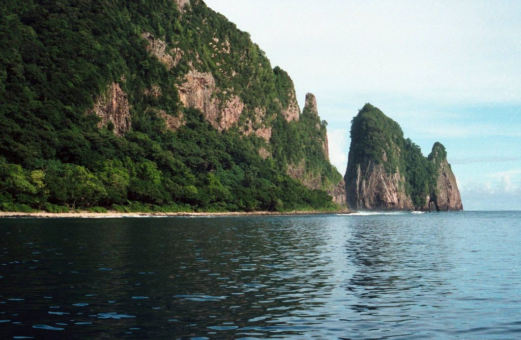
Vaiʻava Strait is the narrow, blue-water channel separating Tutuila’s north coast from the soaring Pola formation by the village of Vatia. The volcanic sea cliffs here—topped with lush vegetation and punctuated by Pola Tai—make this one of the park’s signature coastal scenes. It’s also a designated National Natural Landmark for its geology and biodiversity.
What You’ll See
- Sheer sea cliffs, ocean arches, and the toothy profile of Pola Island across the strait.
- Wide Pacific vistas with deep blues and crashing surf, framed by jungle-clad ridges.
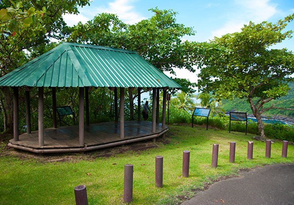
- Interpretive displays near the shoreline approach that set the scene before a short walk to the viewpoint.
Wildlife Highlights
Pola’s cliffs are prime seabird territory—watch for frigatebirds and boobies swirling around the rock face. Overhead, you may spot fruit bats gliding the ridgelines. The surrounding waters are biologically rich, but the shoreline here is rugged; this is a look-and-listen spot more than a swim.
Getting There
Drive scenic Route 006 to Vatia. At the north end of the village, the paved road ends; continue slowly on the one-lane, bumpy track straight ahead to a small parking area by informational panels. From there it’s a very short walk (roughly 100 yards) to the rocky shoreline viewpoint. Alternative angles of the strait and Pola come from nearby ridge trails above Vatia, including the short Lower Sauma Ridge option.
On-the-Ground Experience
Expect a simple, wild overlook: no restrooms, water, or stores, and no direct access to Pola itself. The payoff is intimacy with the landscape—ocean roar, birds riding thermals, and a big-screen view with minimal effort.
Best Time to Visit
This area is effectively open 24/7. Come on a clear weekday morning or late afternoon for softer light on the cliffs and fewer people. Midday sun can be harsh and flatten photos; if clouds hang low, visibility drops and the view loses its pop.
Need to Know
- The final approach is unpaved and narrow—go slow and use a vehicle with some clearance.
- Stay well back from cliff edges and wet rocks; rogue waves and slippery footing are real.
- There’s no fee here, but there are also no services—pack water and snacks.
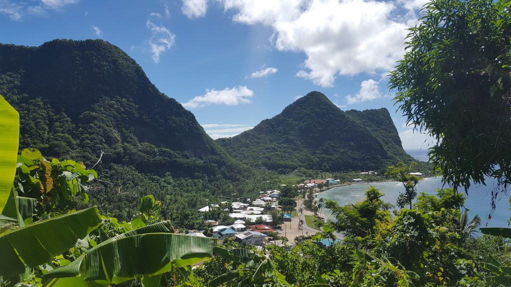
- Respect the quiet vibe in Vatia and local customs as you pass through the village.
Where it is
-14.2383, -170.6712Tips for Vai'ava Strait (Pola Tai)
- 01Drive Route 006 to Vatia and allow extra time for the slow, winding approach.
- 02When pavement ends, continue straight on the one-lane dirt track to the small parking area by the signs.
- 03Bring water, sun protection, and a camera or binoculars—there are no services on site.
- 04Aim for a clear morning or late afternoon for the best color and contrast on Pola.
- 05Keep a respectful distance from cliffs and surf-splashed rocks; footing can be slick.
Amenities
Near Vai'ava Strait (Pola Tai)
All places →All trails →
0.3 mi awayPola IslandSheer sea cliffs and seabirds across the Vaiava StraitTrailhead · Scenic Viewpoint
0.4 mi awayPola Island TrailTiny walk to huge views of Pola’s cliffs and seabirdsEasy · 0.1 mi · 30 min
0.5 mi awayTuafanua TrailShort, jungle climb with ropes to a wild north‑shore coveChallenging · 2.2 mi · 2.5 hr
0.5 mi awayTuafanua Trail OverlookRope-aided rainforest climb to sweeping views and a secluded beachParking · Scenic Viewpoint
0.7 mi awayVatia BayLush, quiet bay beneath Pola Ridge with a cliffside overlookTrailhead · Scenic Viewpoint
1 mi awayLower Sauma Ridge TrailShort rainforest stairs to big ocean views and Vatia’s star mound.Moderate · 0.8 mi · 45 min
1 mi awayPola Island OverlookRoadside window onto Pola Island and the Vaiʻava StraitPullout · Parking
4.2 mi awayMount 'Alava TrailSteep rainforest climb to Pago Pago’s best panoramic ridge viewsChallenging · 7.3 mi · 3.9 hr