
Place · 0 mi away
Moderate
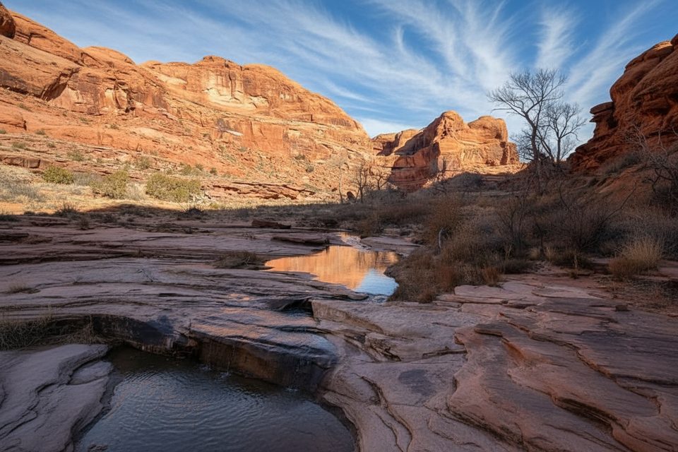
Lower Courthouse Wash is Arches’ left-field pick: a broad, cottonwood-lined canyon with flowing water, slickrock ledges, and a big dose of quiet. It’s a primitive route through the wash bottom—more creek walk than constructed trail—so expect wet feet and a slower pace than the mileage suggests.
This is typically done as a one‑way shuttle from the Arches Scenic Drive crossing to US‑191 near the Colorado River. Plan for about 5.5–6.3 miles one way, largely in the sandy banks and the creek itself. The canyon walls rise and fall around you, cottonwoods throw shade, and you’ll pass clear pools and occasional cascades—refreshing in hot weather. There’s little to no signage; you follow the wash and your judgment.
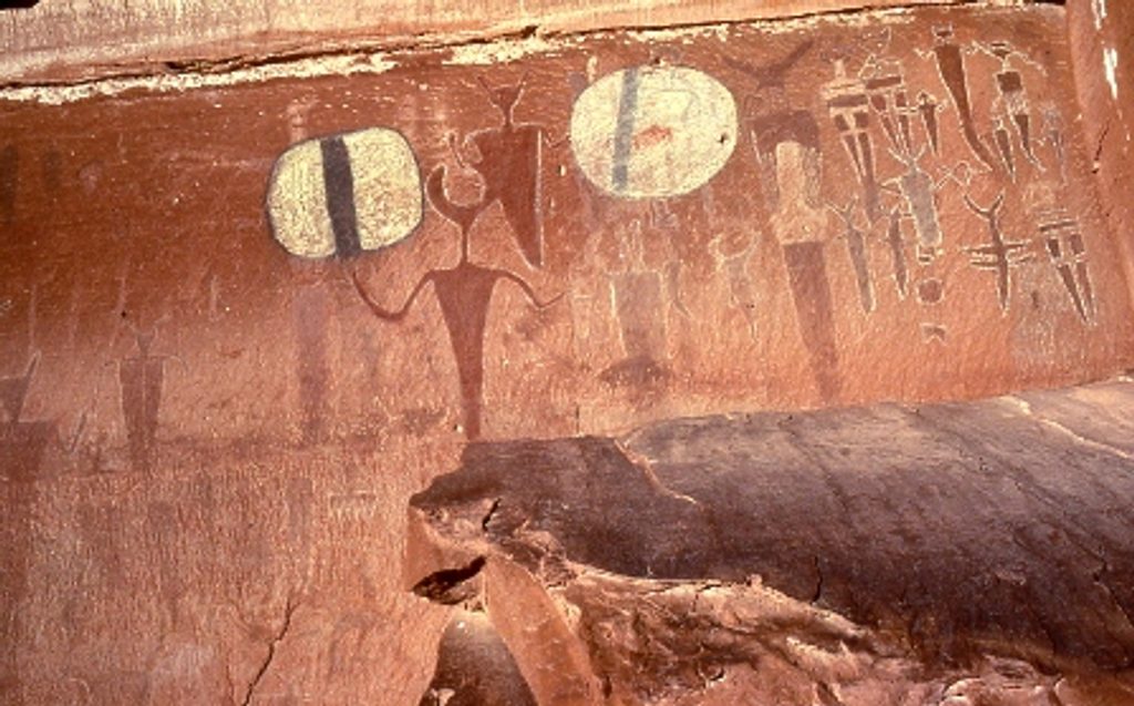
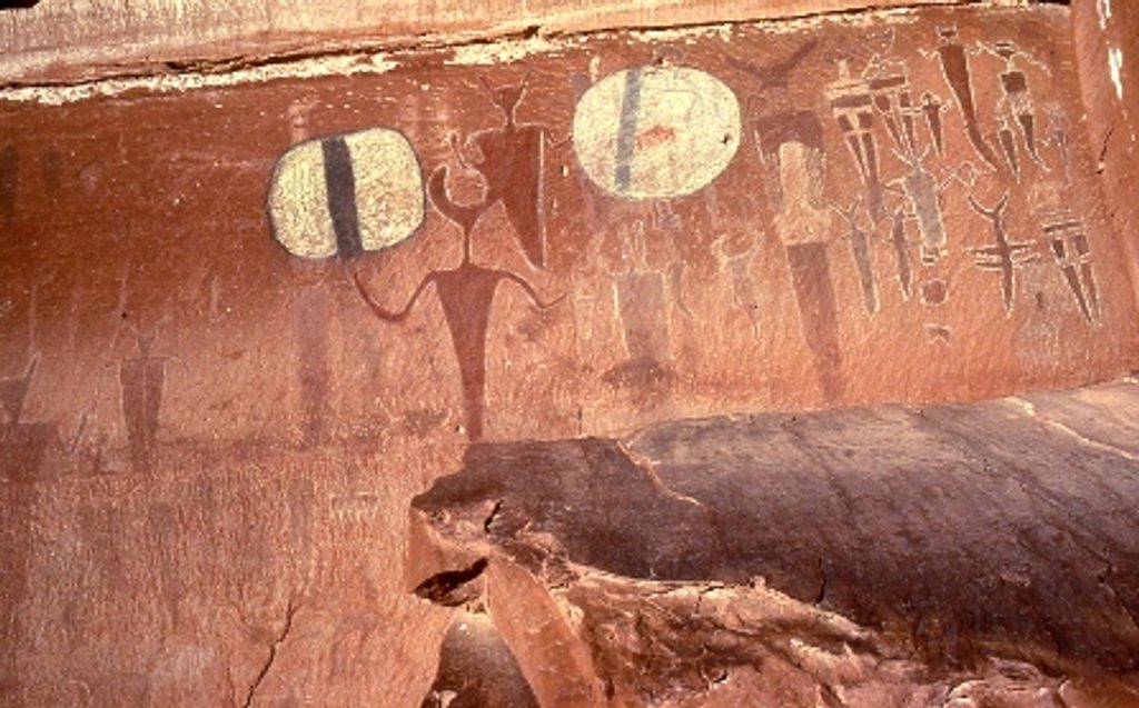
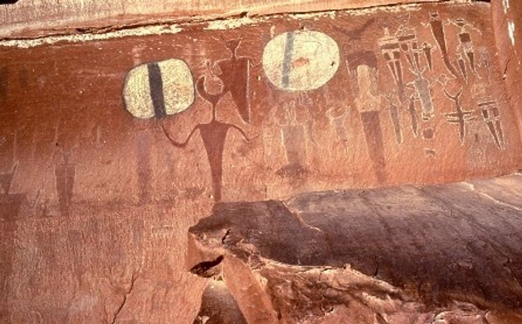
Near the south end, a short side path leads to the Courthouse Wash Rock Art Panel—ancient Barrier Canyon–style pictographs (with some petroglyphs on boulders below). The figures are high on the cliff; binoculars help. It’s a special site that was partially restored after vandalism—look, photograph, but do not touch.
This is about riparian desert canyon scenery, solitude, and wading. You won’t see arches here; if that’s your goal, pick one of the park’s arch hikes instead. Navigation is straightforward if you stay in the wash, but it’s faint in places and sandy walking can be tiring. A shuttle is strongly recommended—turning this into an out‑and‑back is a slog.
Spring and fall bring the friendliest temps and usually manageable water levels. Summer heat is intense, but the creek is wonderfully cooling—just keep a sharp eye on the weather for flash‑flood potential after storms. Winter is quiet but cold, and crossings can be icy.
Two trailheads: a pullout just north of the bridge over Courthouse Wash on Arches Scenic Drive (about 4.5–4.6 miles from the park entrance), and a signed pullout on US‑191 near the Colorado River for the Courthouse Wash Rock Art Panel.
Frequent water crossings and slick, uneven footing; flash flood risk after storms; route is faint in spots—follow the wash. In winter, expect icy water. Do not touch or climb on the rock art panel.
Place · 0 mi away
Place · 1.4 mi away
Place · 1.6 mi away
Place · 1.8 mi away
Easy · 0 mi away
Easy · 1.6 mi away
Moderate · 3 mi away
Easy · 5.9 mi away

Parkwolf Tour Guide
