
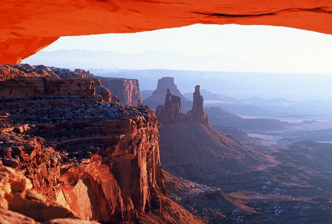
Canyonlands National Park

Canyonlands National Park, UT

Canyonlands alerts

3 current alerts from the park.

Alerts
3
Closures
2
Cautions
1

Hear the audio tour

Mesa Arch

ClosureUpdated

Rain and flooding close Needles backcountry roads

Recent rain and flash flooding have made Needles backcountry routes impassable or closed; do not drive the affected routes.

  • Beef Basin Road/Bridger Jack Road/CR-107 is impassable due to significant flash flooding.
  • Salt Creek/Horse Canyon is impassable due to recent rains; expect deep sand and narrow sections where vehicles may scrape vegetation. High-clearance 4WD and self-rescue preparedness are required.
  • Confluence via Elephant Hill Road is closed because recent rains damaged the road.

Check current NPS backcountry road conditions before traveling.

ClosureUpdated

Rockfall and rain restrict White Rim Road

Rockfall east of Murphy Hogback has temporarily closed a section of White Rim Road to four-wheeled vehicles; do not plan a full-loop vehicle trip.

  • Motorcycles, bicyclists, and hikers can complete the loop. Vehicles should plan an out-and-back trip via Shafer Trail Road/Potash Road or Mineral Bottom Road.
  • NPS advises against travel on the west side of White Rim Road and on Mineral Bottom Road because recent rains have left them slippery and muddy; wait for the roads to dry before traveling.

Check current NPS road conditions before traveling.

CautionUpdated

Green River route to The Maze requires high-clearance 4WD

The route from Green River to Hans Flat or Horseshoe Canyon is passable only to high-clearance 4WD; deep ruts, cutbanks, mud, and deep sand make it unsuitable for low-clearance vehicles.

  • Low-clearance vehicles are not recommended; Highway 24 is usually a faster route.

Check current NPS road conditions before driving to The Maze.

A park ranger sits on a dash-mounted phone, talking, as Parkwolf’s Tour Guide plays “Army Cutworm Moths: A Grizzly Bear Buffet” on Grand Loop Road below Dunraven Pass in Yellowstone
Parkwolf Tour GuideThe highest, rockiest slopes around here are a summer buffet for grizzly bears.

Canyonlands Tour Guide

Canyonlands, narrated.

Parkwolf is a GPS audio tour guide for Canyonlands National Park. As you drive, it chimes in with what’s ahead: hidden gems, upcoming stops, history, geology, and wildlife, right through your car’s speakers.

See the Canyonlands audio tour

Recorded for this place

Mesa Arch
0:00 / 0:30
“You're coming up on Mesa Arch, where a low sandstone opening frames the canyon and the distant La Sal Mountains. Keep this stop even if you missed sunrise.”

Plays as you drive up to Mesa Arch in the Parkwolf Canyonlands Tour Guide.

More stories near here in the app

  • The Sheep That Rebuilt Other Herds
  • Candlestick Tower Overlook
  • Aztec Butte Granaries
  • Willow Flat Campground
  • 43 audio storiesacross Canyonlands’s roads, triggered by GPS as you drive
  • Wildlife heatmapsfor Bighorn Sheep, Mule Deer, Coyote, and 13 more
  • Works offlinemaps, 63 trails, 65 places, and audio download before you lose signal
  • CarPlay readysimple controls built for the drive
★★★★★
“Fantastic app with many points of information… It’s great to just turn on while you’re driving and it gives you an audio tour of the national Park. We love it!!!!”
JMJamesApp Store review
Download Parkwolf on the App StoreGet Parkwolf on Google Play

4.7 from 8,600+ ratings

Take Parkwolf to Canyonlands.

The audio tour guide for the drive, plus offline maps, trails, and wildlife heatmaps for when the signal drops.

4.7 from 8,600+ ratings

Download Parkwolf on the App StoreGet Parkwolf on Google Play