
Place · 0.6 mi away
Moderate
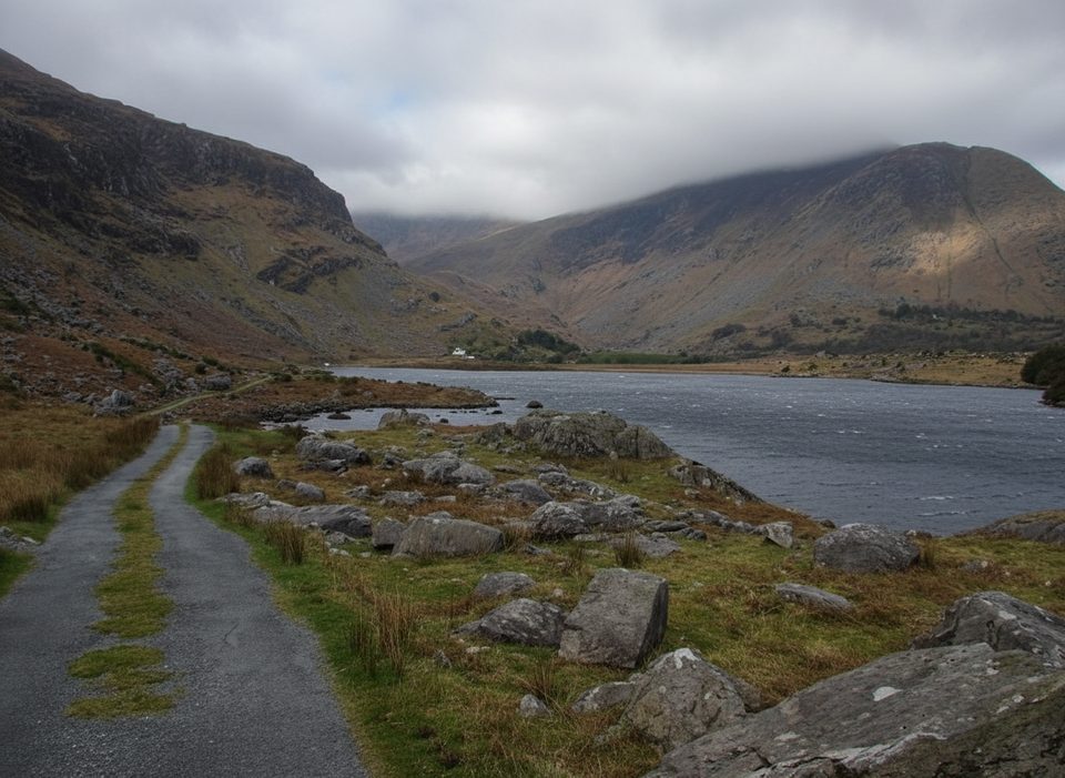
This point‑to‑point stage of the Kerry Way runs about 13 miles (21 km) from the Killarney–Muckross area into the Black Valley, taking most hikers roughly 7–7.5 hours. It’s generally easy to moderate: mostly firm old‑road surfaces with some steady climbs/descents and one short boggy stretch that’s boarded with old railway sleepers. Waymarking is good throughout.
Start near Flesk Bridge on the N71 and follow the Jaunting Cars’ Trail for about 1.5 km into Killarney National Park. You’ll pass Muckross Abbey (free to enter) and the grounds of Muckross House and Gardens (the house itself has an admission fee), with Muckross Lake on your right as you head toward Torc Waterfall. Use the pedestrian tunnel to pass under the N71, then climb past the falls to join the Old Kenmare Road. Continue on this old road surface—expect one short boggy, sleeper‑boarded section—before crossing the N71 again near a small church and descending through a pocket of oak forest. As you emerge, views open to the MacGillycuddy Reeks. Reach Lord Brandon’s Cottage (light refreshments in summer), cross the Gearhaneen River, and continue into the Black Valley to finish by the church/hostel.
This is classic Killarney scenery in one day: waterfalls, lakes, and ancient oak woods, with regular deer sightings on the Old Kenmare Road. The valley backdrop comes from the MacGillycuddy Reeks, Ireland’s highest range. The approach along Upper Lake and into the Black Valley feels increasingly remote—mobile reception is poor here, and the valley is known for being one of the last places in Ireland connected to electricity (in the 1970s).
March through October offers longer daylight and more reliable weather, with July–August warm but busier. Even in summer, carry rain gear and an extra warm layer; conditions change fast on the exposed stretches.
Services are limited en route—outside of summer, assume no food or drink at Lord Brandon’s Cottage and carry what you need. This is a one‑way stage into a remote valley, so arrange pickup, lodging, or onward travel in advance. Waterproof boots help with the boggy section and frequent wet patches. The route can also be sampled via a shorter adjacent segment from Galway’s Bridge to the Black Valley (about 6 km, 1.5–2 hours), which runs through Derrycunihy Nature Reserve along Upper Lake; parking there is limited roadside.
Yes—this stage strings together many of Killarney’s best bits and then leaves the crowds behind. If you want a shorter taste with big scenery, the Galway’s Bridge to Black Valley section is a solid alternative, but the full Killarney start gives you Torc Waterfall, the lakes, and that satisfying push into true remoteness.
Begin near Flesk Bridge on the N71 or at the Muckross/Torc area; parking is limited roadside at Galway’s Bridge for the shorter adjacent option.
One‑way into a remote valley with poor phone reception and limited services; expect wet, boggy footing in places and rapidly changing weather.
Place · 0.6 mi away
Place · 0.6 mi away
Place · 0.7 mi away
Place · 0.9 mi away
Easy · 0.8 mi away
Easy · 0.9 mi away
Easy · 1.6 mi away
Challenging · 3.1 mi away

Parkwolf Tour Guide
