
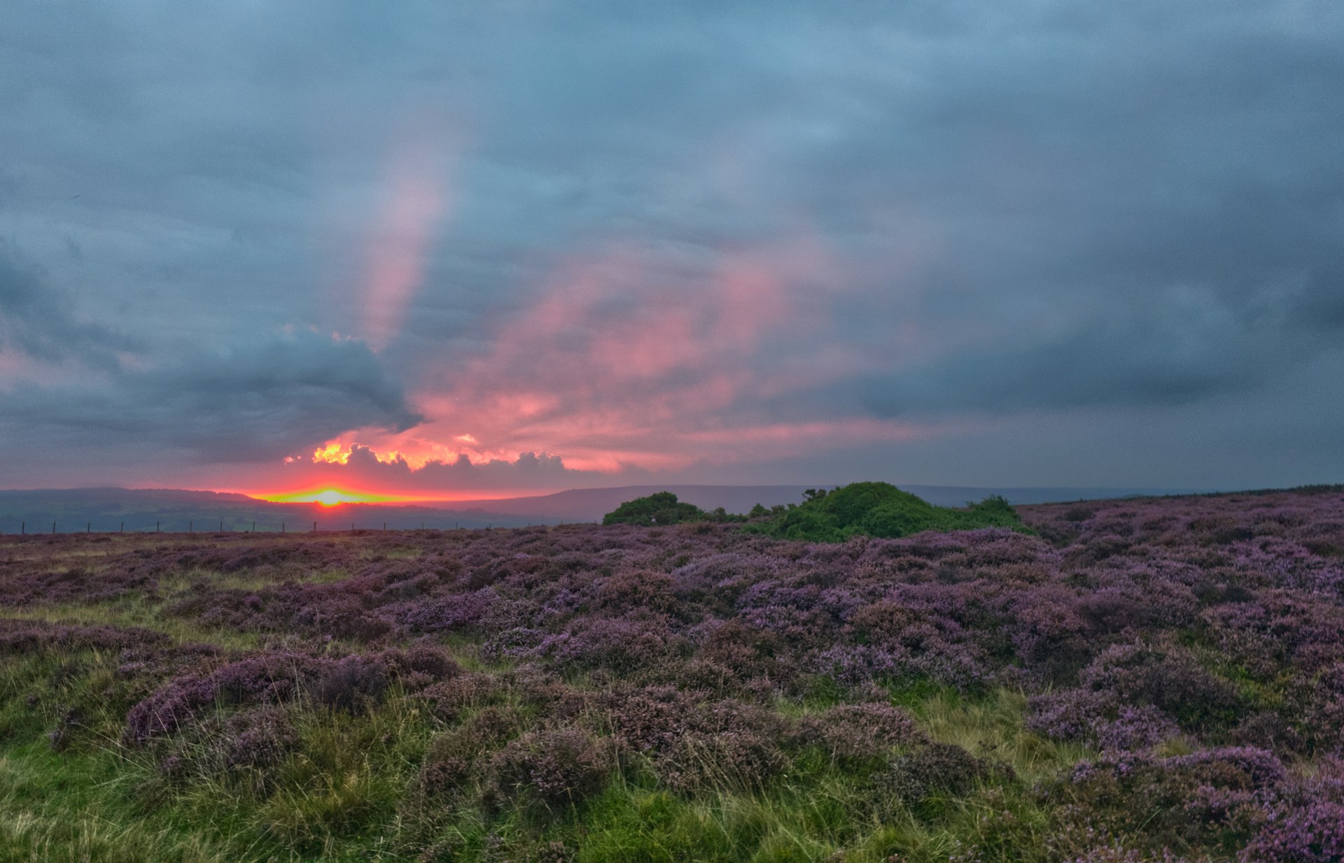
North York Moors National Park

North York Moors National Park, EN

North York Moors alerts

8 current alerts from the park.

Alerts
8
Closures
7
Cautions
1

Hear the audio tour

Roseberry Topping

CautionUpdated

Fylingdales Moor wildfire recovery hazards

Fylingdales Moor remains vulnerable after the wildfire: keep to well-defined paths and do not touch suspicious metal objects.

  • Wildfire heat detonated more than 20 previously dormant explosive devices. There have been no further explosions since the major incident status was stepped down, but lost peat and vegetation have exposed historic military debris; although most items are harmless, unexploded ordnance may remain. If you find a suspicious metal object, do not touch it; note its exact location (preferably using What3Words) and immediately call 999, asking for police.
  • The badly damaged, fragile moorland has bare peat and exposed archaeology at immediate risk of erosion, particularly in wet, wintery conditions. Avoid creating or widening routes, keep dogs on a lead or under close control, do not move stones, artefacts or natural materials, and respect advisory signs.
  • Public Rights of Way and Open Access are open. The area is being surveyed to record archaeological sites and prioritise restoration to stabilise exposed peat and prevent further environmental deterioration.

Check current Fylingdales Moor wildfire guidance before visiting.

ClosureUpdated

West Ayton Footpath 1 closure

Public Footpath 1 through Forge Valley is closed to pedestrians because its boardwalk is unsafe; use the signed alternative.

  • The 2,540-metre closure passes Ayton Castle and runs from SE 9860 8494 to SE 9839 8712.
  • The 2,818-metre alternative follows a permissive path through the woods, Public Footpath 702 and U551 Cockrah Road through West Ayton; follow notices, signs and maps. The order runs 14 October 2026–13 April 2027.

Check current rights-of-way notices before travelling.

ClosureUpdated

Hawnby Bridleway 110 closure

Bridleway 25.122/110/1 at Hawnby (Low Wood) is closed to pedestrians, cyclists and horse traffic because the bridge is unsafe.

  • The closure is between SE 5309 9073 and SE 5335 9097; it applies when traffic signs are in place and runs 6 October 2026–14 March 2027.

Check current rights-of-way notices before travelling.

ClosureUpdated

Ravenscar coastal footpaths closed by landslip

A large landslip has closed sections of Footpaths 10 and 11 at Staintondale (Old Peak and The Coomb); do not use them—there is no alternative route down to the foreshore here.

  • Footpath 10 is closed for 765 metres from the top of Old Peak down the coastal slope to the foreshore; Footpath 11 is closed for 614 metres across The Coomb to the foreshore. Follow closure signs.
  • The order runs until 17 March 2027 or completion of the works, whichever is earlier.

Check current rights-of-way notices before travelling.

ClosureUpdated

Loftus Footpath 12 closure for bridge replacement

Footpath 12 at Loftus is closed to pedestrians while the bridge over Greenhowe Beck is replaced; use Footpath 10 as the alternative.

  • The 1,017-metre closed section runs from Greenhowe Farm on Grinkle Lane, via the bridge site, to its junction with Footpath 10; Footpath 10 provides a 1,391-metre alternative over the beck.
  • The order runs until 16 March 2027 or completion of the works, whichever is earlier.

Check current rights-of-way notices before travelling.

ClosureUpdated

Fylingdales Footpath 48 closure

Public Footpath 48 at Fylingdales is closed to pedestrians so a mains water pipe can be replaced; use Footpath 649 or Footpath 46 instead.

  • The 513-metre closure runs from the A171 opposite Fern Farm to the junction with Footpath 649 between Fen Cottage and Hunter’s Moon.
  • Footpath 649 (710 metres) and Footpath 46 (585 metres) are the alternative routes; follow notices, signs and maps. The order is in force through 6 March 2027.

Check current rights-of-way notices before travelling.

ClosureUpdated

Glaisdale Footpath 98 closure for tree-felling

A 1-kilometre section of Public Footpath 98 at Tyreman’s Plantation, Great Fryup Dale, is closed to pedestrians for tree-felling; use Public Bridleway 99 as the alternative route.

  • The closure runs from the U2261 road south of Wood End Farm to the Bridleway 99 junction; the alternative is also 1 kilometre. Follow notices and signs. The order runs through 29 January 2027.

Check current rights-of-way notices before travelling.

ClosureUpdated

Hackness Footpath 202 closure

Public Footpath 202 at Wrench Green, Hackness, is closed between SE 9678 8968 and SE 9681 8972 to allow design work for a substantial repair; obey notices and signs.

  • The current order listing runs through 5 June 2027.

Check current rights-of-way notices before travelling.

A park ranger sits on a dash-mounted phone, talking, as Parkwolf’s Tour Guide plays “Army Cutworm Moths: A Grizzly Bear Buffet” on Grand Loop Road below Dunraven Pass in Yellowstone
Parkwolf Tour GuideThe highest, rockiest slopes around here are a summer buffet for grizzly bears.

North York Moors Tour Guide

North York Moors, narrated.

Parkwolf is a GPS audio tour guide for North York Moors National Park. As you drive, it chimes in with what’s ahead: hidden gems, upcoming stops, history, geology, and wildlife, right through your car’s speakers.

See the North York Moors audio tour

Recorded for this place

Roseberry Topping
0:00 / 0:26
“You're coming up on Roseberry Topping, the jagged hill above Newton under Roseberry. Go for the summit view across the Cleveland Hills and out to the coast, but choose a clear day.”

Plays as you drive up to Roseberry Topping in the Parkwolf North York Moors Tour Guide.

More stories near here in the app

  • Gribdale Gate and Captain Cook's Monument
  • Guisborough Forest and Walkway
  • The Rock Beside Roseberry
  • Kildale Station and Warren Moor Mine
  • 298 audio storiesacross North York Moors’s roads, triggered by GPS as you drive
  • Wildlife heatmapsfor Eurasian Otter, Red Deer, Grey Seal, and 13 more
  • Works offlinemaps, 125 trails, 68 places, and audio download before you lose signal
  • CarPlay readysimple controls built for the drive
★★★★★
“Fantastic app with many points of information… It’s great to just turn on while you’re driving and it gives you an audio tour of the national Park. We love it!!!!”
JMJamesApp Store review
Download Parkwolf on the App StoreGet Parkwolf on Google Play

4.7 from 8,600+ ratings

Take Parkwolf to North York Moors.

The audio tour guide for the drive, plus offline maps, trails, and wildlife heatmaps for when the signal drops.

4.7 from 8,600+ ratings

Download Parkwolf on the App StoreGet Parkwolf on Google Play