
Place · 4.3 mi away
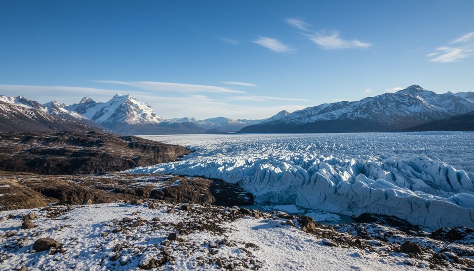
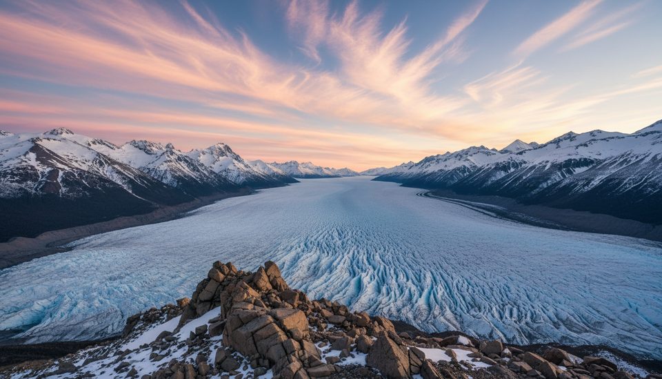
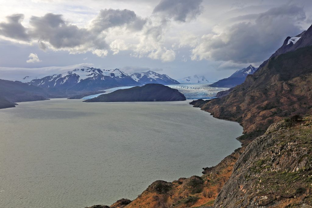
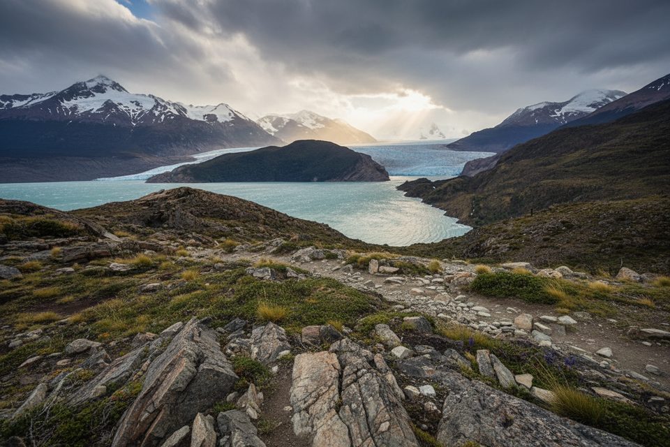
A remote perch above the Pingo Valley, Zapata Viewpoint rewards the effort with big, wild vistas: Pingo Glacier to the north, Zapata Glacier to the west, and Paine Grande looming beyond. It feels wilder than the W/O circuits—fewer people, more animal sign, and raw glacial landscapes.
Access starts at Lago Grey/Grey Checkpoint. It’s typically 4–6 hours to the old Zapata refuge site (now just a flat camping area), then another 1–1.5 hours to the mirador. The path mixes lenga forest, steep ups/downs, peat bogs, and scratchy low shrubs—long pants are smart. From camp, follow red stakes and painted rocks across an old glacial plain, up a short steep rise, then easier ground to the lookout (roughly 230 m a.s.l.). Expect classic Patagonian mood swings: sudden gusts, rain or hail even in summer.
From the top, you get a sweeping read of the valley: the braids of the Pingo River, the icy tongues of Pingo and Zapata, and the hulking mass of Paine Grande. The geology is a highlight—outwash plains and colorful bedrock bands, with the broader Tyndall/Zapata sector known for significant marine fossils and ichthyosaur finds exposed by erosion. Leave any fossils where they are.
This valley is one of the better spots to hope for huemul (South Andean deer)—rare and strictly protected—plus the chance of pumas. You might also see guanaco, feral “baguales” (cattle/horses), rheas, ibises, and passing condors. Observe from a distance and don’t follow wildlife.
You must go with a certified guide and register your visit with CONAF at Lago Grey before heading out. The standard objective is the viewpoint; direct access to the glacier isn’t part of this trek. The area’s scientific value and sensitive geology are key reasons access is controlled.
The former Zapata shelter burned down; the site remains a flat, informal camping area. Water is close by in the Pingo River and small streams, and there’s an estuary about 20 minutes from the viewpoint. Treat/purify all water. Winds can be brutal—anchor tents well and avoid pitching beneath old limbs.
There’s an optional spur to Pingo Waterfall. You return the same way you came.
It’s quiet year‑round compared with the W. December–February delivers long daylight; April brings striking autumn colors and even more solitude. Weather is fickle in any month. Note that this trail has seen temporary closures (for example, in November 2022 due to wild bulls), so confirm current status before committing.
Place · 4.3 mi away
Place · 5.4 mi away
Place · 7.7 mi away
Place · 8.5 mi away
Moderate · 8.5 mi away
Easy · 10.8 mi away
Moderate · 10.8 mi away
Challenging · 11.4 mi away

Parkwolf Tour Guide
