Pros & cons
PROS
- Panoramic cliff‑edge views across a quieter South Unit plateau
- Often uncrowded, with a real sense of solitude and open‑range character
CONS
- Road and soils become impassable, sticky mud after storms
- Not a maintained or signed trail; navigation and judgment required
- No shade or services on the table; full exposure to sun and wind
Park at the overlook atop Sheep Mountain Table at the end of Sheep Mountain Table Road.
Avoid after rain—deep, sticky mud can strand vehicles and make travel hazardous; steep drop‑offs, full sun/wind exposure, no services, unreliable cell service; pets not allowed beyond roads/parking.
Overview
If you crave sweeping Badlands vistas without the crowds, this is your spot. The route explores the flat top of Sheep Mountain Table—one of the park’s most dramatic landforms and the highest accessible area—where cliff-edge panoramas, quiet prairie stretches, and a real sense of isolation define the day. It’s less a classic singletrack and more a mellow walk across a dirt two‑track road on a lofty plateau.
Route and Distance
From the overlook atop the table, you can walk the continuation of the dirt road for about 2.5 miles one way to the end of the table (5.0 miles total out and back). The tread is almost entirely flat, making the walking easy; expect sun, wind, and long horizons. If you prefer to explore off‑trail terrain, experienced hikers sometimes leave the table to pick their way among banded buttes toward features like “The Horn,” but that’s unmaintained, unsigned travel and entirely choose‑your‑own distance.
Scenery and What You’ll See
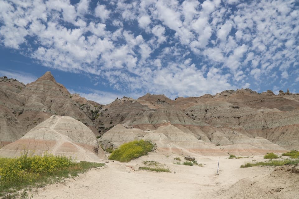
You’ll look out over canyons, buttes, and a greener, more vegetated slice of the South Unit than most visitors ever see. The edges drop away dramatically on either side of the table, and there are frequent natural overlooks perfect for photos or a quiet picnic. Keep an eye out for horses or cattle—open‑range grazing occurs here under long‑standing agreements—adding to the wild, open character of the place.
Access and Parking
Reach Sheep Mountain Table Road from SD 27 (about 4.5 miles south of Highway 44 at Scenic). In dry conditions most vehicles can make the climb to the overlook at the top, where there’s parking. Beyond this point, only high‑clearance 4WD should drive—most people simply walk the remaining road from here.
Best Time to Hike
Spring and fall bring the friendliest temperatures and light, and summer evenings can be spectacular if you avoid the midday heat. This area is extremely weather‑dependent: after any rain or storms, the road and clay soils turn into deep, sticky mud and can become impassable. In fair weather, you can visit year‑round, but always check conditions first.
Know Before You Go
There are no services up here—no water, shade, or facilities—so arrive self‑sufficient with plenty of water, food, sun protection, and an offline map. Expect unreliable or no cell service. Pets are not allowed beyond roads and parking areas. Even when dry, portions of the upper road are narrow and rutted with steep drop‑offs; if you’re walking, give vehicle traffic (if any) a wide berth and mind the edges.
Bottom Line
This is an easy walk with premium payoff: huge views, real solitude, and a feel‑good, off‑the‑beaten‑path vibe. If you need a signed, maintained trail with facilities, look elsewhere. If you’re game for a remote plateau stroll with dramatic Badlands scenery, it’s absolutely worth your time.
Where it starts
43.7017, -102.5768Wildlife on this trail
Near Sheep Mountain Table Trail
All places →All trails →
0.6 mi awaySheep Mountain Table OverlookRemote, big-sky views from the park’s highest tableParking · Pullout
13.7 mi awayWhite River Visitor CenterLakota-focused hub for the park’s South UnitRestroom · Parking
15.6 mi awaySage Creek CampgroundFree, wild camping with bison, prairie dogs, and outrageous starsRestroom · Picnic Table
15.6 mi awaySage Creek Wilderness LoopChoose-your-own bison-trail loop across wild mixed-grass prairieChallenging · 23 mi · 14 hr
18.5 mi awaySage Creek Basin OverlookQuiet rim stop with big prairie views and frequent bisonPullout · Parking
20.9 mi awayDeer Haven TrailJuniper oasis and solitude on a choose your own routeModerate · 5 mi · 3 hr
29 mi awayFossil Exhibit TrailHands-on fossil boardwalk with wide-open butte and prairie viewsEasy · 0.3 mi · 18 min
29.1 mi awayCastle TrailLong, flat badlands wander with big views and real solitudeModerate · 5 mi · 2.5 hr