
Place · 7.7 mi away
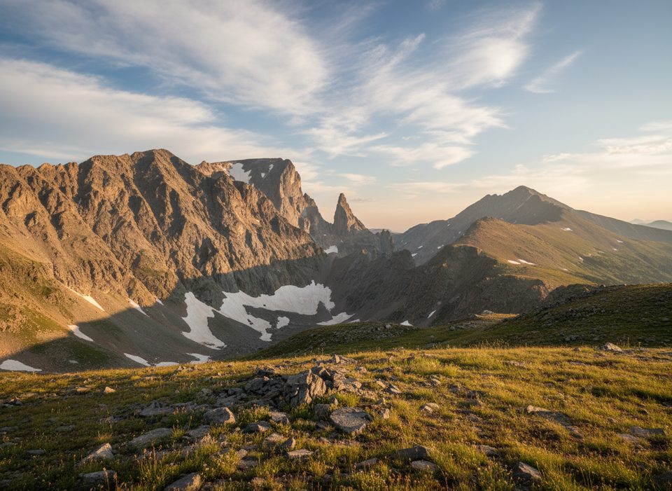
This is the quick roadside pullout where you can spot the sharp, pyramidal rock that gave the entire range—and highway—its name. It’s an easy, hop-out-of-the-car stop just below Beartooth Pass on US‑212 with a sign and big, windy alpine views. No frills, just the classic look at the Bear’s Tooth spire.
The Crow name for this peak is “Na Piet Say,” meaning “bear’s tooth”—a dead‑on description of its silhouette. Early mapmakers and explorers noted a remarkable mountain called “the tooth,” and it ultimately lent its name to the Beartooth Mountains and, by extension, this highway.
The feature is tied to Late Cretaceous igneous rock (rhyodacite). Its porphyritic texture includes feldspar crystals that weather in a way some observers have likened to a dusting of snow—part of why the spire stands out so starkly.
This high country holds grizzly bears, moose, and mountain goats. Goats are the most likely roadside sighting near cliffs; give all wildlife space. Open‑range cattle show up on some stretches—stay alert when pulling in and out.
There are no services at the Bear’s Tooth marker—no restroom or water. Closest reliable pit-stop is the Top of the World Store between the pass and Beartooth Lake for food and general supplies. Clark’s Fork Overlook has restrooms farther along. Expect basic, seasonal vault toilets outside of towns.
The Beartooth Highway typically runs from late May to early October, but exact dates swing with snow. Plan this stop in daylight and expect chill and wind even in mid‑summer. For photos, mid‑day to afternoon (roughly 10 a.m.–5 p.m.) often delivers bright, clear looks at the spire. Always check highway status with Montana DOT/NPS before you go, especially at the season edges.
Place · 7.7 mi away
Place · 7.8 mi away
Place · 7.8 mi away
Place · 7.8 mi away
Challenging · 4.7 mi away
Moderate · 4.7 mi away
Moderate · 5.8 mi away
Easy · 7.4 mi away

Parkwolf Tour Guide
