
Pros & cons
PROS
- A rare desert-to-montane traverse capped with a Guadalupe Peak summit finish
- Peak McKittrick Canyon fall color can elevate an already stellar ridge walk
CONS
- Water logistics dominate the itinerary; reliable natural sources are scarce
- Long, rocky ATV roads and faint tread in places slow progress and morale
Stage vehicles: one at Pine Springs Trailhead/Campground (Guadalupe Mountains NP) and another at White’s City near Carlsbad Caverns; no public shuttle. Parking in the parks is handled through the wilderness permit process.
Water is the crux—cache ahead and carry ~8 liters; do not rely on stock tanks. Expect strong winds, sharp limestone, and faint or unmaintained sections (notably in Lincoln NF); bring paper maps. No shuttles—plan car drops. Overnight permits required inside both parks and camping in Guadalupe Mountains NP is at designated sites only. Pets are not allowed on NPS sections.
Overview
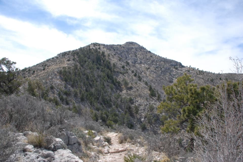
The Guadalupe Ridge Trail (GRT) is a demanding, point‑to‑point backcountry traverse linking Carlsbad Caverns country in New Mexico to Guadalupe Peak—the highest point in Texas—across roughly 100 miles. You’ll move from desert floors dotted with creosote and yucca to high country forests of ponderosa pine and Douglas fir, with big wind, bigger views, and long water carries the norm. It’s a serious route for experienced backpackers who are comfortable with route finding, self‑reliance, and caching.
Distance, Direction, and Difficulty
Plan for ~100 miles total (the optional Sitting Bull Falls add‑on tacks on significant mileage). Many hikers prefer traveling north‑to‑south—starting near Carlsbad Caverns and finishing on Guadalupe Peak—for a more gradual build and a satisfying summit finale. Expect very rugged, rocky limestone footing, occasional overgrowth or faint tread (especially in Lincoln National Forest), and some confusing junctions. Typical end‑to‑end time ranges from about 5–8 days depending on pace, weather, and your water plan.
Permits and Camping
Permits are required for overnight travel inside both national parks. In Guadalupe Mountains, camping is only at designated backcountry sites such as McKittrick Ridge, Wilderness Ridge, Mescalero, Tejas, Pine Top, and Guadalupe Peak. Carlsbad Caverns allows dispersed backcountry camping with a permit. Lincoln National Forest permits aren’t required for dispersed camping. You can build a single, end‑to‑end itinerary (including “Out of Park” nights) through the park’s permit system—do this early, then lock in your nightly targets.
Water and Caching Strategy
Water is the crux of this trail. Natural sources are scarce and unreliable, and stock tanks are not to be trusted. Reliable treated sources include White’s City, Carlsbad Caverns Visitor Center, McKittrick Canyon Visitor Center, and Pine Springs Trailhead/Campground. Many parties cache jugs in advance at legal, accessible points; plan to carry up to ~8 liters between sources. The optional detour to Sitting Bull Falls provides a dependable refill but adds miles and time.
Navigation, Conditions, and Gear
Carry paper maps as a fail‑safe—don’t rely solely on a phone. Expect rocky ATV roads in sections of Lincoln National Forest, occasional bushwhacking, and very windy conditions at elevation and at night. Long pants and sleeves help with catclaw and agave; add a sun hoodie, a wind‑worthy shell, and sturdy footwear for sharp limestone. Trekking poles shine on the endless rock.
Geology and Natural Highlights
You’re walking the flank of an ancient sea—the Permian‑age Capitan fossil reef. Uplift and erosion exposed this massive reef complex, and the Western Escarpment, including El Capitan and Guadalupe Peak, shows textbook cross‑sections of the old Delaware Sea. In the lowlands look for creosote and yucca; higher up you’ll pass through pine‑fir pockets, with Texas madrone and oaks adding variety. Wildlife is sparse but present—keep an eye out for mule deer, kit foxes, and coyotes.
Best Time to Hike
Aim for fall through early winter or spring. Summer heat is dangerous. Oct–Dec is prime; mid‑November frequently brings standout foliage in McKittrick Canyon, while January often kicks off the windy season. Start early each day for cooler temps and softer light, and consider timing your final push to catch sunset from Guadalupe Peak—unforgettable if your permit and weather cooperate.
Logistics and Parking
There’s no shuttle. Most hikers stage one vehicle at Pine Springs (Guadalupe Mountains) and another at White’s City (near Carlsbad Caverns). Parking details are included in the national parks’ wilderness permit process; no parking permit is needed in Lincoln National Forest. Build your caches, lock your permits, and carry the right maps—this trail rewards preparation as much as grit.
Who Will Love It (and Who Won’t)
If you crave a remote, geologically rich, desert‑to‑alpine traverse capped by a state high point, this is a gem. If you prefer plentiful water, well‑signed tread, and shorter days, consider sampling the Guadalupe Peak Trail or a McKittrick Canyon out‑and‑back instead.
Where it starts
31.8967, -104.8282Wildlife on this trail
Near Guadalupe Ridge Trail
All places →All trails →
0 mi awayGuadalupe Peak TrailStrenuous climb to the Top of Texas with sweeping desert viewsChallenging · 8.4 mi · 7 hr
0 mi awayHunter Peak via Bear Canyon and Tejas LoopSteep climb, huge views, and cool pine forests in one loopChallenging · 8.7 mi · 7 hr
0 mi awayBush Mountain TrailRemote ridge climb to Texas's second-highest summit with big viewsChallenging · 13.2 mi · 7.5 hr
0 mi awayDevil’s Hall TrailShort, scrambly canyon to a photogenic limestone hallwayModerate · 4.2 mi · 3 hr
0 mi awayPine Springs TrailheadGateway to Guadalupe Peak, Devils Hall, and big desert viewsTrailhead · Restroom
0.2 mi awayPine Springs CampgroundTrailhead-side basecamp with basics, high winds, and big viewsCampground · Restroom
0.4 mi awayPine Springs Visitor CenterPark HQ for maps, permits, water, and trailhead intelVisitor Center · Restroom
0.4 mi awayPine Springs Picnic AreaConvenient picnic spot beside the main trailheadsRestroom · Parking








