Facilities for a brief pause
Picnic tables are visible beside the kiosk, and visitors have reported public toilets here. Reports about toilet upkeep are old and mixed, so make a backup plan if you need a dependable restroom.
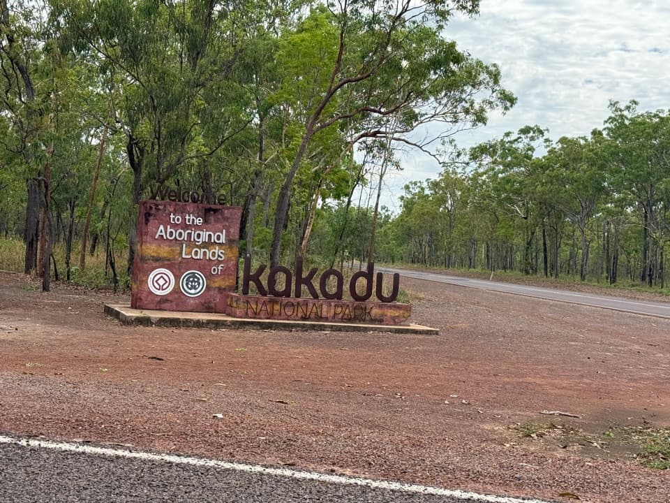
Scenic pullout · Kakadu National Park
A quick map and stretch break on the Arnhem Highway.
Photo: DaHuzyBru, CC BY-SA 4.0, via Wikimedia Commons
Overview
Map
Plan your stop

The highest, rockiest slopes around here are a summer buffet for grizzly bears.
Kakadu Tour Guide
Parkwolf is a GPS audio tour guide for Kakadu National Park. As you drive, it chimes in with what’s ahead: hidden gems, upcoming stops, history, geology, and wildlife, right through your car’s speakers.
See the Kakadu audio tourRecorded for this place
Arnhem Highway Information Bay: A Quick Map Stop“Up ahead is the Arnhem Highway Entrance Information Bay, with a covered kiosk and a Kakadu welcome sign. It's a handy place to check the map and break up the drive.”
Plays as you drive up to Arnhem Highway Entrance Information Bay in the Parkwolf Kakadu Tour Guide.
More stories near here in the app
“Fantastic app with many points of information… It’s great to just turn on while you’re driving and it gives you an audio tour of the national Park. We love it!!!!”


Guide
This is a small roadside information bay on the Arnhem Highway approach to Kakadu, with a roofed welcome kiosk and entry sign. It works best as a short orientation break: check the map, take a moment out of the drive, then continue into the park. It is a useful first pause rather than a destination that needs a long visit.
The covered kiosk displays three illustrated panels on a brick-paved area, with picnic tables just behind it. The neighboring Kakadu welcome sign is the recognizable arrival photo. Include a little highway and woodland around it so the frame shows a real road entrance rather than just the sign face; stay within the established visitor area.
For drivers coming this way, the bay marks the approach to Kakadu’s South Alligator region, the first region reached from Arnhem Highway. The wider region is noted for birdlife, and the South Alligator River is a popular barramundi-fishing area. That is useful context for the country ahead, not an activity at the information bay itself.
Wildlife
 1,126 sightingsSaltwater CrocodileMost seen around 7 AMSighting map
 122 sightingsWater BuffaloMost seen around 6 AMSighting map
 77 sightingsFrilled DragonMost seen around 7 AMSighting map
 118 sightingsRed-tailed Black CockatooMost seen around 7 AMSighting map
 108 sightingsBrolgaMost seen around 7 AMSighting map
 310 sightingsMagpie GooseMost seen around 5 PMSighting map
Sighting maps show where each species has been reported across Kakadu. Wildlife moves, so no sighting is guaranteed.
Parkwolf’s Kakadu ranking

The audio tour guide for the drive, plus offline maps, trails, and wildlife heatmaps for when the signal drops.