
Place · 0.1 mi away
Easy
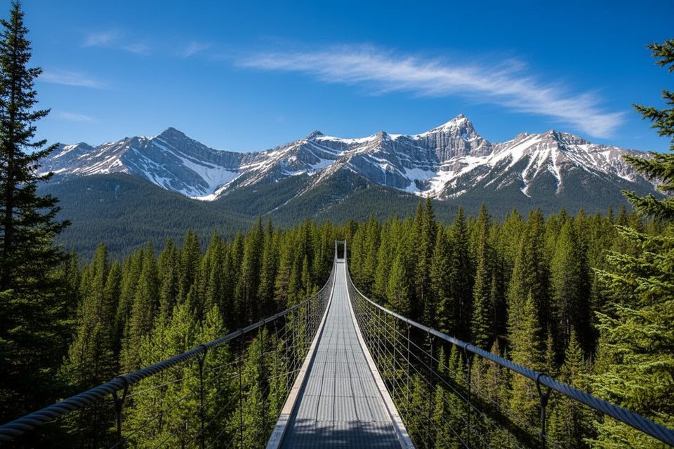
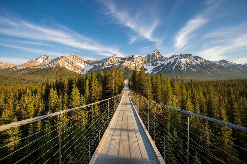
This short, crowd‑pleasing walk delivers a big payoff: a 73 m/240 ft suspension bridge spanning Blackshale Creek amid dense forest and mountain views. The loop itself is about 1.0 km/0.6 mi total with roughly 60 m/190 ft of gain—easy, family friendly, and fun if you’re OK with a little sway.
You’ve got two ways to see the bridge. Most visitors do the compact 1.0 km/0.6 mi loop that reaches the span quickly and circles back. For a longer outing, start at Black Prince Day Use and follow the High Rockies Trail to the bridge and back—about 6.1 km/3.8 mi round‑trip with roughly 351 m/1,151 ft of gain. Expect about 2 hours 18 minutes on the longer approach if you keep a steady pace.
The trail is well‑traveled and generally maintained, but it can be muddy or icy depending on season. It’s multi‑use (hikers, runners, and bikes in warmer months), and the bridge can see lines at peak times. A safety limit of about 20 people on the bridge may be enforced. Dogs are welcome on leash.
Late spring through fall is the sweet spot for dry tread and easier access. Go early or late in the day to dodge the biggest crowds and get softer light on the bridge. In winter, the bridge often closes when snow loads are high; a signed bypass keeps the High Rockies Trail moving even when the span is closed. Conditions on the gravel Smith‑Dorrien/Spray Trail can shift fast—after storms expect snow/ice and slower driving.
Park at Black Prince Day Use on the Smith‑Dorrien/Spray Trail (Hwy 742). The lot has toilets, fills quickly on fair‑weather weekends, and roadside parking is not permitted. A Kananaskis Conservation Pass is required to park anywhere in Kananaskis Country.
There’s no drinking water—bring your own. Cell service is unreliable, so download maps and your pass ahead of time. Carry bear spray in warmer months; bears and cougars use this valley. In shoulder or early winter, traction like microspikes makes the short hills and bridge approaches safer. The bridge sways—skip it in strong winds or if you’re unsteady, and use the signed detour. Parts of the broader High Rockies Trail have seasonal closures for avalanche control (Nov 1–May 1) that do not specifically target the bridge area but can affect travel plans.
If the bridge is closed, you can still do the loop via the bypass. For a winter‑friendly alternative nearby, consider well‑traveled snowshoe routes in Peter Lougheed that are typically snowmobile‑packed early season.
Park at Black Prince Day Use along Smith–Dorrien/Spray Trail (Hwy 742); lot fills early, no roadside parking, toilets on site; Kananaskis Conservation Pass required.
Bridge may close in winter; use signed bypass. Gravel Hwy 742 can be snowy/icy. Limited cell service. Carry bear spray; wildlife active. Bridge sway and packed snow/ice can be unnerving—use traction and caution. Seasonal avalanche-control closures affect parts of the High Rockies Trail.
Place · 0.1 mi away
Place · 1.3 mi away
Place · 1.5 mi away
Place · 1.9 mi away
Moderate · 1.2 mi away
Easy · 1.2 mi away
Easy · 1.2 mi away
Easy · 3.1 mi away

Parkwolf Tour Guide
