
Place
Moderate
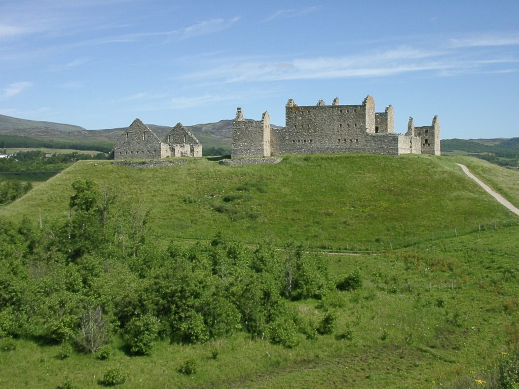
This route begins at the dramatic, roofless Ruthven Barracks on its natural mound above the Spey valley. From the monument, the full outing most people mean by “Ruthven Barracks Path” follows the Ruthven and Glen Tromie circuit: a roughly 7.5‑mile (12 km) loop that mixes open moorland, birch woods, and vantage points across the Insh Marshes National Nature Reserve. Expect a genuine Highland mash‑up of culture and landscape—Jacobite history underfoot, big‑sky views ahead, and bird‑rich wetlands shimmering below.
The loop starts and finishes at the barracks, which themselves are a highlight worth lingering over. After leaving the monument, you’ll cross rough, sometimes boggy moorland on an old right of way. This section can be overgrown and unmarked in places, so navigation skills matter—especially after rain—before descending into birchwoods and picking up better tracks and waymarked paths for a friendlier return leg. Total distance is about 7.5 miles (loop, total), and most walkers take 4–5 hours depending on conditions and pace.
If you’re after just a taste, the immediate path around the barracks offers huge views for minimal effort. But the full circuit is the payoff for hikers who want a wilder stretch without crowds.
Views sweep over the Insh Marshes, one of Scotland’s most significant wetlands, with a classic Cairngorms backdrop of glacially carved valleys, heather moorland, and pockets of birch woodland. Keep an eye out for marsh and woodland birds, and even highland cows grazing nearby.
Ruthven Barracks dates to 1719, built in the aftermath of the 1715 Jacobite rising to help control the Highlands. It saw action during the 1745 uprising, surviving an attack in 1745 before being destroyed by retreating Jacobites after Culloden in 1746. Earlier castle remains lie beneath the site, adding deeper historical layers to your circuit.
Walkable year‑round, but the moorland is far more enjoyable in late spring through early autumn when the ground tends to be drier and the marshes are buzzing with birdlife. For photography, aim for early or late in the day when the ruin and marshland light up. After rain or in winter, expect slower going, more bog, and trickier burn crossings.
If you want something similar but shorter, stroll around the barracks mound for the views. If you want more mileage from the same start, the full circuit delivers a satisfying, varied day out.
Park in the lot opposite the barracks across the road; the route starts from the monument.
Expect unmarked, overgrown, boggy moorland with potential tricky burn crossings after rain; bring navigation and wear waterproof boots. Keep dogs controlled near livestock and the nature reserve.
Place
Place
Place
Place
Challenging
Challenging
Challenging
Challenging

Parkwolf Tour Guide
