Pros & cons
PROS
- Free, first-come primitive sites
- Red Canyon trail starts right from camp
CONS
- No potable water on-site
- Access via dirt road; conditions vary after rain
Overview
Cedar Mesa Campground is the park’s quiet, backcountry-style base in the Waterpocket District, about 23 miles south of Highway 24 along the Notom–Bullfrog Road at roughly 5,500 feet. It’s simple and remote by design—perfect if you want big skies, classic Capitol Reef geology, and a peaceful camp far from the Fruita buzz.
Campsites and Amenities
There are five first-come, first-served sites here, each with a picnic table and fire grate. A single pit (vault) toilet serves the campground. There’s no fee, no reservations, and no hookups. Plan to be fully self-sufficient: there’s no potable water, store, gas, or trash service. Standard site limits apply (up to 8 people and 2 vehicles per site), and pets must be leashed.
Getting There
The Notom–Bullfrog Road is usually manageable in 2WD when dry, but it turns to dirt after the initial paved stretch and can rough up quickly with washboards, potholes, and mud. After storms, high clearance may be advisable. Check the park’s road report before you commit, and give yourself extra time for the last miles.
Why It Stands Out
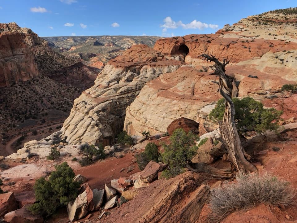
Solitude is the draw—this is the antidote to crowded camp loops. The setting brushes the edge of the Waterpocket Fold, with pinyon-juniper woodlands and views toward the Henry Mountains. It also doubles as a trailhead: the Red Canyon Trail (about 4.5 miles round-trip) leaves right from camp and slips into a scenic box canyon for a crowd-free hike at dawn or dusk.
Nature and Night Skies
Expect a high-desert cast of characters—lizards skittering over slickrock, songbirds in the junipers, and occasional mule deer—especially around dawn and dusk. With no nearby development, nights can be wonderfully dark for stargazing when skies are clear.
Best Time to Visit
- Spring and fall bring the friendliest temps for camping and hiking.
- Arrive before midday to snag a site; with only five spots, the campground can fill on weekends and holidays.
- For photography, morning and late-day light warms the sandstone; nights reward patient stargazers.
- Open year-round, but winter and post-storm periods demand extra attention to road conditions.
Know Before You Go
- Bring all the water you’ll need (drinking, cooking, cleaning), plus a plan to pack out every scrap of trash.
- Fires are allowed only in provided grates; bring your own firewood.
- Sites are tight and best for tents or small vehicles; trailers and large RVs will struggle with the access and turnarounds.
Where it is
38.0074, -111.0846Tips for Cedar Mesa Campground
- 01Call the park road report before you go (press 1, then 4).
- 02Arrive before midday; only five first-come sites can fill fast on weekends.
- 03Bring all your water and pack out all trash—no services or bins here.
- 04Download offline maps; cell coverage is unreliable in the Waterpocket District.
- 05Sites are tight; tents and small vehicles fare better than trailers or big rigs.
Amenities
Near Cedar Mesa Campground
All places →All trails →
7.4 mi awaySaddle ArchSignature arch marking the loop split on Upper Muley Twist
7.6 mi awaySheets Gulch TrailQuiet slot canyon with mellow narrows and few obstacles.Moderate · 9 mi · 6 hr
7.7 mi awayMuley ArchPhotogenic arch on a remote Upper Muley Twist route
8.9 mi awayStrike Valley OverlookVast Waterpocket Fold views from a remote, crowd-free perchTrailhead · Parking
10.6 mi awayUpper Muley Twist Canyon TrailRemote canyon and rim loop with arches, narrows, and huge views.Challenging · 14.8 mi · 8 hr
10.6 mi awayUpper Muley Twist ArchRemote arch zone with big views over the Waterpocket FoldTrailhead · Parking
10.9 mi awayCottonwood Wash TrailRemote slot canyon with scrambles, pools, and a big dryfallModerate · 6 mi · 4 hr
12.1 mi awayBurro WashQuiet, sculpted narrows with wading and hands-on scramblingChallenging · 8 mi · 6 hr