
Place · 3 mi away
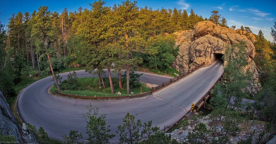
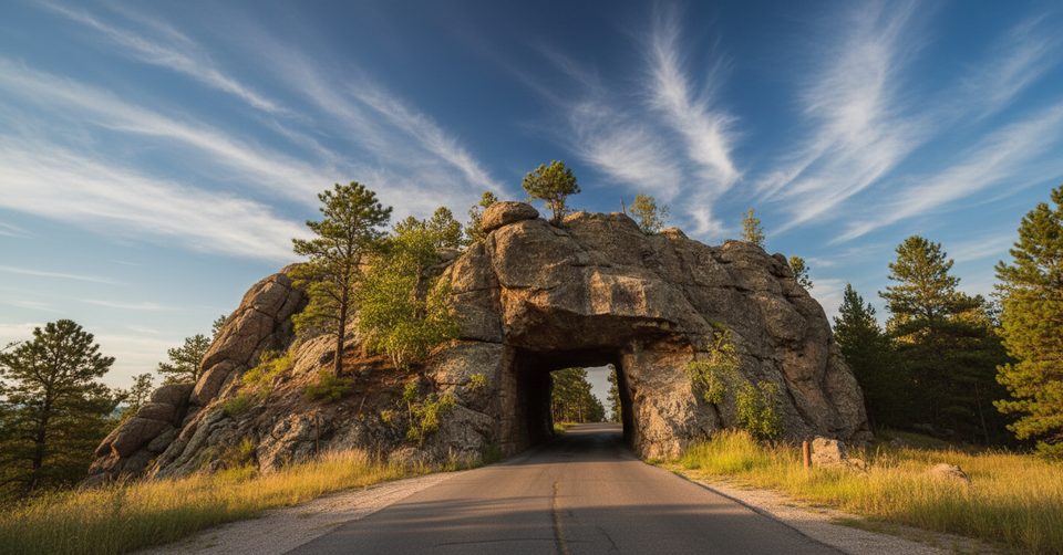
Iron Mountain Road is the 17–18 mile, slow‑going scenic connector between the park and Mount Rushmore, purpose‑built in the 1930s to wow you at every turn. Expect 314 curves, 14 switchbacks, three pigtail bridges, and three one‑lane tunnels—each crafted to reveal the Black Hills and, at key moments, perfectly frame Rushmore.
This isn’t a commuter road; it’s an experience. The whimsical pigtail bridges loop over themselves to climb without scarring the hillsides, and the tunnels are aligned for classic “through‑the‑tunnel” views of the Presidents. It’s an engineering love letter to the landscape envisioned by Governor (later Senator) Peter Norbeck.
Plan to cruise at 20–35 mph and embrace the curves—this road rewards unhurried driving. For the best Rushmore reveals, many drivers prefer going south to north. The tunnels are small (the narrowest is about 10’9” wide and 11’ high), so leave big rigs and trailers parked elsewhere.
There’s little in the way of services on the road itself—no fuel—so come prepared. You’ll find scenic pullouts for photos and breaks, and a visitor center/store with coffee near Spokane Creek, but otherwise expect minimal amenities.
Pullouts and overlooks dot the route; don’t be shy about using them. Spots like the Peter Norbeck Overlook deliver wide‑angle Black Hills vistas and a chance to soak in the silence between the twists.
Built in the 1930s under Peter Norbeck’s direction, Iron Mountain Road was laid out on foot and horseback to maximize scenery and minimize scarring—hence the tight curves, pigtails, and slow pace. It’s famously the road “engineers once said couldn’t be built,” and that’s exactly why it’s so fun to drive.
Early morning or late afternoon offers softer light for photography, fewer cars, and better chances at wildlife. Weekdays are noticeably calmer than weekends. The road isn’t maintained for winter conditions and can close for snow or ice, so prime months are late spring through fall; autumn color can be spectacular.
Place · 3 mi away
Place · 3.1 mi away
Place · 3.1 mi away
Place · 3.2 mi away
Easy · 1.4 mi away
Moderate · 3.1 mi away
Moderate · 5 mi away
Easy · 5.1 mi away

Parkwolf Tour Guide
