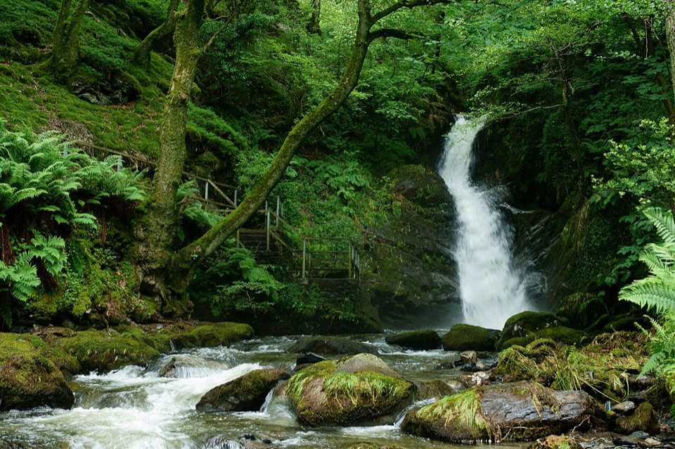
Dolgoch Falls in Eryri National Park

Sight · Eryri National Park

Dolgoch Falls

Three forest waterfalls linked by a steep, atmospheric ravine walk

Photo: Wikimedia Commons
Type
Sight
Nearest trail
3.8 km
Audio stories
4 nearby
  • Parking
  • Restrooms
  • Picnic tables
  • Food
  • #23 of 73 sights

Hear the audio tour

Dolgoch Falls

Overview

About Dolgoch Falls

Why stop

  • Three distinct cascades in a lush, mossy gorge
  • A memorable railway-and-waterfall combination

Heads up

  • Steep upper paths have many steps and no handrail
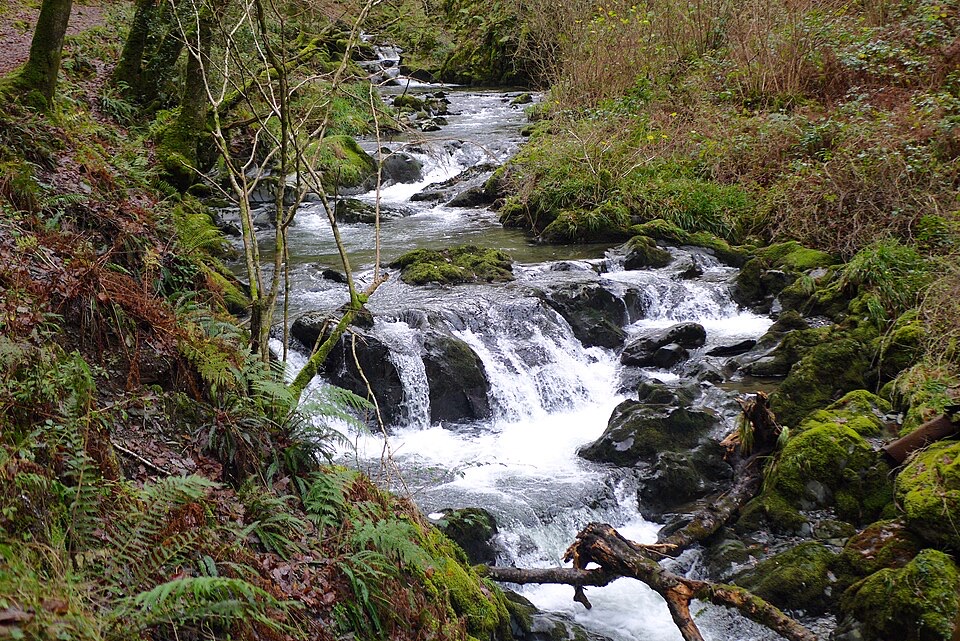
Dolgoch is a three-tier waterfall walk in a dark, ferny ravine. Water from the Nant Dôl-goch drops through moss-covered rock and woodland, with the stream, bridges, and old railway viaduct making the short visit feel more like an outing than a quick roadside photo. The lower fall is the easiest reward; climbing higher brings more enclosed views of the middle and upper falls, plus traces of the area's slate-working past.
Parkwolf’s verdictWhy stop

Map

Where it is

Loading the Eryri map
Full map
SightDolgoch Falls52.62002, -3.99470
Keep this map with you offline in the Parkwolf app

Plan your stop

Before you go

Facilities and the railway connection

There is a pay-and-display car park beside the B4405, with a bus stop nearby. Toilets are provided at Dolgoch station; they are composting toilets, and the cold wash water is not suitable for drinking. Picnic tables sit near the upper part of the route, and the hotel beside the car park provides refreshments.

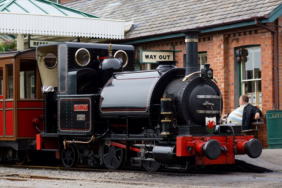
Dolgoch station is on the Talyllyn Railway, so the falls can be paired with a ride on the historic narrow-gauge line when trains are operating. The railway and the waterfalls belong to the same valley story: slate quarrying shaped the route, while today the train provides an unusually memorable way to arrive.


A park ranger sits on a dash-mounted phone, talking, as Parkwolf’s Tour Guide plays “Army Cutworm Moths: A Grizzly Bear Buffet” on Grand Loop Road below Dunraven Pass in Yellowstone
Parkwolf Tour GuideThe highest, rockiest slopes around here are a summer buffet for grizzly bears.

Eryri Tour Guide

Your drive to Dolgoch Falls, narrated.

Parkwolf is a GPS audio tour guide for Eryri National Park. As you drive, it chimes in with what’s ahead: hidden gems, upcoming stops, history, geology, and wildlife, right through your car’s speakers.

Recorded for this place

Dolgoch Falls
0:00 / 0:34
“You're approaching Dolgoch Falls, where three cascades sit in a mossy, wooded ravine. If you want a short stop, the lower fall is about 150 yards along a firm path beneath the Talyllyn Railway viaduct.”

Plays as you drive up to Dolgoch Falls in the Parkwolf Eryri Tour Guide.

More stories near here in the app

  • A Railway Stop for Waterfalls
  • The Slate Village
  • A Dolphin's Signature Whistle
  • How Slate Hauled Slate
  • 298 audio storiesacross Eryri’s roads, triggered by GPS as you drive
  • Wildlife heatmapsfor Grey Heron, Tawny Owl, Common Raven, and 9 more
  • Works offlinemaps, 120 trails, 82 places, and audio download before you lose signal
  • CarPlay readysimple controls built for the drive
★★★★★
“Fantastic app with many points of information… It’s great to just turn on while you’re driving and it gives you an audio tour of the national Park. We love it!!!!”
JMJamesApp Store review
Download Parkwolf on the App StoreGet Parkwolf on Google Play

4.7 from 8,600+ ratings

Guide

More about Dolgoch Falls

What the walk is likeFrom the B4405 car park, a wide, firm path follows the stream for roughly 150 yards and passes…

From the B4405 car park, a wide, firm path follows the stream for roughly 150 yards and passes beneath the Dolgoch Railway viaduct to the Lower Falls. This first section is the sensible stopping point if you want a brief, gentle visit. The full circular route is about a mile and usually takes 45 minutes to 1.5 hours, depending on how long you spend at each fall.

Beyond the Lower Falls, the character changes. Expect steps, rough earth and slate, muddy patches, and a steep section around a 1-in-4 gradient. The route crosses a footbridge and continues toward the railway station and upper falls. Some of the old slate workings form short tunnels along the walk, so a small torch is useful if you look into them. Keep close to the marked path and away from the stream edge.

Plan it wellWet weather brings the best water flow, but it also makes the steps and rocks slick.

Wet weather brings the best water flow, but it also makes the steps and rocks slick. Wear walking shoes with good grip and bring a rain layer. The thick canopy keeps the ravine cool and shaded, and an overcast day usually gives better photographs than hard sun, which can leave bright patches and deep shadows. Arrive early on a fine summer day if you want more room at the viewpoints.

The approach to the Lower Falls is firm and level for much of its length, but the final rise and the upper circuit are not straightforwardly accessible. The steeper routes have many steps and some sections without a handrail, so take extra care with children and anyone who is unsteady on wet ground.

Wildlife

Wildlife in Eryri

All Eryri wildlife maps

Sighting maps show where each species has been reported across Eryri. Wildlife moves, so no sighting is guaranteed.

Parkwolf’s Eryri ranking

Top sights in Eryri

All 82 places
  1. 1Yr Wyddfa (Snowdon)Sight
  2. 2Snowdon Mountain RailwaySight
  3. 3Cader IdrisSight
  4. 4Harlech CastleSight
  5. 5Betws-y-CoedSight
  6. 6LlanberisSight

Take Parkwolf to Eryri.

The audio tour guide for the drive, plus offline maps, trails, and wildlife heatmaps for when the signal drops.

4.7 from 8,600+ ratings

Download Parkwolf on the App StoreGet Parkwolf on Google Play