
Place
Challenging
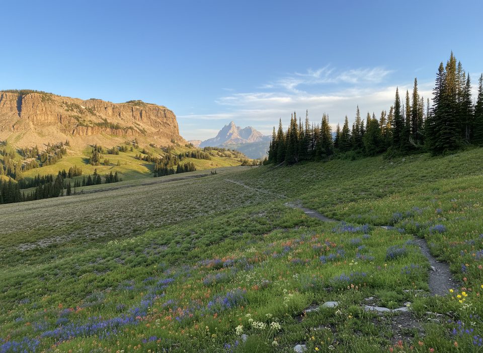
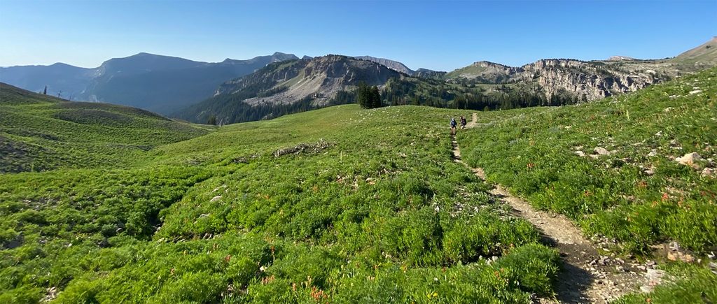
Fox Creek Pass sits at 9,570 feet at the head of Death Canyon, and the trail segment here is a scenic connector on the Teton Crest corridor. Expect classic Teton high country: alpine meadows, conifer forest patches, and huge views across the upper canyon and surrounding peaks. Many hikers experience this as part of a larger itinerary, but there’s also a well-traveled loop approach.
The most-referenced option is the Fox Creek Pass Loop via the Granite Canyon Trail, a 23.4-mile total loop with about 3,337 feet of gain. Strong day hikers often budget roughly 12–13 hours, but most people treat it as an overnight or multi-day backpack. The trail segment itself contours a broad plateau from the Death Canyon Shelf/Death Canyon Trail junction, passes Pass Lake on the left, skirts the west slopes of Spearhead Peak, then descends toward brilliant-blue Marion Lake. Surface is natural singletrack—mostly dirt with some rocky stretches.
This corridor delivers big alpine vistas and frequent summer wildflower displays in the meadows. The traverse near Spearhead Peak offers “top of the world” feels before the trail drops toward Marion Lake, a perfect rest stop and photo perch. Just beyond the pass, the Death Canyon Shelf rolls out for nearly four miles—a highlight of the entire Crest experience.
Between the shelf and the descent, the walking is mostly level and forgiving across a high plateau, then shifts into a sustained, scenic drop toward Marion Lake. Wildlife sightings—especially moose in the woods and meadows—are possible. Water is typically available from creeks and at Marion Lake; always treat or filter.
Late June through September is the sweet spot, with wildflowers peaking in July and early August. Expect lingering snow on higher sections into early summer. Fall brings colorful aspen patches and thinner crowds, but nights are colder and early storms are possible.
This is backcountry travel at high elevation, and conditions change fast. Snow and ice can persist early, and winter/early-spring travel involves avalanche exposure and is only for those with the skills and gear. Navigation can be trickier in early season—carry a detailed map or GPS. For overnight trips, use designated backcountry campsites and obtain a permit. Pets and bicycles are not allowed on these backcountry trails.
Use the trailhead that matches your approach—Granite Canyon Trail or Death Canyon Trail—to access the Fox Creek Pass segment.
High-elevation weather shifts quickly; early-season snow complicates route finding. Avalanche danger exists in winter and spring. Carry bear spray and give moose (especially cows with calves) plenty of space. Treat all water.
Place
Place
Place
Place
Challenging
Moderate
Moderate
Moderate

Parkwolf Tour Guide
