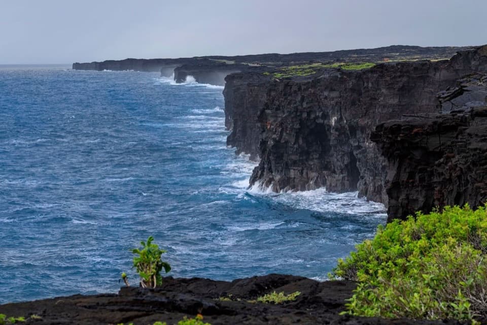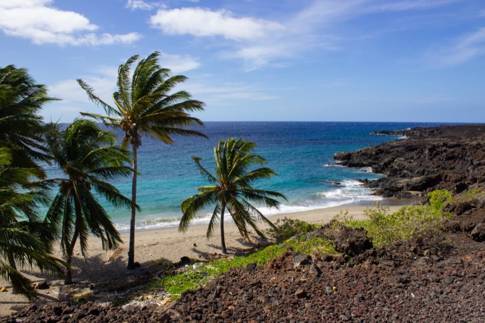
Pōhue Bay in Hawaiʻi Volcanoes National Park

Sight · Hawaiʻi Volcanoes National Park

Pōhue Bay

An ancient coast preserved for its archaeology and endemic wildlife.

Photo: National Park Service

Overview

About Pōhue Bay

Why stop

  • Distinctive Hawaiian coastal archaeology and endangered wildlife habitat.

Heads up

  • Public shoreline access is currently restricted.

Map

Where it is

Loading the Hawaiʻi Volcanoes map
Full map
SightPōhue Bay19.00976, -155.80417
Keep this map with you offline in the Parkwolf app

Plan your stop

Before you go

5 active Hawaiʻi Volcanoes alerts

  • ClosureWork closures on Hilina Pali and Mauna Loa roadsMentions Mauna Loa, referenced in this guideRoad work is restricting motorized and all-use access on portions of Hilina Pali Road and Mauna Loa Road.Official details
  • ClosureStorm-damage closures at Kahuku, Kīpukapuaulu, and Sulphur BanksStorm damage and hazardous trees continue to restrict access at Kahuku and Kīpukapuaulu; the damaged Sulphur Banks Bridge is closed.Official details

See all 5 alerts
A park ranger sits on a dash-mounted phone, talking, as Parkwolf’s Tour Guide plays “Army Cutworm Moths: A Grizzly Bear Buffet” on Grand Loop Road below Dunraven Pass in Yellowstone
Parkwolf Tour GuideThe highest, rockiest slopes around here are a summer buffet for grizzly bears.

Hawaiʻi Volcanoes Tour Guide

Your drive to Pōhue Bay, narrated.

Parkwolf is a GPS audio tour guide for Hawaiʻi Volcanoes National Park. As you drive, it chimes in with what’s ahead: hidden gems, upcoming stops, history, geology, and wildlife, right through your car’s speakers.

See the Hawaiʻi Volcanoes audio tour
  • 58 audio storiesacross Hawaiʻi Volcanoes’s roads, triggered by GPS as you drive
  • Wildlife heatmapsfor Hawaiian Goose (Nēnē), Green Sea Turtle, Hawaiian Hawk ('Io), and 13 more
  • Works offlinemaps, 33 trails, 53 places, and audio download before you lose signal
  • CarPlay readysimple controls built for the drive
★★★★★
“Fantastic app with many points of information… It’s great to just turn on while you’re driving and it gives you an audio tour of the national Park. We love it!!!!”
JMJamesApp Store review
Download Parkwolf on the App StoreGet Parkwolf on Google Play

4.7 from 8,600+ ratings

Guide

More about Pōhue Bay

A remote bay on Kaʻū's coastPōhue Bay is a natural bay on the southern flank of Mauna Loa, within the 16,451-acre…

Pōhue Bay is a natural bay on the southern flank of Mauna Loa, within the 16,451-acre Kahuku–Pōhue addition to Hawaiʻi Volcanoes National Park. Kaʻū residents distinguish the bay from its adjacent beach, Kahuku Beach. Public shoreline access is currently restricted, and no day-use permit procedure is listed as operating, so don't plan a shore visit unless the park confirms access. When an authorized visit is possible, frame the pale sand and turquoise water between coconut palms and dark lava to show the coast's contrast.

An ancient coastal routeA well-preserved section of the Ala Kahakai National Historic Trail, also called Ala Loa,…

A well-preserved section of the Ala Kahakai National Historic Trail, also called Ala Loa, follows this coast. The wider parcel preserves fishing shrines, village remains, petroglyphs and lava tubes, as well as Hawaiʻi's largest recorded abrader quarry. Kahuku is the historic mauka-to-makai ʻahupuaʻa, or land division, that contains Pōhue.

Wildlife of the coastThis shoreline is critical habitat for endangered honuʻea (Hawaiian hawksbill turtles) and…

This shoreline is critical habitat for endangered honuʻea (Hawaiian hawksbill turtles) and Hawaiian monk seals. Anchialine ponds in the area support endemic ʻōpaeʻula (red shrimp). The park also notes ʻiwa (great frigatebirds), koaʻe kea (white-tailed tropicbirds), kōlea (Pacific golden plovers), ʻūlili (wandering tattlers) and ʻaukuʻu (black-crowned night herons) among birds that frequent the area; sightings are not guaranteed.

Protected from developmentThe Trust for Public Land transferred the 16,451-acre parcel to the National Park Service in…

The Trust for Public Land transferred the 16,451-acre parcel to the National Park Service in July 2022 after resort proposals had threatened the undeveloped landscape. The acquisition had been identified as a high-priority protection in local and park planning.

Know before you goAs of October 17, 2026, the park's page still says public access is temporarily restricted…

As of October 17, 2026, the park's page still says public access is temporarily restricted while safe, resource-protective procedures are prepared. Existing roads and trails to the shoreline cross private property, and the park cannot authorize those crossings; do not use them. There is no formal parking or bathroom facility, no trash-removal capacity, and emergency response is very limited. The park describes a day-use permit pilot as planned, not operating; check its current access notice before making plans.

Wildlife

Wildlife in Hawaiʻi Volcanoes

All Hawaiʻi Volcanoes wildlife maps

Sighting maps show where each species has been reported across Hawaiʻi Volcanoes. Wildlife moves, so no sighting is guaranteed.

Parkwolf’s Hawaiʻi Volcanoes ranking

Top sights in Hawaiʻi Volcanoes

All 53 places
  1. 1UēkahunaSight
  2. 2Nāhuku Lava TubeSight
  3. 3Kīlauea OverlookSight
  4. 4Puʻuloa PetroglyphsSight
  5. 5Hōlei Sea ArchSight
  6. 6Kīlauea Iki OverlookSight

Take Parkwolf to Hawaiʻi Volcanoes.

The audio tour guide for the drive, plus offline maps, trails, and wildlife heatmaps for when the signal drops.

4.7 from 8,600+ ratings

Download Parkwolf on the App StoreGet Parkwolf on Google Play