Kane Meadows Backcountry Campground in Jasper National Park

Campground · Jasper National Park

Kane Meadows Backcountry Campground

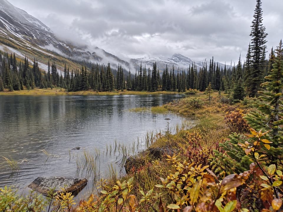
Four sites beside a creek, deep on a historic crossing.

Type
Campground
  • Restrooms
Parkwolf audio tour170 stories across Jasper’s roads
Download Parkwolf on the App StoreGet Parkwolf on Google Play

4.7 from 8,600+ ratings

Overview

About Kane Meadows Backcountry Campground

Why stop

  • A scenic creekside camp on the historic Athabasca Pass route.

Heads up

  • A remote 48.5 km approach with route-finding and risky river fords.

Map

Where it is

Loading the Jasper map
Full map
CampgroundKane Meadows Backcountry Campground52.43140, -118.19709
Keep this map with you offline in the Parkwolf app

Plan your stop

Before you go

4 active Jasper alerts

  • ClosureCavell Road and Maligne Canyon closedCavell Road and Maligne Canyon are closed; do not plan access to these areas.Official details
  • Caution93A construction restricts cyclistsConstruction on Highway 93A between the north end of 93N and Marmot Road means single-lane vehicle access and no cycling from November 2026 through spring 2027.Official details

See all 4 alerts
A park ranger sits on a dash-mounted phone, talking, as Parkwolf’s Tour Guide plays “Army Cutworm Moths: A Grizzly Bear Buffet” on Grand Loop Road below Dunraven Pass in Yellowstone
Parkwolf Tour GuideThe highest, rockiest slopes around here are a summer buffet for grizzly bears.

Jasper Tour Guide

Your drive to Kane Meadows Backcountry Campground, narrated.

Parkwolf is a GPS audio tour guide for Jasper National Park. As you drive, it chimes in with what’s ahead: hidden gems, upcoming stops, history, geology, and wildlife, right through your car’s speakers.

See the Jasper audio tour
  • 170 audio storiesacross Jasper’s roads, triggered by GPS as you drive
  • Wildlife heatmapsfor Grizzly Bear, Caribou, Gray Wolf, and 13 more
  • Works offlinemaps, 74 trails, 189 places, and audio download before you lose signal
  • CarPlay readysimple controls built for the drive
★★★★★
“Fantastic app with many points of information… It’s great to just turn on while you’re driving and it gives you an audio tour of the national Park. We love it!!!!”
JMJamesApp Store review
Download Parkwolf on the App StoreGet Parkwolf on Google Play

4.7 from 8,600+ ratings

Guide

More about Kane Meadows Backcountry Campground

Four sites on the Athabasca Pass routeKane Meadows Backcountry Campground is a four-site overnight stop beside Kane Creek at 1,602 m,…

Kane Meadows Backcountry Campground is a four-site overnight stop beside Kane Creek at 1,602 m, on the Athabasca Pass Trail. This is a multi-day backcountry destination, not a drive-in campground: the route is 48.5 km one way and usually takes four to five days. Save it for a prepared wilderness trip; the draw is an open, creekside camp in a remote mountain valley.

Plan the approachThe trailhead is at the end of the 6.

The trailhead is at the end of the 6.8 km unpaved Moab Lake Road, reached from Wabasso Road south of Jasper. Beyond Whirlpool, the trail is remote and rarely maintained; it can be overgrown, so expect route-finding. Backcountry camping requires a camping permit and a national park entry pass, and is allowed only at designated sites.

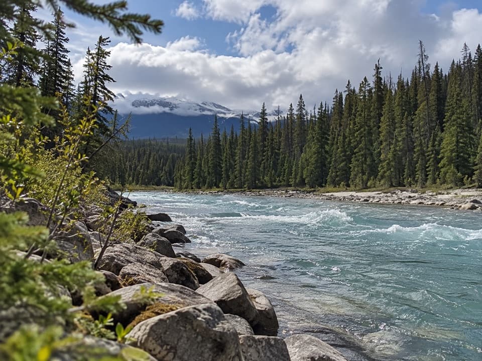
Take the river crossings seriouslySeveral creeks and rivers are unbridged.

Several creeks and rivers are unbridged. Parks Canada specifically warns that the Whirlpool River crossing near Kane Meadows and Simon Creek can be dangerous, and high water can make crossings impassable. Check current conditions before setting out and be prepared to turn back.

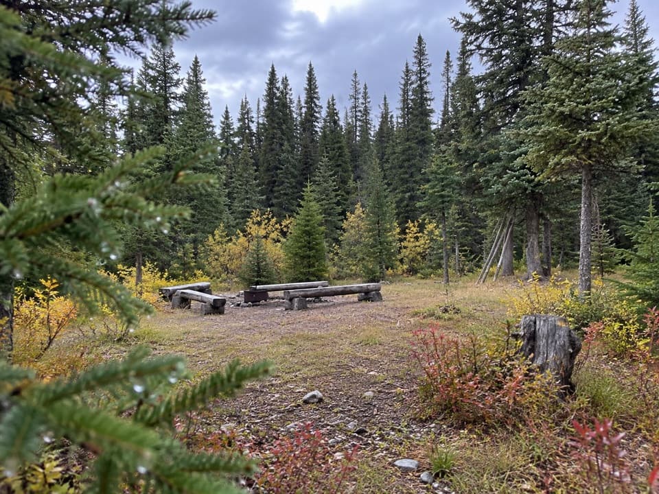
Camp beside Kane CreekThe four tent sites sit beside Kane Creek with open views.

The four tent sites sit beside Kane Creek with open views. The campground listing records a “Bar” toilet type and a food-storage pole, though it does not explain the toilet label. No food service or potable-water information is listed, so carry your meals and be prepared to treat backcountry water.

A fur-trade routeThe Athabasca Pass Trail follows the Whirlpool River Valley, a route used by early fur traders…

The Athabasca Pass Trail follows the Whirlpool River Valley, a route used by early fur traders crossing the Rockies; much of it has changed little since that era. About 8 km beyond Kane Meadows are the Athabasca Pass National Historic Site and Committee’s Punchbowl, where fur traders traditionally toasted Hudson’s Bay Company officers.

Wildlife

Wildlife in Jasper

All Jasper wildlife maps

Sighting maps show where each species has been reported across Jasper. Wildlife moves, so no sighting is guaranteed.

Parkwolf’s Jasper ranking

Top sights in Jasper

All 189 places
  1. 1Maligne LakeSight
  2. 2Spirit IslandSight
  3. 3Athabasca GlacierSight
  4. 4Athabasca FallsSight
  5. 5Sunwapta FallsSight
  6. 6Mount Edith CavellSight

Take Parkwolf to Jasper.

The audio tour guide for the drive, plus offline maps, trails, and wildlife heatmaps for when the signal drops.

4.7 from 8,600+ ratings

Download Parkwolf on the App StoreGet Parkwolf on Google Play