Overview
About Mount Bruce (Punurrunha)
Why stop
- A summit panorama over the Hamersley Range and Marandoo operation.
Heads up
- A long, exposed Class 5 scramble with steep sections and limited waymarking.
Mount Bruce (Punurrunha) is a 1,234 m summit in the Hamersley Range and Western Australia’s second-highest peak. The 9 km return walk climbs a rough ridge above Karijini, opening onto broad views of the range and the Marandoo iron-ore operation. This is an extreme Class 5 outing for very fit, experienced walkers who are comfortable scrambling on exposed rock. If that sounds like too much, the short walk to Marandoo View gives you a much easier way to see the mountain.
 Parkwolf’s verdictIs this the climb for you?
Map
Where it is

The highest, rockiest slopes around here are a summer buffet for grizzly bears.
Karijini Tour Guide
Your drive to Mount Bruce (Punurrunha), narrated.
Parkwolf is a GPS audio tour guide for Karijini National Park. As you drive, it chimes in with what’s ahead: hidden gems, upcoming stops, history, geology, and wildlife, right through your car’s speakers.
See the Karijini audio tourRecorded for this place
Mount Bruce and Marandoo View“You're approaching the trailhead for Mount Bruce, also called Punurrunha.”
Plays as you drive up to Mount Bruce (Punurrunha) in the Parkwolf Karijini Tour Guide.
More stories near here in the app
- The Microbes Behind the Iron
- A Spotted Hunter After Dark
- Why Gum Leaves Hang Down
- Why Wet Rock Looks Darker
- 141 audio storiesacross Karijini’s roads, triggered by GPS as you drive
- Wildlife heatmapsfor Dingo, Rock Wallaby, Mulga Snake, and 13 more
- Works offlinemaps, 22 trails, 30 places, and audio download before you lose signal
- CarPlay readysimple controls built for the drive
“Fantastic app with many points of information… It’s great to just turn on while you’re driving and it gives you an audio tour of the national Park. We love it!!!!”


Guide
More about Mount Bruce (Punurrunha)
What the ridge asks of youThe summit route starts at the Mount Bruce car park, heads toward Marandoo View, then follows…
The summit route starts at the Mount Bruce car park, heads toward Marandoo View, then follows the ridge. A little over two kilometres in, it crosses broad rock slabs; higher up come steep switchbacks, rough scrambling and a narrow ledge beside a fixed chain. Natural iron-rich rock formations make hand- and footholds, but waymarking is limited. Bring navigation skills and be comfortable with exposure before you set out.
Choose a shorter walkMarandoo View is a 500 m return walk from the car park, graded Class 2 and about 30 minutes.
Marandoo View is a 500 m return walk from the car park, graded Class 2 and about 30 minutes. It looks over Rio Tinto’s Marandoo iron-ore operation without the summit scramble. The 4.6 km return Honey Hakea walk, graded Class 3, is a longer middle option if you want more time on the mountain.
Two names and an ancient rangePunurrunha is the peak’s Aboriginal name. The European name dates to explorer Francis T.
Punurrunha is the peak’s Aboriginal name. The European name dates to explorer Francis T. Gregory’s 1861 expedition; he named the mountain for Lieutenant-Colonel John Bruce. Karijini’s landscape began forming more than 2.5 billion years ago from iron-rich seafloor sediments, later folded and fractured before water cut the gorges. Mount Bruce’s strong horizontal bands are part of that layered country.
Give the heat and distance roomWalker times vary widely, from about 2½ hours for fast parties to around six hours, and the…
Walker times vary widely, from about 2½ hours for fast parties to around six hours, and the route is also described as a full-day outing. Keep most of a day free, especially if you want a careful pace and breaks. In warmer months, start during the cooler part of the day; temperatures can exceed 40°C. Carry plenty of water and sun protection for the exposed ridge.
Getting to the startThe trailhead is reached from Karijini Drive by about 3 km of unsealed road, roughly an hour…
The trailhead is reached from Karijini Drive by about 3 km of unsealed road, roughly an hour east of Tom Price. There’s a toilet and information bay at the Mount Bruce car park, but no food service is listed there. Pack your food and enough water for the walk; the facilities are at the start, not on the summit.
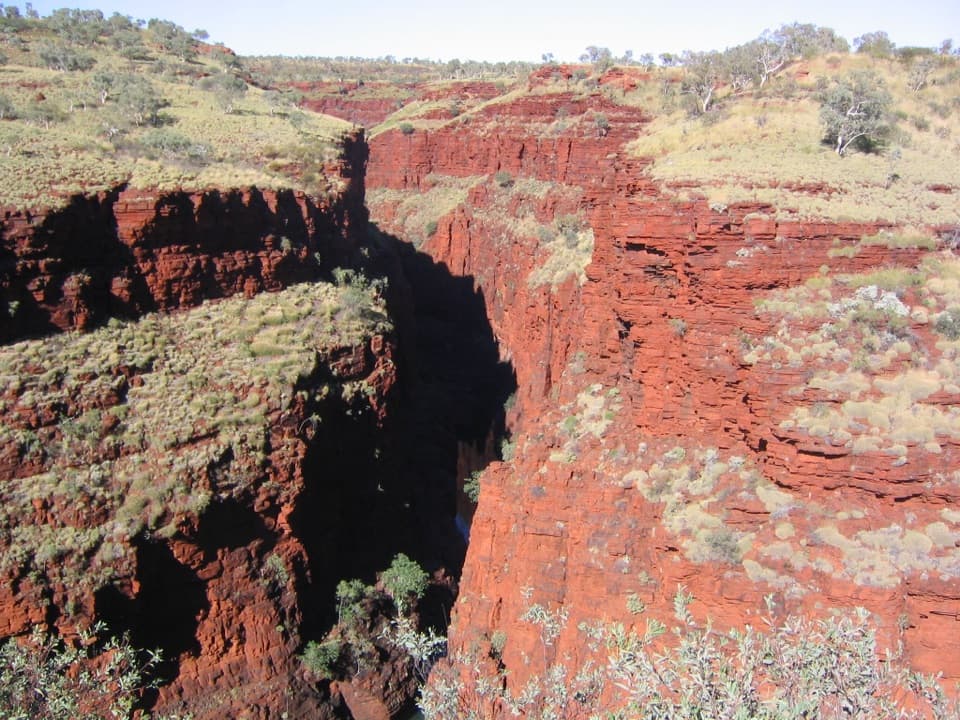
Take in the whole viewThe summit is the photo stop: its layered brown ridges rise above the grassland, with the…
The summit is the photo stop: its layered brown ridges rise above the grassland, with the Hamersley Range and Marandoo operation spread across the landscape. Frame some of the banded rock or a foreground ledge with the distant ranges to show the mountain’s scale. From Marandoo View, the mine and peak fit into a shorter, lower-angle view.
Wildlife
Wildlife in Karijini
 44 sightingsDingoMost seen around 6 PMSighting map
 18 sightingsRock WallabyMost seen around 6 AMSighting map
 15 sightingsMulga SnakeMost seen around 7 PMSighting map
 36 sightingsHamersley Rock MonitorMost seen around 9 AMSighting map
 13 sightingsWestern BowerbirdMost seen around 7 AMSighting map
 34 sightingsChildren's PythonMost seen around 8 PMSighting map
Sighting maps show where each species has been reported across Karijini. Wildlife moves, so no sighting is guaranteed.