

Place · 0 mi away
Moderate

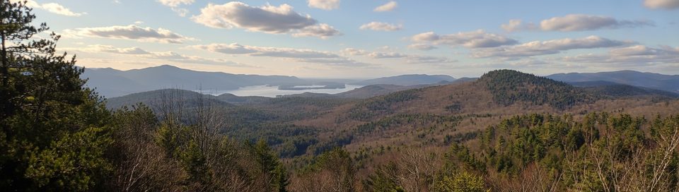
Cat Mountain delivers one of the best panoramas in the Lake George region—an expansive, mostly bald-rock summit with sweeping views of the lake, its islands, The Narrows, Trout Lake, and distant Adirondack peaks. It’s a true views-for-effort hike: approachable at first, then satisfyingly steep and rocky near the top.
Plan on roughly 6 miles total out-and-back if you take the most direct approach from Edgecomb Pond Road. Expect an easy-to-moderate start: about two-thirds of the climb follows an old logging road. The final third narrows into a rougher, rooty, and rocky footpath with steeper grades and some switchbacks before popping onto spacious open rock. Allow 3–5 hours round-trip depending on pace and summit linger time.
Along the way you’ll pass mixed hardwood and conifer forest, wetlands, and small ponds (occasionally beaver-made). The summit’s open ledge is classic Adirondack granite shaped by glacial scouring—bring lunch and take your time roaming for different angles on the lake.
April through October tends to offer the best footing and clearest views, with fall foliage being a standout. Winter travel is possible with proper gear; expect the upper trail to feel much more challenging with snow and ice. For photos, early morning or late afternoon light flatters the lake and islands, and weekdays are generally quieter than weekends.
Looking to mix it up? You can link Thomas Mountain via the ridge (yellow) trail for a bigger day. There are multiple approaches within the Lake George Land Conservancy’s Cat & Thomas Mountains Preserve, including a more challenging red trail and longer routes that start from other trailheads.
Pets are allowed on leash. Camping is permitted with restrictions (short stays, follow local rules), and fires must be monitored. Some sections can be muddy or washed out after rain, and no motor vehicles are allowed in the preserve.
Primary access from Edgecomb Pond Road (direct approach to Cat Mountain). Alternate access from Valley Woods Road within the Lake George Land Conservancy’s Cat & Thomas Mountains Preserve.
Steep, rocky, rooty upper section; junctions can be confusing; mud after rain; limited water; winter conditions add difficulty.
Place · 0 mi away

Place · 1.1 mi away

Place · 1.4 mi away

Place · 1.5 mi away

Easy · 0 mi away

Easy · 0 mi away

Easy · 1.9 mi away
Moderate · 2 mi away

Parkwolf Tour Guide
