Pros & cons
PROS
- Roadside pullout with big views and interpretive exhibits
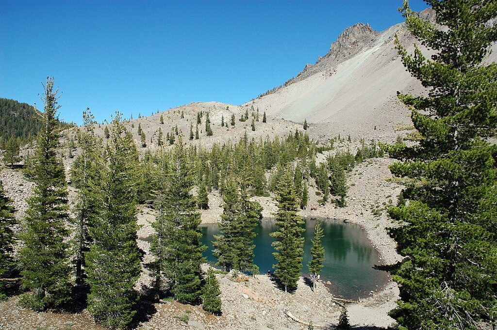
- Rewarding 4-mile hike to Crags Lake beneath the domes
CONS
- No restrooms or drinking water at the viewpoint/trailhead
- Crags Lake can shrink to a puddle or dry out by late summer
Overview
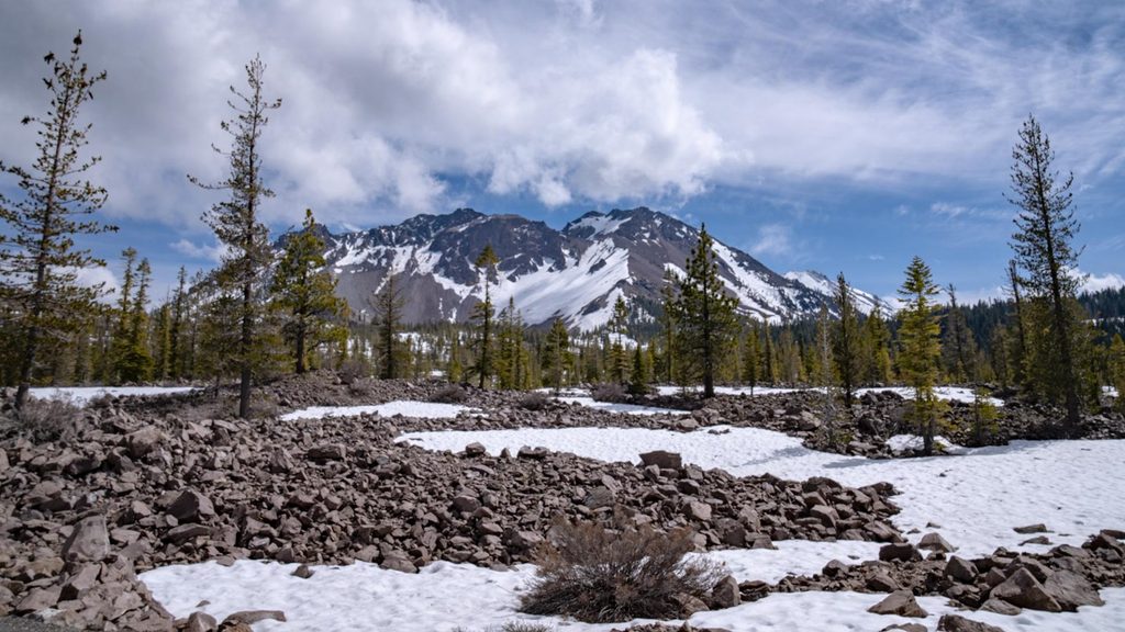
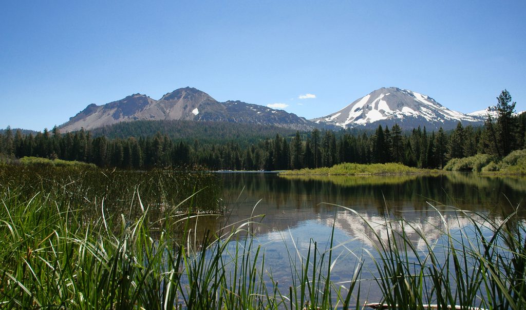
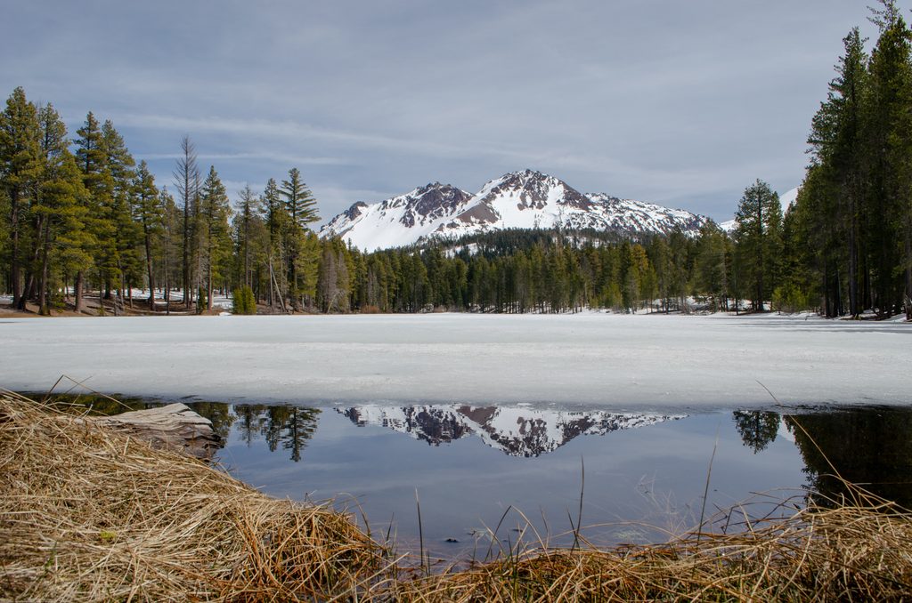
Chaos Crags is a tight cluster of steep, blocky dacite lava domes—young by volcanic standards, with eruptions about 1,100 years ago. Their northwest flank let go roughly 300 years ago in a massive rock avalanche known as the Chaos Jumbles. That slide hurtled downslope at highway speeds, flattened forest, surged hundreds of feet up nearby terrain, and even dammed a creek to create Manzanita Lake. It’s one of the park’s clearest windows into how fast landscapes can change.
What You'll See
- A quick, informative roadside stop: there’s a pullout along the park road with interpretive panels and sweeping views of the jumbled avalanche deposits and the pink-gray domes above.
- The best on-foot experience is the Crags Lake Trail (about 4.0 miles round-trip, ~1,000 feet of gain, 2–3 hours). It starts near the Manzanita Lake area, climbs through forest alongside the Chaos Jumbles, and finishes at a small lake tucked right beneath the domes. Expect steady uphill on the way out and an easy glide back.
- Crags Lake is seasonal. In spring and early summer it collects snowmelt; by late summer it can shrink dramatically or even dry out.
Geology—Why It’s Special
These domes represent young, silicic dome-building activity at the southern end of the Cascade arc. The Chaos Jumbles tell the backstory: a huge rock avalanche that demonstrates just how energetic dome-collapse events can be. The roadside panels make the story click once you’re looking at the debris field and the cliffs it came from.
Season & Conditions
- Prime hiking season typically runs June–October. Outside of summer, road and trail access vary with snow—always check current conditions with the park.
- In winter, the route becomes a mellow snowshoe/XC option when access allows; some visitors start from the Loomis Ranger Station area when the main road beyond is closed.
Facilities
There are no restrooms or drinking water at the Chaos Crags viewpoint/trailhead—plan to arrive self-sufficient. Use developed areas (campgrounds and major parking lots) along the park road for bathrooms and water.
Best Time to Visit
- For the lake: late spring to early summer gives you the best chance at water.
- For convenience: the roadside viewpoint is an easy anytime stop, but parking is limited—arrive earlier in the day or be ready to park at nearby developed lots in the Manzanita Lake area.
- Many visitors also enjoy the area after dark on clear nights for stargazing.
Safety & Tips on the Ground
The jumbled talus is unstable; if you step onto it, move carefully. Most people get excellent views from the pullout and the established trail without scrambling.
Where it is
40.5241, -121.5222Tips for Chaos Crags
- 01Bring all the water you need and plan bathroom stops elsewhere—there are no facilities here.
- 02For a fuller lake, go in late spring or early summer; it may be dry by late summer.
- 03Parking is limited; if the small turnout is full, use nearby developed lots around Manzanita Lake.
- 04If you venture onto the jumbled rocks, step carefully—talus shifts easily.
- 05In winter, treat it as a snowshoe; start from the Loomis Ranger Station area when the road is closed and check conditions first.
Amenities
Near Chaos Crags
All places →All trails →
0.7 mi awayCrags LakeEphemeral basin beneath Chaos Crags with outsized geologyScenic Viewpoint
1.6 mi awayChaos Crags and Jumbles Scenic Pull-outQuick roadside window into a colossal rock avalanchePullout · Scenic Viewpoint
2.1 mi awayManzanita Creek TrailQuiet forest-and-meadow ramble with big Lassen Peak views and solitudeModerate · 6.8 mi · 3.2 hr
2.2 mi awayManzanita Lake Boat Rentals (Seasonal)Easy walk-up kayaks and SUPs with peak viewsRestroom · Parking
2.2 mi awayManzanita Lake Camper StoreOne‑stop camp store with fuel, showers, and lake rentalsStore · Food
2.3 mi awayLily Pond Nature TrailShort, flat interpretive loop with pond views and Chaos Crags historyEasy · 0.5 mi · 30 min
2.4 mi awayManzanita Lake LoopEffortless loop with postcard reflections of Lassen Peak and Chaos CragsEasy · 1.7 mi · 1 hr
2.6 mi awayReflection Lake TrailEasy loop with standout Lassen Peak reflections and waterfowl watchingEasy · 0.5 mi · 30 min