
Place · 2.6 mi away
Moderate
This is a historic wagon route turned footpath that cuts across the park’s north side. The classic hike is a 12.7-mile point‑to‑point from the Highway 89 corridor to Butte Lake (or reverse), with about 669 feet of total gain. Expect mostly gentle grades, long forest traverses, and a finale of volcanic scenery near Butte Lake and Cinder Cone. A 24‑mile portion of the route inside the park is listed on the National Register of Historic Places (1975), and you’ll feel that sense of traveling a corridor used since the 1850s.
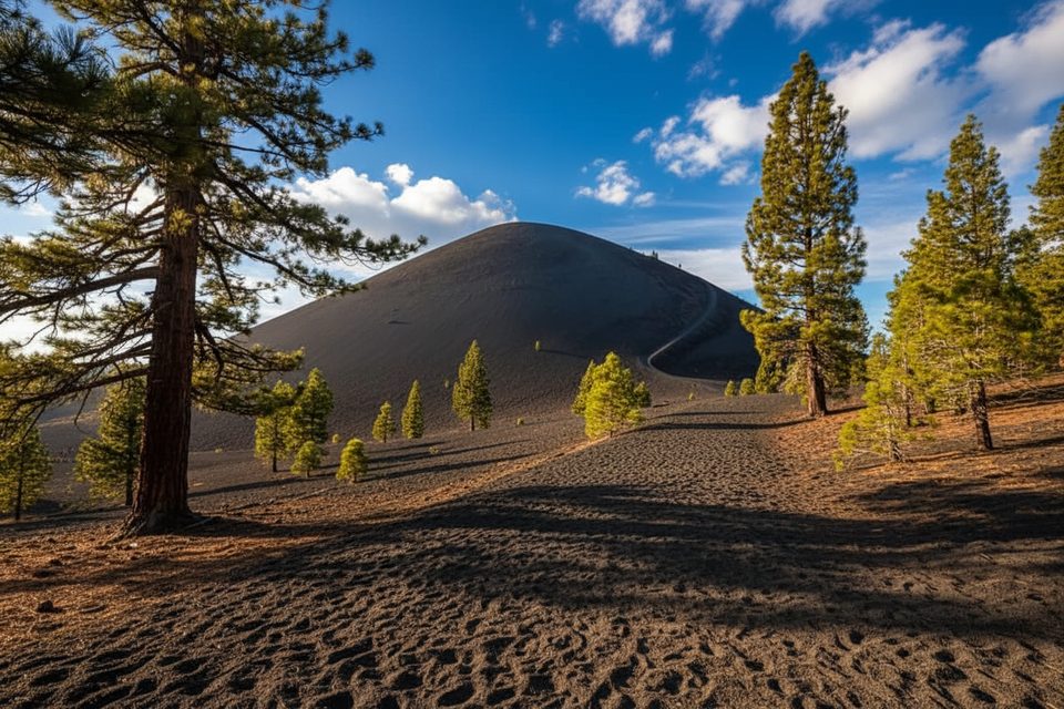
West to east, you start in open conifer forest with occasional views toward the Chaos Crags area, then settle into mellow tread across pumice flats and mixed forest. As you near Butte Lake, the character shifts to sandy cinders and stark lava flows—dramatic, other‑worldly terrain. Much of the corridor outside the immediate Cinder Cone area passes through regenerating sections of the 2012 Reading Fire, so expect a mix of low ground cover, snag forests, and patches of healthy pine. It’s not all postcard vistas, but the geologic story is front and center by the lake.
Hiked west→east (Highway 89 to Butte Lake) it feels net‑downhill and ends at water, shade, and a campground—an easy place to recover. The tread is generally straightforward, but a few stretches can be faint or lightly signed; having a map/GPS helps. Sandy cinder sections near Butte Lake are slow and can feel hot on sunny days.
Two main access points: the Highway 89 corridor near Manzanita Lake/Reflection Lake on the west end, and the Butte Lake trailhead by Butte Lake Campground on the east. This is best done with a two‑car shuttle. If you’re piecing together shorter outings, use established, signed trailheads; some minor pullouts (like Sunflower Flats) don’t function well as loop starts and can force awkward highway walks.
Reliable water is limited away from lakes and creeks—carry what you need, especially in late summer, and treat all sources. Snow can linger into spring; mid/late summer through fall is the dependable window. In brushy stretches, ticks are possible; treat clothing or use pre‑treated garments, avoid sitting in tall grass/leaf litter, and do regular checks. The burn area offers little shade—plan for sun.
No permit is needed for day hiking. Overnight trips anywhere along this route require a Lassen wilderness permit. Established campgrounds like Butte Lake are convenient bases if you’re breaking the hike into segments.
Aim for early morning starts in summer to beat heat on cinder sections, or fall for cooler temps and quieter trails. Weekdays see lighter use. If you’re adding the Cinder Cone, low‑angle light at the ends of the day makes the cinders and lava textures pop.
Park at the Highway 89/Manzanita Lake–Reflection Lake corridor for the west end, or at the Butte Lake trailhead by Butte Lake Campground for the east end. Use a two‑car shuttle for the 12.7‑mile point‑to‑point. Avoid unsigned pullouts that may require highway walking.
Some sections are faint and lightly signed—bring a map/GPS. Sandy cinders near Butte Lake are slow and can be hot. Limited water away from lakes; carry and treat what you find. Expect sun exposure in burn areas. Ticks are present in brushy stretches—use permethrin‑treated clothing and do checks.
Place · 2.6 mi away
Place · 2.6 mi away
Place · 3 mi away
Place · 3.6 mi away
Easy · 2.6 mi away
Moderate · 3 mi away
Moderate · 3.6 mi away
Moderate · 3.6 mi away

Parkwolf Tour Guide
