Parking
Portavadie is the start and Inveruglas the finish. The route sources do not identify a dedicated trail car park or give parking capacity; arrange transport at both ends and confirm parking where you plan to leave a vehicle.
Loch Lomond & The Trossachs National Park, SC
A 57-mile crossing from Loch Fyne to Loch Lomond.
Overview
Map & elevation
Plan your hike

The highest, rockiest slopes around here are a summer buffet for grizzly bears.
Loch Lomond & The Trossachs Tour Guide
Parkwolf is a GPS audio tour guide for Loch Lomond & The Trossachs National Park. As you drive, it chimes in with what’s ahead: hidden gems, upcoming stops, history, geology, and wildlife, right through your car’s speakers.
“Fantastic app with many points of information… It’s great to just turn on while you’re driving and it gives you an audio tour of the national Park. We love it!!!!”


Trail guide
The Loch Lomond & Cowal Way is a 57-mile (92 km) point-to-point walk from Portavadie on Loch Fyne to Inveruglas on Loch Lomond. It crosses Cowal through Tighnabruaich, Glendaruel, Strachur, Lochgoilhead and Arrochar, changing from shoreline and beach to forest, open hillside, quiet road and hill pass. The appeal is seeing the peninsula and the edge of the Highlands unfold over several days, not ticking off one summit. About half lies within Loch Lomond & The Trossachs National Park, though the Portavadie start is outside its southwest boundary. It is a through-route, so the stored distance is one way, not a return walk.
Allow four to five days, with roughly 26 to 31.5 hours of walking spread across the stages. The route is fully waymarked, but it is still a substantial undertaking, with roughly 1,810 metres of reported ascent and several exposed passes. Published ascent estimates range from about 1,810 to 2,439 metres, so expect sustained climbing rather than planning around a single ascent figure. Starting at Portavadie puts the usual southwesterly wind behind you; the route can also be walked in the opposite direction. Pick this if you want a long, varied journey with overnight stops in small communities. If you have one day, choose a single stage instead of trying to rush the whole Way.
The first leg from Portavadie to Tighnabruaich is 10.5 km and usually takes three to four hours. The next 18.25 km reaches Glendaruel; then comes the longest listed stage, 25.5 km from Glendaruel to Strachur. Those middle miles make this a real multi-day walk, even before the higher country begins. The 14.5 km stretch from Strachur to Lochgoilhead has a challenging uphill section and a remote hilltop loch as its reward. From there, another 14.5 km reaches Arrochar, followed by a final 7.75 km to Inveruglas. The route's northern hills rise successively to about 360, 350 and 500 metres. In wet weather, some hill sections become boggy; around two kilometres of the highest ground can be hard to navigate when low cloud cuts visibility.
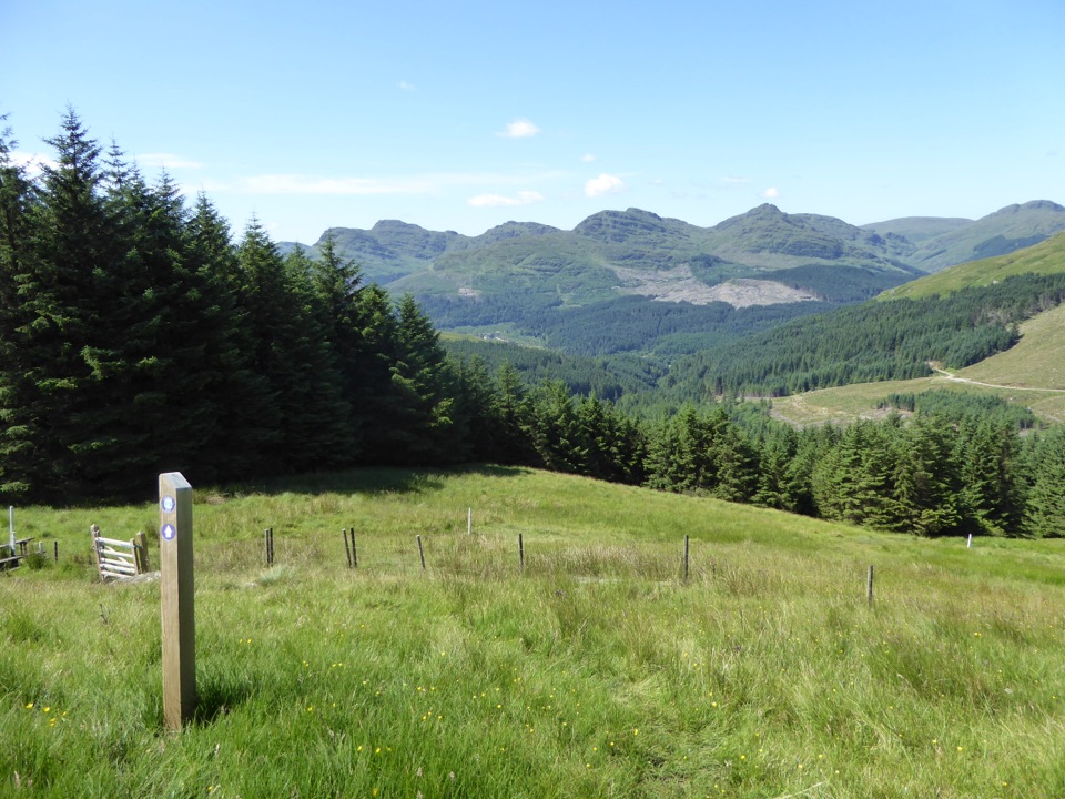
Underfoot, expect a changing mix of established paths, beaches, forest tracks, hillside and quiet roads. That variety is the point, but the road mileage is a real tradeoff and the route is not a continuous remote footpath. Forest and lowland stretches break up the climbs; open hillside brings the broadest views, including the Clyde coast, while lochs and the Arrochar Alps mark the later miles. Keep the route's waymarks in sight where a rough or boggy path becomes less obvious.
Portavadie is the start and Inveruglas is the finish, so arrange transport for both ends before setting out. A waterbus from Inveruglas can connect with the West Highland Way in season, but check current service times. Portavadie has a marina and cafe; the villages along the way offer places to stay and resupply, though services are not evenly spaced and some are seasonal. The route sources do not identify a dedicated long-distance trail car park or give parking capacity, so check your chosen endpoint before leaving a car. Dogs are permitted under Scotland's responsible-access rules; keep them under proper control around livestock and wildlife. For a photo, wait for an open hillside and turn toward the Clyde coast; the shoreline below gives the view a sense of scale that the enclosed forest sections lack.
Wildlife
 14 sightingsGolden EagleMost seen around 6 PMSighting map
 37 sightingsRed DeerMost seen around 7 PMSighting map
 100 sightingsMute SwanMost seen around 11 AMSighting map
 48 sightingsOspreyMost seen around 6 PMSighting map
 24 sightingsEurasian BeaverMost seen around 8 PMSighting map
 37 sightingsEurasian Pine MartenMost seen around 7 PMSighting map
Sighting maps show where each species has been reported across Loch Lomond & The Trossachs. Wildlife moves, so no sighting is guaranteed.
Parkwolf’s Loch Lomond & The Trossachs ranking

The audio tour guide for the drive, plus offline maps, trails, and wildlife heatmaps for when the signal drops.





