Pros & cons
PROS
- Iconic 1901 heritage bridge with dramatic canyon views
- You can walk across for thrilling Shotover River perspectives
- Small DOC info shelter and parking right at the span
CONS
- Reached via narrow, exposed Skippers Road; 4WD recommended and many rentals prohibit it
- No toilets or water at the bridge; facilities are at the nearby campsite
Overview
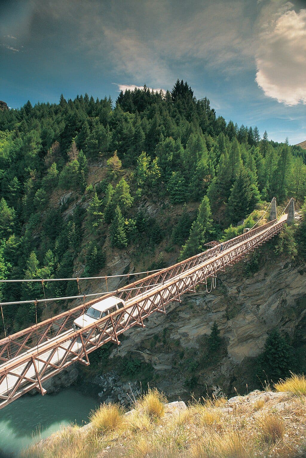
Perched high above the Shotover River, the 1901 Skippers Suspension Bridge is the showpiece of Skippers Canyon and a standout of Otago’s gold‑mining era. It’s a single‑lane, timber‑decked span with reinforced‑concrete towers—unusual for its time—stretching 96.3 m and sitting about 91.4 m above the river. Recognised as a top‑tier heritage site, the bridge now serves sightseers heading into Mount Aurum Recreation Reserve and the remnants of the Skippers settlement.
Why It’s Special
This isn’t just a pretty crossing; it’s a piece of engineering history that opened the canyon to miners and later farmers. The height and position over the gorge make it one of the most dramatic suspension bridges in New Zealand. Walking onto the deck gives vertigo‑tinged views straight down to the turquoise Shotover and the schist walls flanking the canyon.
Getting There
Access is via Skippers Road—a narrow, unsealed, cliff‑hugging track with sheer drop‑offs and limited passing bays. From Queenstown, allow roughly 1–1.5 hours in good conditions. The final 13 km from Skippers Saddle are especially exposed; 4WD is recommended, and many rental‑car contracts exclude this road. Weather can alter conditions and closures do occur after storms, so plan conservatively. If the drive sounds stressful, join a local guided 4WD tour.
On‑Site Details
Right by the bridge you’ll find a small DOC parking area and an information shelter. There are no shops or water here, and no toilets at the bridge itself. For facilities, cross to the Skippers campsite area near Mt Aurum Homestead: it offers a picnic shelter, a water tank, and seasonal toilets (flush in summer, pit in winter).
Best Time to Visit
Daylight hours are best—both for safer driving and softer photography. Early morning or late afternoon adds warm, side‑light on the canyon walls. Spring and autumn often balance pleasant temperatures with lighter visitation. After heavy weather, expect slower travel or temporary closures.

Photography Tips
Golden‑hour light makes the bridge pop against the schist. For scale, frame the bridge with the river far below; from the deck, shoot along the trusses to accentuate leading lines. It’s often windy in the canyon, so stabilize your shots.
Etiquette and Conservation
This is a protected historic area: don’t remove artifacts or disturb historic plantings, and skip campfires—use a stove. Dogs are permitted in the wider reserve; keep them under control and away from heritage structures.
Where it is
-44.8442, 168.6870Tips for Skippers Suspension Bridge
- 01Allow 1–1.5 hours each way from Queenstown and drive in daylight.
- 02Many rental contracts exclude Skippers Road; verify before you go.
- 034WD is recommended; consider a guided tour if you’re uneasy with exposure.
- 04Use toilets and refill at the Skippers campsite across the bridge.
- 05After heavy rain or snow, check for road issues and go slow.
Amenities
Near Skippers Suspension Bridge
All places →All trails →
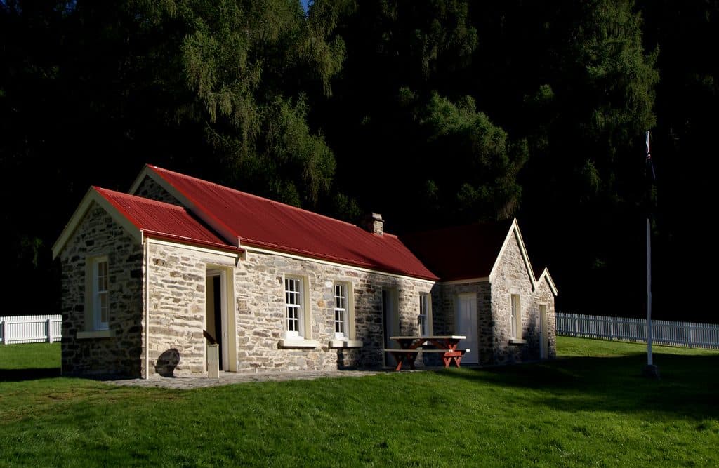
0.3 mi awaySkippers SchoolRestored goldfields schoolhouse in a dramatic canyon settingRestroom · Parking
6.2 mi awayCoronet Peak Ski AreaQueenstown’s closest ski field with night skiing and big viewsParking · Restroom
6.7 mi awayMacetown Historic TownshipGhost town ruins up a riverbed track with real adventure vibesCampground · Exhibit
6.9 mi awaySkippers Canyon LookoutHair-raising roadside perch above the Shotover River gorgePullout · Parking
9.5 mi awayNew Chum Gully TrackUnderrated Arrowtown loop with ridge views and a spicy gorge climbModerate · 4.5 mi · 2 hr
9.5 mi awayBig Hill TrackHistoric bridle route to big Otago views from Big Hill SaddleChallenging · 9.3 mi · 5.5 hr
9.5 mi awaySawpit Gully TrackGold mining history and big views on a punchy Arrowtown loop.Moderate · 4.8 mi · 2.5 hr
9.5 mi awayCoronet Face Water Race TrackHistoric traverse with huge Wakatipu views and a few spicy edgesModerate · 3.7 mi · 1.3 hr