Aysgarth Falls in Yorkshire Dales National Park

#2 of 53 sights in Yorkshire Dales

Sight · Yorkshire Dales National Park

Aysgarth Falls

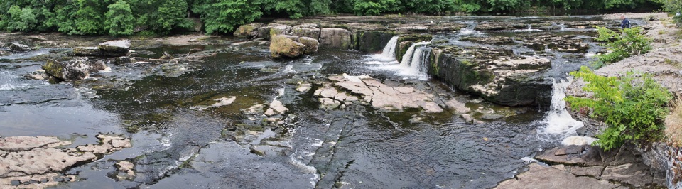
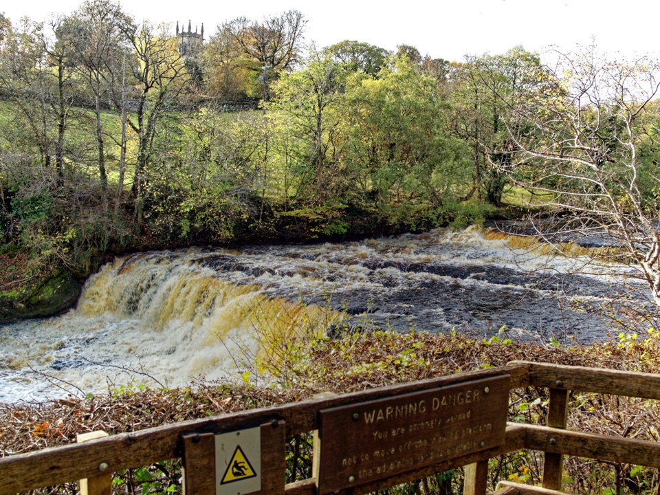
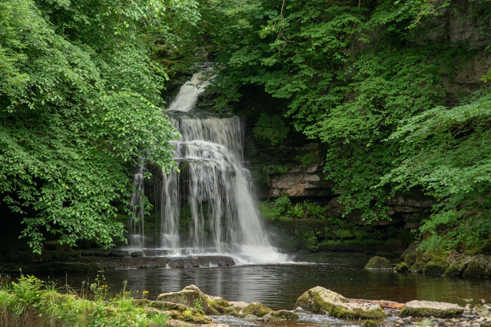
Three stepped cascades on the Ure, thunderous after heavy rain

Photo: Public Domain
Type
Sight
Nearest trail
0.1 km
Audio stories
6 nearby
  • Parking
  • Restrooms
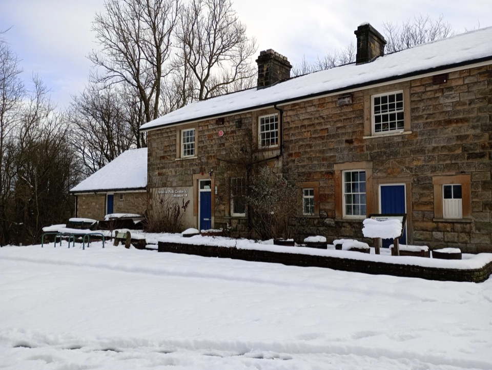
  • Visitor center
  • Exhibit

Hear the audio tour

Aysgarth Falls

Overview

About Aysgarth Falls

Why stop

  • Three distinct cascades to explore in one stop

Heads up

  • Lower Falls require a steep 70-step staircase
  • Upper Falls can feel busy

Map

Where it is

Loading the Yorkshire Dales map
Full map
SightAysgarth Falls54.29439, -1.98410
Keep this map with you offline in the Parkwolf app

Plan your stop

Before you go

Best time to go

  • After heavy rain the falls are at their most dramatic, with the widest sheets of water across the limestone steps. In dry spells they shrink to modest trickles over bare rock.
  • The trade-off: rain and snow leave the paths muddy and slippery, especially on the wooded sections and the steps down to Lower Force. Wear boots with grip.
  • Spring is the sweet spot for flowers, fresh leaf and decent water levels.
  • Early morning or late afternoon is best for both light in the gorge and elbow room. The Upper Falls get the busiest, being closest to the car park, so walk on to Middle and Lower Force if you want quieter viewpoints.

Getting there and parking

  • The practical starting point is the National Park Visitor Centre and car park at Church Bank, Aysgarth, DL8 3TH.
  • From Leyburn, take the A684 toward Hawes and turn right at the signpost for Aysgarth Falls.
  • The car park is run by the National Park Authority, holds around 70 cars, and charges a fee. It has an electric vehicle charger.
  • Toilets, including a RADAR facility, are at the visitor centre. The nearest Changing Places toilets are at Leyburn Long Stay Car Park and the Dales Countryside Museum, not here.

1 active Yorkshire Dales alert

  • ClosureTemporary closures on public rights of wayAvoid the listed sections of public rights of way while their temporary closures or pedestrian prohibition are in force. - Public Bridleway No. 52 (05.Official details
Yorkshire Dales alerts
A park ranger sits on a dash-mounted phone, talking, as Parkwolf’s Tour Guide plays “Army Cutworm Moths: A Grizzly Bear Buffet” on Grand Loop Road below Dunraven Pass in Yellowstone
Parkwolf Tour GuideThe highest, rockiest slopes around here are a summer buffet for grizzly bears.

Yorkshire Dales Tour Guide

Your drive to Aysgarth Falls, narrated.

Parkwolf is a GPS audio tour guide for Yorkshire Dales National Park. As you drive, it chimes in with what’s ahead: hidden gems, upcoming stops, history, geology, and wildlife, right through your car’s speakers.

Recorded for this place

Aysgarth Falls
0:00 / 0:38
“You're coming up on Aysgarth Falls, three separate steps in the River Ure, not one roadside waterfall.”

Plays as you drive up to Aysgarth Falls in the Parkwolf Yorkshire Dales Tour Guide.

More stories near here in the app

  • Why the Ure Foams
  • Two Faces on the Market Cross
  • Cauldron Falls at West Burton
  • The Mystery of Old Bartle
  • 298 audio storiesacross Yorkshire Dales’s roads, triggered by GPS as you drive
  • Wildlife heatmapsfor Eurasian Otter, Atlantic Salmon, Short-eared Owl, and 13 more
  • Works offlinemaps, 99 trails, 63 places, and audio download before you lose signal
  • CarPlay readysimple controls built for the drive
★★★★★
“Fantastic app with many points of information… It’s great to just turn on while you’re driving and it gives you an audio tour of the national Park. We love it!!!!”
JMJamesApp Store review
Download Parkwolf on the App StoreGet Parkwolf on Google Play

4.7 from 8,600+ ratings

Guide

More about Aysgarth Falls

What you're looking atThe River Ure drops through three separate stepped cascades, known as High (Upper), Middle and…

The River Ure drops through three separate stepped cascades, known as High (Upper), Middle and Lower Force, each with its own character and its own viewpoint. They spread over about a kilometre of wooded gorge, so this is a short walk between waterfalls rather than one single lookout. People have been coming here for over 200 years: Wordsworth and his sister Dorothy stopped by while their coach horses were changed, Turner sketched the falls on a northern tour, and the gorge appeared as a setting in Robin Hood: Prince of Thieves.


Paths and accessibilityThe route is a Miles without Stiles trail of roughly 1.
  • The route is a Miles without Stiles trail of roughly 1.5 km, graded green for all and red for some, so check which sections suit you.
  • Upper and Middle Falls are the accessible end: a firm, wide path leads from the car park to the Middle Falls, with a wheelchair viewing platform.
  • The first 500 m through Freeholders Wood is compact aggregate, at least 100 cm wide, with benches along the way. A further 600 m of woodland path is unsurfaced.
  • Lower Force is reached by a steep staircase of seventy steps and is not wheelchair accessible.
  • The full circular route mixes aggregate, grass, tree roots and stones, and is doable with an all-terrain wheelchair. The Authority keeps a Tramper that can reach the upper and middle falls; it is booked in advance through Access the Dales, so treat it as something to arrange rather than turn up for.
  • The circuit also opens out to views across Wensleydale toward Bolton Castle.
Freeholders WoodThe woodland beside the falls is a Local Nature Reserve owned by the National Park Authority,…

The woodland beside the falls is a Local Nature Reserve owned by the National Park Authority, threaded with easy paths. In spring it fills with wood anemones and primroses, and roe deer sometimes slip away into the shadows as you pass. Dormice were reintroduced and are doing well, though they are nocturnal and you almost certainly won't see one.

Good to knowThe visitor centre has displays, maps, guidebooks and leaflets, souvenirs and clothing, plus…
  • The visitor centre has displays, maps, guidebooks and leaflets, souvenirs and clothing, plus staff who can advise on walks, accommodation and public transport. It is also a natural start for walks toward Carperby or Aysgarth village.
  • A cafe behind the centre does sit-in and takeaway refreshments.
  • If the centre happens to be closed, the car park, falls and local walks are still usable.
  • The site is dog friendly, cycle friendly and dark sky friendly.

Wildlife

Wildlife in Yorkshire Dales

All Yorkshire Dales wildlife maps

Sighting maps show where each species has been reported across Yorkshire Dales. Wildlife moves, so no sighting is guaranteed.

Parkwolf’s Yorkshire Dales ranking

Top sights in Yorkshire Dales

All 63 places
  1. 1Malham CoveSight
  2. 3Ribblehead ViaductSight
  3. 4Gordale ScarSight
  4. 5Bolton CastleSight
  5. 6Janet's FossSight
  6. 7White Scar CaveSight

Take Parkwolf to Yorkshire Dales.

The audio tour guide for the drive, plus offline maps, trails, and wildlife heatmaps for when the signal drops.

4.7 from 8,600+ ratings

Download Parkwolf on the App StoreGet Parkwolf on Google Play