

Place · 0.7 mi away
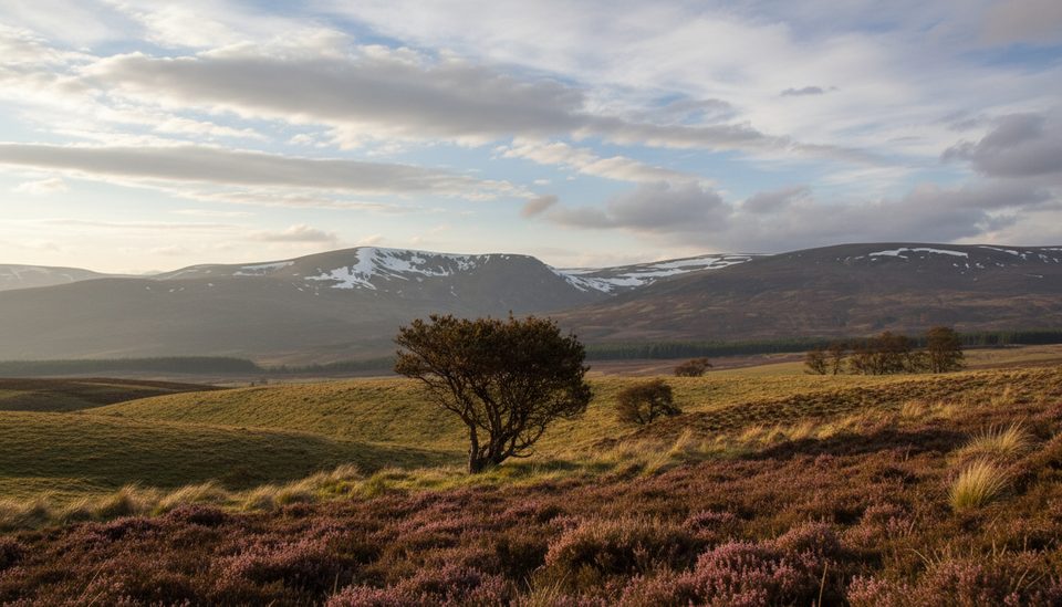
Carn Sgulain (918 m / 3,012 ft) sits on the rolling Monadhliath plateau on the park’s western edge. It’s not a dramatic summit—more a stony rise on a vast, peat‑topped moor—but that’s the charm: big skies, open distances, and a genuine sense of wildness.
Expect rough, boggy ground and long, featureless stretches with peat hags. In clear weather you’ll get wide views across the Monadhliath and toward the higher Cairngorms; in clag, it can feel endless and disorienting. Old fenceposts cross sections of the plateau and can help with line‑keeping, but they’re incomplete and shouldn’t be relied on alone.
Most walkers link Carn Sgulain with neighboring Carn Dearg and A’ Chailleach from Glen Banchor near Newtonmore, making a satisfying circuit of around 15 km. It’s a straightforward bagging day on paper, but the underfoot conditions and exposure make it feel tougher.
This open moorland can turn up red grouse and mountain hare, and occasionally raptors like hen harrier or golden eagle cruising the corries. Keep your distance and bring binoculars—wildlife here is wary and the landscapes are big.
There are no facilities: no signage, no toilets, no formal parking. Starts are typically from the road end in Glen Banchor; there’s no public transport to the trailhead (Newtonmore is roughly 3 km away). The plateau is exposed to wind and rapid weather changes, and the ground can be very wet—waterproof boots and gaiters pay off.
Pick a clear, calm day for the views and safer navigation. After heavy rain, the bogs are more tedious. Summer can be blissful on a breeze—but midges can be relentless on still days. Winter transforms the plateau into serious hill country requiring full winter skills and equipment.
Map and compass skills are essential; don’t count on following paths or fenceposts. Bring full waterproofs, warm layers, food, and emergency kit. A GPS is useful as backup with a spare power bank.
The Gaelic name is often translated as “Hill of the Basket,” fitting for a summit perched at the edge of a broad upland bowl.
Place · 0.7 mi away
Place · 3.1 mi away
Place · 3.7 mi away
Place · 4.5 mi away
Easy · 4.6 mi away
Moderate · 4.6 mi away
Moderate · 5.5 mi away
Easy · 6.8 mi away

Parkwolf Tour Guide
