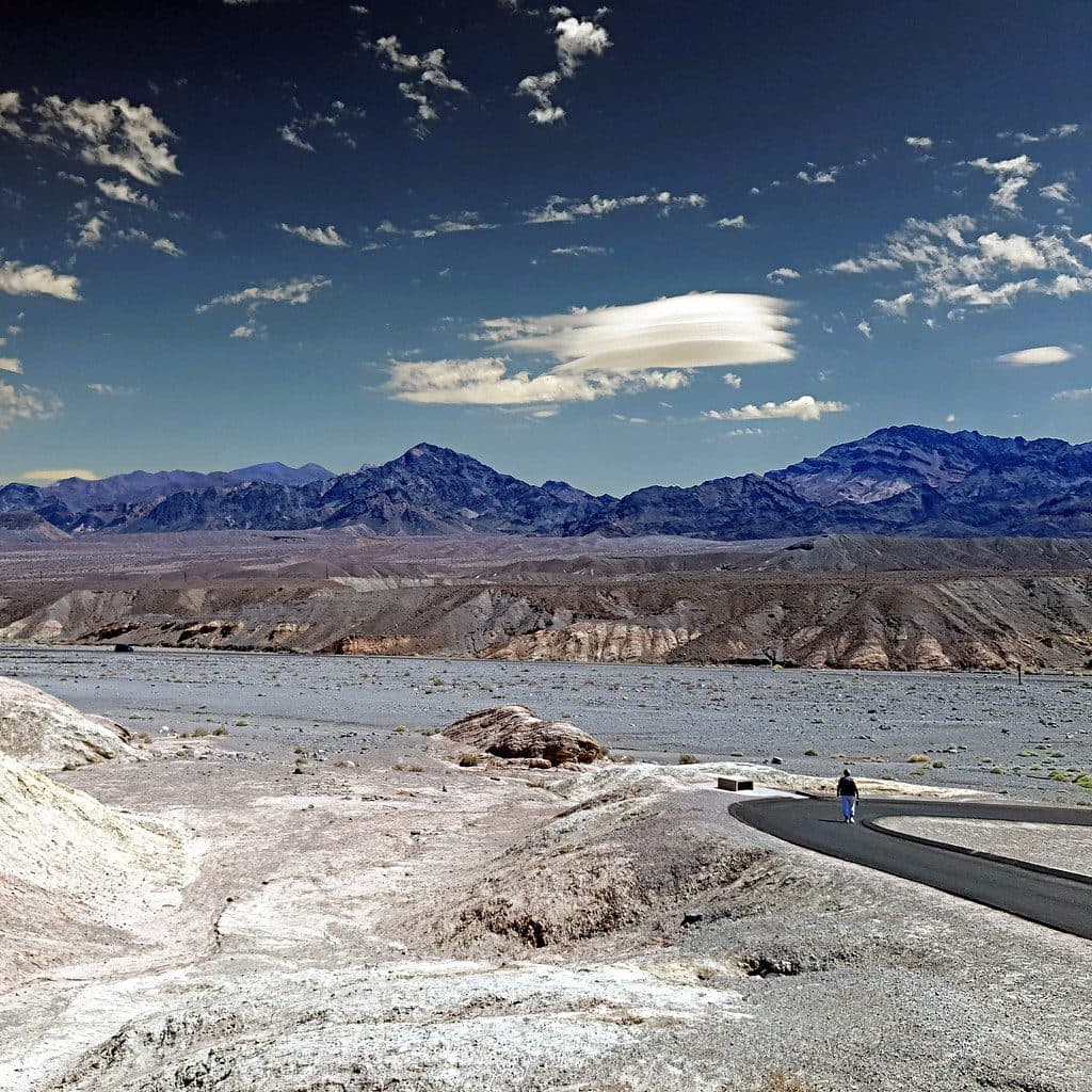
Crankshaft Crossing in Death Valley National Park

Sight · Death Valley National Park

Crankshaft Crossing

Quirky crankshaft monument at a lonely desert crossroads

Type
Sight
Audio stories
2 nearby

Hear the audio tour

Crankshaft Crossing: A Quirky Backcountry Landmark

Overview

About Crankshaft Crossing

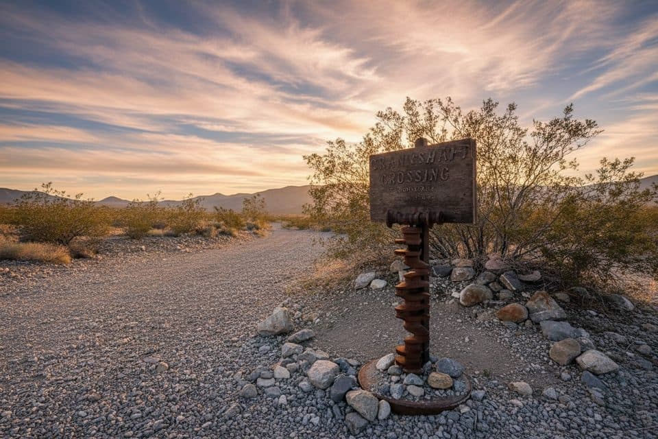
Crankshaft Crossing is a remote roadside landmark in the park’s northern backcountry, where rough dirt roads meet and a pile of old engine crankshafts marks the junction. It’s not a developed stop—think folk-art curiosity and navigational waypoint rather than an attraction with amenities. Off‑roaders and overlanders know it as a fun, oddball photo op and a reference point when linking northern routes.

Why stop

  • Quirky roadside photo spot marked by a stack of crankshafts
  • Expansive, lonely desert views at a remote junction
  • Useful waypoint for northern backcountry routes

Heads up

  • No services or facilities of any kind
  • Rough, remote dirt roads; high-clearance recommended and flats possible

Map

Where it is

Loading the Death Valley map
Full map
SightCrankshaft Crossing37.24345, -117.63333
Keep this map with you offline in the Parkwolf app

Local know-how

Tips for visiting Crankshaft Crossing

  1. Bring high‑clearance (ideally 4WD), a full‑size spare, and a repair kit.

  2. Carry extra water, food, and a first‑aid kit—there are zero services here.

  3. Download offline maps and don’t rely on cell coverage for navigation.

  4. Expect slow going on rough roads; build buffer time into your day.

  5. Leave no trace and don’t alter the crankshaft pile.

Plan your stop

Before you go

Best time to visit

There are no hours and crowds are minimal year‑round. Treat it as a quick, on‑your‑route stop—plan daylight travel windows and extra time for slow, rough roads.
Road Conditions & Logistics

Getting here means unpaved, remote driving. High‑clearance (and ideally 4WD) is recommended, and flats or mechanical hiccups aren’t uncommon. Bring a full‑size spare, repair kit, extra fuel if needed, and the usual desert travel essentials. Cell service is unreliable; rely on GPS and paper maps, and don’t count on quick help if something goes sideways.

3 active Death Valley alerts

  • ClosurePark roads closed or hazardousPlan around multiple closed roads and use extra caution on damaged routes. - Paved roads: North Highway and Beatty Cut-off are closed due to flooding and debris from the October 22 storm.Official details
  • ClosureSaline Valley Lower Springs closed after wildfireLower Springs at Saline Valley Warm Springs remains closed after the September 15 wildfire; stay out because the fire left safety hazards, including potential hazardous chemicals.Official details
See all 3 alerts
A park ranger sits on a dash-mounted phone, talking, as Parkwolf’s Tour Guide plays “Army Cutworm Moths: A Grizzly Bear Buffet” on Grand Loop Road below Dunraven Pass in Yellowstone
Parkwolf Tour GuideThe highest, rockiest slopes around here are a summer buffet for grizzly bears.

Death Valley Tour Guide

Your drive to Crankshaft Crossing, narrated.

Parkwolf is a GPS audio tour guide for Death Valley National Park. As you drive, it chimes in with what’s ahead: hidden gems, upcoming stops, history, geology, and wildlife, right through your car’s speakers.

See the Death Valley audio tour

Recorded for this place

Crankshaft Crossing: A Quirky Backcountry Landmark
Listen
“That lonely junction you're approaching is known as Crankshaft Crossing. It's exactly what it sounds like—a monument made of old engine crankshafts piled up to mark where these remote backcountry roads meet.”

Plays as you drive up to Crankshaft Crossing in the Parkwolf Death Valley Tour Guide.

More stories near here in the app

  • Two Deserts, One Park
  • 130 audio storiesacross Death Valley’s roads, triggered by GPS as you drive
  • Wildlife heatmapsfor Bighorn Sheep, Desert Tortoise, Coyote, and 13 more
  • Works offlinemaps, 36 trails, 114 places, and audio download before you lose signal
  • CarPlay readysimple controls built for the drive
★★★★★
“Fantastic app with many points of information… It’s great to just turn on while you’re driving and it gives you an audio tour of the national Park. We love it!!!!”
JMJamesApp Store review
Download Parkwolf on the App StoreGet Parkwolf on Google Play

4.7 from 8,600+ ratings

Guide

More about Crankshaft Crossing

What You’ll SeeThe star is the crankshaft monument itself—an eccentric stack of metal in the middle of stark…
  • The star is the crankshaft monument itself—an eccentric stack of metal in the middle of stark desert.
  • Big‑sky emptiness and long views of surrounding mountains and valleys add to the sense of isolation.
  • You’ll likely have it to yourself; it’s far from the park’s busy corridors.
Amenities (There Aren’t Any)No restrooms, water, picnic tables, gas, or stores.

No restrooms, water, picnic tables, gas, or stores. This is simply a junction with a quirky marker. It’s not a developed campground and doesn’t appear on the park’s official developed campground list.

WildlifeThere’s no specific wildlife draw here.

There’s no specific wildlife draw here. Typical desert critters may be around, but sightings are sparse in this harsh, open setting.

EtiquetteLeave no trace. Enjoy the oddity, but resist the urge to add or remove parts from the monument.

Leave no trace. Enjoy the oddity, but resist the urge to add or remove parts from the monument.

Wildlife

Wildlife in Death Valley

All Death Valley wildlife maps

Sighting maps show where each species has been reported across Death Valley. Wildlife moves, so no sighting is guaranteed.

Parkwolf’s Death Valley ranking

Top sights in Death Valley

All 114 places
  1. 1Badwater BasinSight
  2. 2Dante's ViewSight
  3. 3Mesquite Flat Sand DunesSight
  4. 4Zabriskie PointSight
  5. 5Golden CanyonSight
  6. 6Artists PaletteSight

Take Parkwolf to Death Valley.

The audio tour guide for the drive, plus offline maps, trails, and wildlife heatmaps for when the signal drops.

4.7 from 8,600+ ratings

Download Parkwolf on the App StoreGet Parkwolf on Google Play