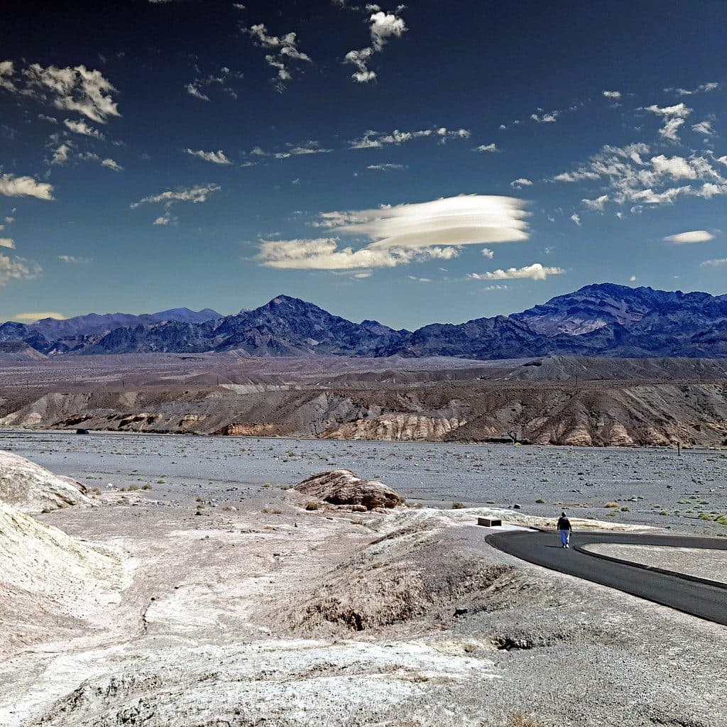
Death Valley National Park Entrance Sign in Death Valley National Park

Scenic pullout · Death Valley National Park

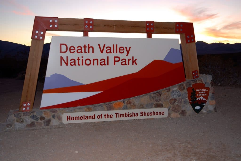
Death Valley National Park Entrance Sign

Classic photo stop at the park boundary on CA-190

Photo: Wikimedia Commons
Type
Scenic pullout
Audio stories
1 nearby
  • Pullout
  • Parking
  • Scenic viewpoint

Hear the audio tour

Death Valley National Park Entrance Sign

Overview

About Death Valley National Park Entrance Sign

This is the classic boundary sign on CA-190—a simple, satisfying photo stop that marks your entry into the park’s vast desert. It’s not a facility, just a pullout with the big wooden-and-stone sign and sweeping views that set the tone for the trip.

Why stop

  • Quick photo stop with a dedicated roadside pullout
  • Broad desert-and-mountain backdrop for classic trip photos

Heads up

  • No amenities at the pullout
  • Fast-moving traffic on CA-190 requires extra care

Map

Where it is

Loading the Death Valley map
Full map
Scenic pulloutDeath Valley National Park Entrance Sign36.37557, -116.68505
Keep this map with you offline in the Parkwolf app

Local know-how

Tips for visiting Death Valley National Park Entrance Sign

  1. Use the designated turnout and signal early; traffic moves fast.

  2. Shoot at sunrise or late afternoon for the best light.

  3. Bring water and sun protection—there’s no shade or services here.

  4. Download offline maps before arriving due to limited cell service.

Plan your stop

Before you go

Best time to visit

  • Early morning or late afternoon for soft light and cooler temps.
  • Weekdays see fewer cars pulling in and out.
  • Midday sun is harsh and unflattering for photos; plan around it if you can.
Safety and Logistics

  • CA-190 is a high-speed corridor; use the turnout and watch for traffic when stepping out.
  • Expect strong sun and heat with little to no shade. Bring water and sun protection.
  • Cell service is spotty to nonexistent—download maps/info before you arrive.

3 active Death Valley alerts

  • ClosurePark roads closed or hazardousPlan around multiple closed roads and use extra caution on damaged routes. - Paved roads: North Highway and Beatty Cut-off are closed due to flooding and debris from the October 22 storm.Official details
  • ClosureSaline Valley Lower Springs closed after wildfireLower Springs at Saline Valley Warm Springs remains closed after the September 15 wildfire; stay out because the fire left safety hazards, including potential hazardous chemicals.Official details
See all 3 alerts
A park ranger sits on a dash-mounted phone, talking, as Parkwolf’s Tour Guide plays “Army Cutworm Moths: A Grizzly Bear Buffet” on Grand Loop Road below Dunraven Pass in Yellowstone
Parkwolf Tour GuideThe highest, rockiest slopes around here are a summer buffet for grizzly bears.

Death Valley Tour Guide

Your drive to Death Valley National Park Entrance Sign, narrated.

Parkwolf is a GPS audio tour guide for Death Valley National Park. As you drive, it chimes in with what’s ahead: hidden gems, upcoming stops, history, geology, and wildlife, right through your car’s speakers.

See the Death Valley audio tour

Recorded for this place

Death Valley National Park Entrance Sign
Listen
“You're about to reach one of the main Death Valley National Park signs. It's the classic photo op to mark the start of your adventure, with the big wooden sign set against the desert mountains.”

Plays as you drive up to Death Valley National Park Entrance Sign in the Parkwolf Death Valley Tour Guide.

More stories near here in the app

  • Creosote Bush: The Smell of Desert Rain
  • Furnace Creek Wash: A Dry Riverbed with a Punch
  • 130 audio storiesacross Death Valley’s roads, triggered by GPS as you drive
  • Wildlife heatmapsfor Bighorn Sheep, Desert Tortoise, Coyote, and 13 more
  • Works offlinemaps, 36 trails, 114 places, and audio download before you lose signal
  • CarPlay readysimple controls built for the drive
★★★★★
“Fantastic app with many points of information… It’s great to just turn on while you’re driving and it gives you an audio tour of the national Park. We love it!!!!”
JMJamesApp Store review
Download Parkwolf on the App StoreGet Parkwolf on Google Play

4.7 from 8,600+ ratings

Guide

More about Death Valley National Park Entrance Sign

What You’ll SeeThe signature park sign framed by open desert and distant ranges.
  • The signature park sign framed by open desert and distant ranges.
  • Clean sightlines and big-sky vibes—great for a quick group shot or a solo portrait to kick off the day.
  • The sign’s rugged materials echo the surrounding landscape, making photos feel very “of the place.”
What It Is (and Isn’t)A photo pullout only—no restrooms, water, or services here.
  • A photo pullout only—no restrooms, water, or services here.
  • Not an entrance station; pay your park fee at staffed locations, kiosks elsewhere in the park, or online. Full services are at developed hubs like Furnace Creek or Stovepipe Wells.
WildlifeRight at the roadside, wildlife is scarce.

Right at the roadside, wildlife is scarce. You might spot a raven or small lizard, but the real animal encounters happen deeper in the park.

Wildlife

Wildlife in Death Valley

All Death Valley wildlife maps

Sighting maps show where each species has been reported across Death Valley. Wildlife moves, so no sighting is guaranteed.

Parkwolf’s Death Valley ranking

Top sights in Death Valley

All 114 places
  1. 1Badwater BasinSight
  2. 2Dante's ViewSight
  3. 3Mesquite Flat Sand DunesSight
  4. 4Zabriskie PointSight
  5. 5Golden CanyonSight
  6. 6Artists PaletteSight

Take Parkwolf to Death Valley.

The audio tour guide for the drive, plus offline maps, trails, and wildlife heatmaps for when the signal drops.

4.7 from 8,600+ ratings

Download Parkwolf on the App StoreGet Parkwolf on Google Play