Pros & cons
PROS
- World-class alpine routes like the classic Ham and Eggs couloir
- Photogenic, tooth-like granite pinnacle above the Ruth Gorge
- Fly-in glacier basecamps (Ruth/Root Canal) streamline the approach for climbers
CONS
- No trails or facilities; access is by ski plane and glacier travel
- Serious objective hazards: avalanches, rockfall, crevasses, fast-changing weather
- Climbers must register with the park’s Mountaineering HQ in Talkeetna
Overview
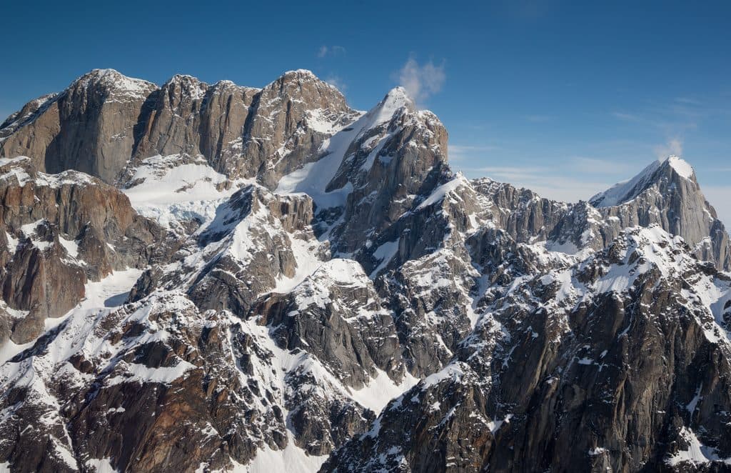
Mooses Tooth is the serrated granite fang looming above the east side of the Ruth Gorge—a magnet for seasoned alpinists. At 10,335 feet, it’s not the tallest peak in the Alaska Range, but its steep faces and razorback ridges make it one of the range’s most recognizable and coveted objectives.
Why it’s special
Every side is steep, which keeps the climbing technical from the first pitch to the summit. Legendary mixed lines trace snow-and-ice couloirs that split otherwise sheer walls. Climbers travel from around the world for classics like the Ham and Eggs couloir and other serious routes on the south face.
Setting and scenery
Expect dramatic granite walls stacked over deeply glaciated terrain. The Ruth Gorge funnels your eye to neighboring spires and, on clear days, broader Alaska Range giants. Common basecamps sit on the Ruth or the Root Canal Glacier below the mountain, with aircraft buzzing in when weather allows.
Getting there and permits
There’s no road, trailhead, or casual hike here—access is by bush plane from Talkeetna, typically landing on the glacier beneath the peak. Before any climb, parties register with the park’s Mountaineering Headquarters in Talkeetna. Build flexibility into your plans; weather can ground flights for days.
Conditions, season, and style
Weather changes fast. Storms, spindrift, and temperature swings are part of the deal, and avalanche and rockfall hazard is real. Many teams choose light-and-fast tactics to minimize time under seracs and on exposed faces. Peak-specific forecasts are essential for choosing a safe window.

Safety and hazards
This is committing, glaciated alpine terrain with crevasses, icefall, and long, exposed climbing. Rescue is difficult and slow; you need to be self-reliant with crevasse rescue skills, navigation, and emergency comms. Historic incidents and fatalities underscore the need for conservative decision-making.
Wildlife
High on the mountain you won’t see much beyond ravens on the wind. Lower slopes and adjacent valleys in this part of the park can hold Dall sheep and, occasionally, bears—but wildlife is incidental to the alpine objective here.
History and geology
The first ascent came in 1964 via the West Ridge by a German team, kicking off decades of bold route development. The name is a translation of an Athabascan term and fits the toothy profile perfectly. The peak’s granite architecture—sculpted by relentless glaciation—creates the clean walls and couloirs climbers prize.
Who it’s for
If you’re not an experienced alpinist, admire it from photos or on a flightseeing tour of the Ruth Gorge. For competent teams with mixed-climbing chops, glacier skills, and solid logistics, Mooses Tooth offers some of Alaska’s most storied lines.
Where it is
62.9692, -150.6133Tips for Mooses Tooth
- 01Register with the park’s Mountaineering Headquarters in Talkeetna before your climb.
- 02Book glacier flights early and pad your schedule for weather delays.
- 03Use a peak-specific forecast and commit only with a stable weather window.
- 04Plan for crevasse rescue and bring sat-comm; self-reliance is essential.
- 05Go light and fast on steep routes to reduce time under objective hazards.
Near Mooses Tooth
All places →All trails →
3.4 mi awayDon Sheldon AmphitheaterRemote glacier landing amid towering granite walls of Ruth Glacier
6.9 mi awayThe Great GorgeAlaska’s deepest glacial gorge, best seen on a Talkeetna flight
14.1 mi awayRuth GlacierFly over Denali's deepest, granite-walled glacier gorge
14.1 mi awayRuth Glacier LandingSki-plane touchdown on Denali’s Ruth Glacier in the Great Gorge
33.3 mi awayEielson Alpine TrailShort, very steep climb to Thorofare Ridge with big Alaska Range viewsChallenging · 1.7 mi · 1.5 hr
33.3 mi awayGorge Creek TrailSteep drop from Eielson to river bars with big Alaska Range viewsModerate · 2 mi · 1.5 hr
33.3 mi awayTundra Loop TrailTiny alpine loop with big tundra views at EielsonEasy · 0.3 mi · 30 min
34.6 mi awayMcKinley River Bar TrailEasy Wonder Lake walk to a big braided river with Denali views.Moderate · 5 mi · 2.5 hr