
Place · 2.2 mi away
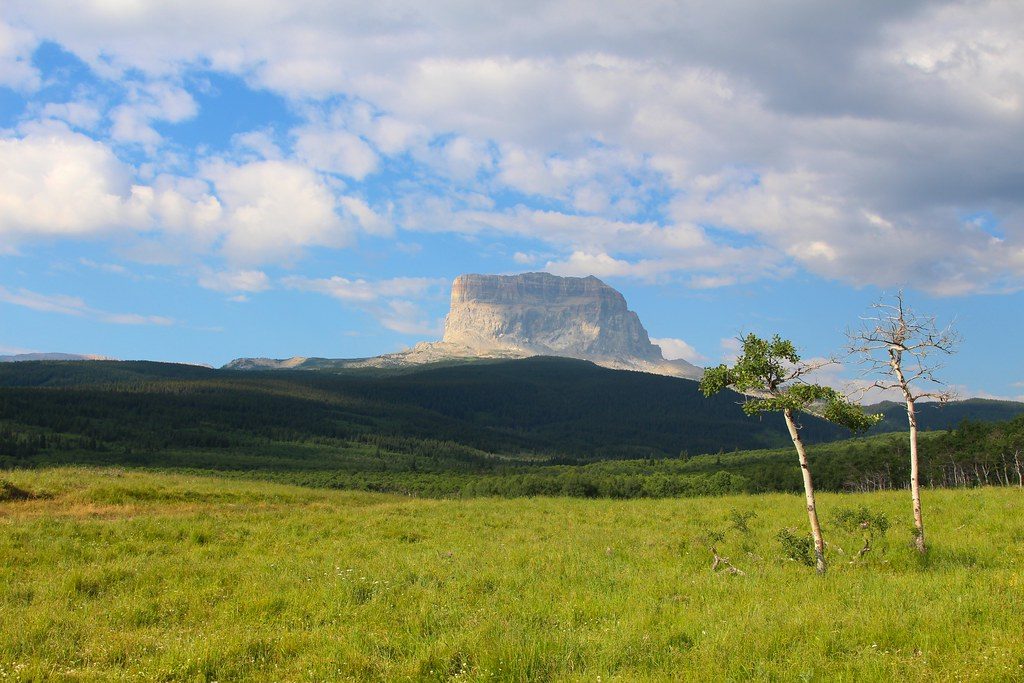
Chief Mountain rises to about 9,080 feet on the boundary between the park and the Blackfeet Reservation, a few miles south of the international border. Its abrupt, flat‑topped summit and sheer cliffs make it one of the most recognizable silhouettes on the northern plains.
This is a deeply significant spiritual place for the Blackfeet (Nínaistáko), long used for vision seeking and prayer. Geologically, it’s a classic klippe of ancient Precambrian limestone riding over much younger Cretaceous shales along the Lewis Overthrust—an eye‑opening stack of old rock atop young.
From the mountain and its approach, expect enormous views across the plains, into Glacier’s high country, and toward Waterton. On clear days, the vistas can seem to run for a hundred miles, with that blocky summit and steep faces begging for photos.
There’s no developed trailhead, parking lot, or facilities at the mountain itself. Approaches are rugged and informal, and if you come in over Blackfeet land you must secure the appropriate tribal permit. If your itinerary involves Canada, plan around border‑crossing requirements and hours.
For those aiming higher, the standard outing is a strenuous hike/scramble with hands‑on sections, loose rock, and an airy ridge finish. It’s not a casual stroll—plan for a long day in remote terrain.
Expect strong winds and fast‑changing weather on the exposed upper mountain. Loose rock is common. Carry layers, plenty of water and food, navigation, and bear spray. This is a sacred landscape—treat it with respect and do not disturb ceremonial items.
You’re in Glacier’s wild neighborhood: bears, mountain goats, marmots, deer, and raptors are all possible. Give wildlife space and make noise in brushy areas.
Clear summer days offer the longest views and the most reliable weather. Start early to beat afternoon winds and storms and to give yourself time for the long round‑trip. If your plan involves the nearby border crossing, verify seasonal hours in advance. Weekdays are generally quieter.
Place · 2.2 mi away
Place · 4.7 mi away
Place · 5.4 mi away
Place · 5.6 mi away
Challenging · 8.9 mi away
Moderate · 8.9 mi away
Challenging · 8.9 mi away
Challenging · 9.6 mi away

Parkwolf Tour Guide
