
Place
Moderate
This is a moderate, out-and-back hike from the Illecillewaet area up to a broad apron of glacially polished bedrock below the Illecillewaet (formerly “Great”) Glacier. It’s a compact half‑day with satisfying elevation, forest shade down low, and wide‑open mountain scenery up high. Officially, the trail ends on bedrock well short of the glacier, so come for the geology and the views—not a face‑to‑face with ice.
Plan on about 4.2 miles total (out and back) with roughly 1,100 feet of gain, taking most hikers around 3 hours with a photo stop or two. The path starts broad and easy, then steepens into rocky, rooty switchbacks before popping onto the sloping slabs at the end.
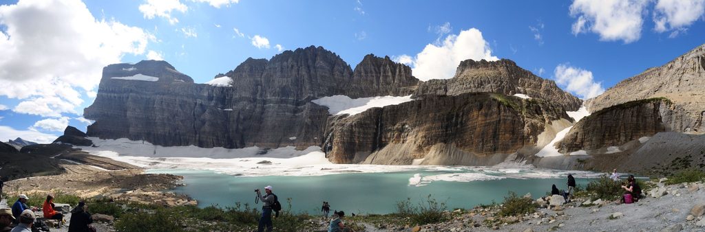
You’ll pass the foundations of historic Glacier House near the start, follow the sound of the Illecillewaet River, and cross lively creek drainages as the forest thins. The finale is the fun part: an expanse of striated, glacially scoured rock with head‑turning views of Mount Sir Donald and the Vaux Glacier across the valley. It’s a great place to read the landscape—polish, grooves, and boulders all tell the story of ice that’s now retreated far upslope.
Despite the name, you won’t see the Illecillewaet Glacier from the official end. Many hikers wander a little higher onto the slabs for bigger views, but there’s no maintained route up there—just occasional cairns and smooth rock. If you’re not comfortable with pathfinding on friction slabs, enjoy the official terminus and call it good.
Traffic is reasonable compared to the park’s marquee summits, and the mix of history, geology, and views makes it a well‑rounded pick. Above treeline you’re exposed—hat, sunscreen, and water help. Download your map; cell service can be spotty. Trekking poles shine on the steeper, rocky grades and in shoulder‑season snow.
Mid‑summer through early fall is prime. Snow can linger into the shoulder seasons, and early‑season avalanche hazards sometimes persist on upper slopes—check current conditions before you go. Mornings offer cooler temps and softer light on Sir Donald; afternoons can be hot on the slabs.
Trailheads sit by the Illecillewaet Campground/Valley area near Rogers Pass. If you’re camped at Illecillewaet, you can start right from there; the signed trailhead is at the end of the road past the campsites. A park entry pass is required. Nearby Illecillewaet and Loop Brook campgrounds have useful amenities if you’re making a weekend of it.
Keep an ear out for pikas squeaking from the talus and ravens or other raptors cruising overhead. As always in this region, carry bear spray and practice clean‑camp habits if you’re staying nearby.
Park at the Illecillewaet area trailheads near the campground; the Great Glacier trailhead is at the end of the road past the campsites. Facilities are nearby at Illecillewaet/Loop Brook campgrounds.
Beyond the signed end, slabs are unmarked with only intermittent cairns—turn around if unsure. Smooth rock is slick when wet or snowy; early season may include avalanche hazards. Limited shade and water up high.
Place
Place
Place
Place
Challenging
Challenging
Challenging
Challenging

Parkwolf Tour Guide
