
Place
Moderate
If you want Glacier’s big-country feel without big elevation, this low-lying corridor along the Middle Fork of the Flathead River delivers. Starting by the historic Belton Bridge in West Glacier, the South Boundary Trail meanders in and out of forest, rises and falls along the base of the Belton Hills, and trades views between mellow pools and busy rapids. Most day hikers treat this as an out-and-back and pick a turnaround point; the common day route is roughly 11.7 miles total with about 1,300–1,433 feet of rolling gain. Expect a quieter experience than Glacier’s marquee hikes—and also some brush and road noise near US‑2.
The first miles wander through mixed Douglas-fir forest, then open into lodgepole pine with the kind of hush you only get away from the crowds. Farther along, spruce and western redcedar become more common. Keep an ear out for rafts and kayaks in late spring and early summer and watch the river morph between lazy bends and riffles. Wildlife-wise, this corridor skirts a big game wintering area on the open slopes, so keep your eyes up as much as you keep them on the river.
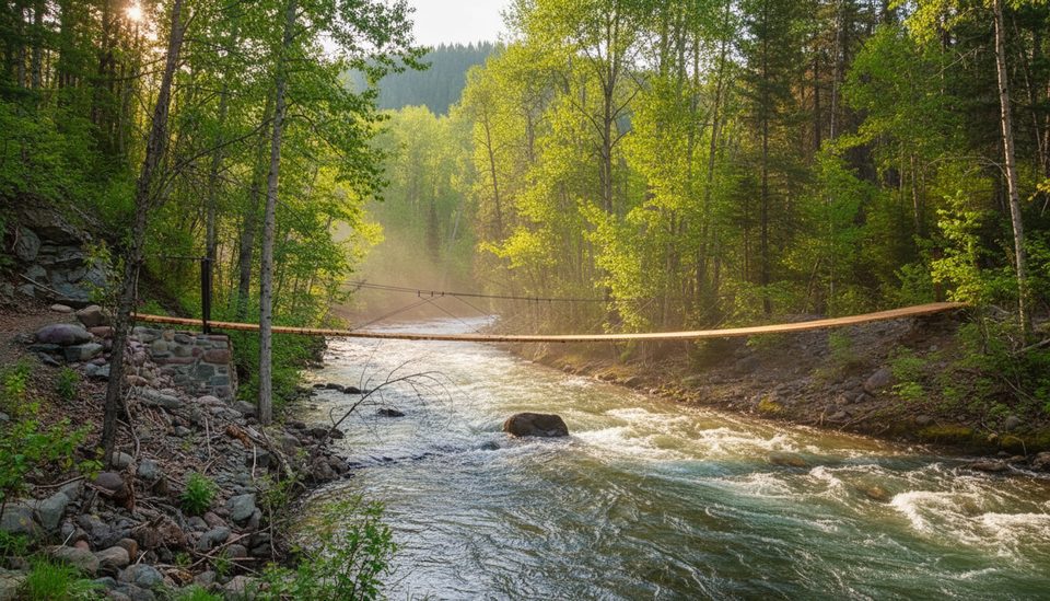
Right out of the gate you’ll cross the restored Belton Bridge—the early west entrance to the park that famously survived the 1964 floods. Around 5.6 miles in, a single-person suspension bridge crosses Lincoln Creek and a short detour reveals the 1931 Lincoln Creek Snowshoe Cabin, a patrol shelter from the park’s early days. At about 7.6 miles, near the Harrison Lake junction, you’ll pass the remnants of Dan and Josephine Doody’s homestead—a colorful slice of pre-park lore, including the shell of a two-story hunting lodge and an old Fordson tractor.
Translation: pick your adventure. Turn around earlier for an easygoing day, or push to a junction for a longer grind.
Grades are mostly gentle, but the miles add up, and brush ramps up after Lincoln Creek. Expect a few steeper undulations, sections of overgrowth (pants recommended), and a lightly used feel. Wildlife encounters are possible—travel smart. Some stretches sit near US‑2, so intermittent road noise isn’t unusual.
This is a clutch early- and late-season option when high-elevation trails still hold snow. In shoulder seasons, traction (microspikes/snowshoes) can be useful if snow lingers. Late spring/early summer brings lively river views (and raft traffic); fall colors around the river corridor and Belton Bridge are a bonus. If you’re contemplating any Middle Fork ford, plan for low water—typically mid‑August or later—and always check current conditions before committing. Start early for calmer conditions and better wildlife viewing.
If you crave alpine vistas, pick another day. But for a quieter Glacier day with steady river scenery, real history underfoot, wildlife potential, and choose-your-distance flexibility, the South Boundary is an underrated win—especially in the shoulder seasons.
Park near the Belton Bridge at the end of Old River Road/Old River Bridge Road without blocking gates (including the green BNSF access gate). Cross the pedestrian bridge; the trail begins just beyond.
Brushy tread and some steep dips; active bear country; occasional hard-to-follow sections past Nyack; dangerous river fords except during late-summer low water; limited water once off the valley floor benches.
Place
Place
Place
Place
Challenging
Challenging
Challenging
Challenging

Parkwolf Tour Guide
