Zapata Falls Campground in Great Sand Dunes National Park

Campground · Great Sand Dunes National Park

Zapata Falls Campground

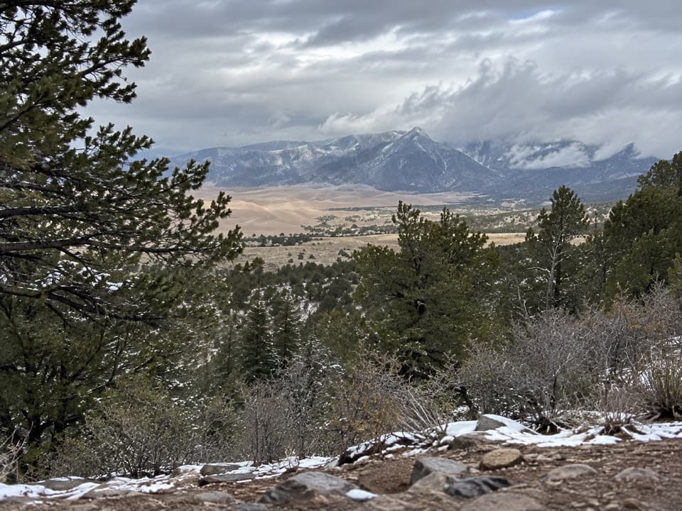
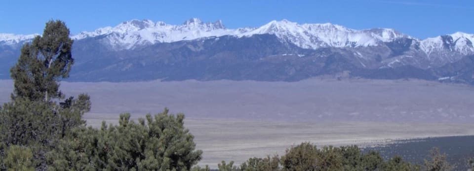
Big valley views from a rugged campground with no drinking water.

Photo: Public domain (U.S. federal work)
Type
Campground
Nearest trail
0.3 mi
Audio stories
3 nearby
  • Scenic viewpoint
  • Parking
  • Restrooms
  • Picnic tables

Hear the audio tour

Zapata Falls

Overview

About Zapata Falls Campground

Why stop

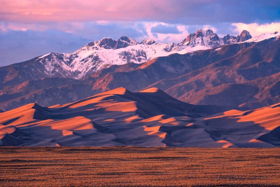
  • Dune, valley, and mountain views with especially good sunrise and sunset light.

Heads up

  • No drinking water or hookups; the unpaved approach can be rough.

Map

Where it is

Loading the Great Sand Dunes map
Full map
CampgroundZapata Falls Campground37.61769, -105.55991
Keep this map with you offline in the Parkwolf app

Plan your stop

Before you go

2 active Great Sand Dunes alerts

  • CautionStage 1 fire restrictionsStage 1 fire restrictions are active throughout Great Sand Dunes; use fires only in designated steel fire rings or picnic-site barbecues.Official details
  • CautionSwift, deep water on Medano Pass Primitive RoadMedano Pass Primitive Road is open, but heavy rain has created swift water up to 3 feet deep, especially at creek crossings 3, 4, and 5.Official details
Great Sand Dunes alerts
A park ranger sits on a dash-mounted phone, talking, as Parkwolf’s Tour Guide plays “Army Cutworm Moths: A Grizzly Bear Buffet” on Grand Loop Road below Dunraven Pass in Yellowstone
Parkwolf Tour GuideThe highest, rockiest slopes around here are a summer buffet for grizzly bears.

Great Sand Dunes Tour Guide

Your drive to Zapata Falls Campground, narrated.

Parkwolf is a GPS audio tour guide for Great Sand Dunes National Park. As you drive, it chimes in with what’s ahead: hidden gems, upcoming stops, history, geology, and wildlife, right through your car’s speakers.

Recorded for this place

Zapata Falls
0:00 / 0:33
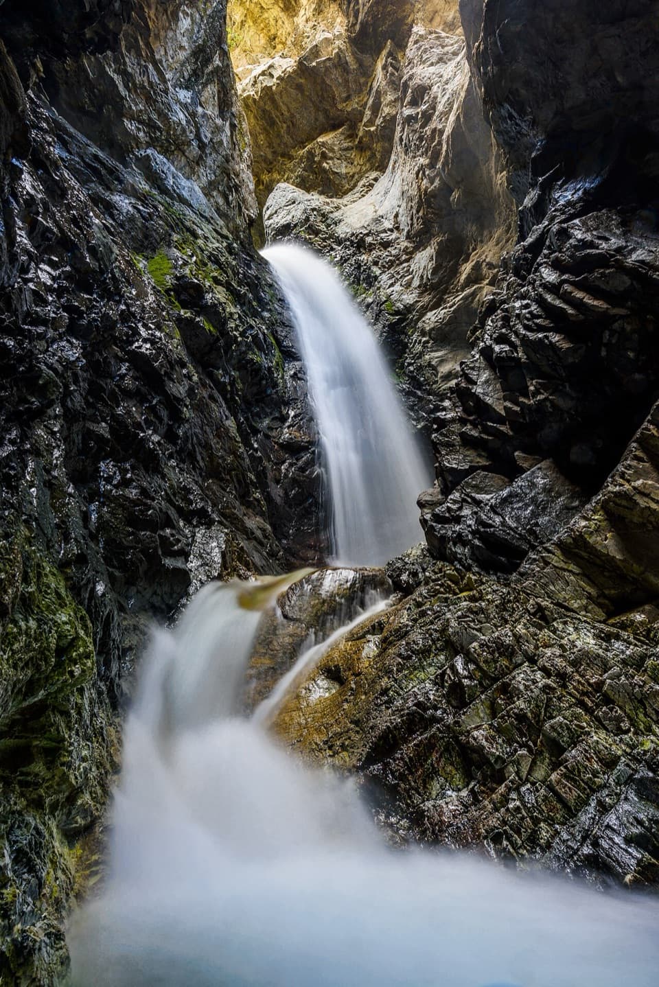
“Up ahead is the Zapata Falls trailhead, where a short hike leads to a waterfall hidden inside a narrow rock cleft. Allow about an hour for the mile round trip, but don't mistake the short distance for an easy stroll.”

Plays as you drive up to Zapata Falls Campground in the Parkwolf Great Sand Dunes Tour Guide.

More stories near here in the app

  • A Valley That Sank
  • The Birds Behind the Waterfall
  • Lightning Written in Glass
  • Why the Sand Has Black Streaks
  • 31 audio storiesacross Great Sand Dunes’s roads, triggered by GPS as you drive
  • Wildlife heatmapsfor Elk, Pronghorn, Wild Turkey, and 13 more
  • Works offlinemaps, 17 trails, 29 places, and audio download before you lose signal
  • CarPlay readysimple controls built for the drive
★★★★★
“Fantastic app with many points of information… It’s great to just turn on while you’re driving and it gives you an audio tour of the national Park. We love it!!!!”
JMJamesApp Store review
Download Parkwolf on the App StoreGet Parkwolf on Google Play

4.7 from 8,600+ ratings

Guide

More about Zapata Falls Campground

Stay for the viewZapata Falls Campground is a BLM campground at about 9,088 feet on the east flank of the Sangre…

Zapata Falls Campground is a BLM campground at about 9,088 feet on the east flank of the Sangre de Cristo Mountains, roughly 11 miles south of Great Sand Dunes Visitor Center. It sits on BLM land outside the national park. Its 23 individual sites, one group site, and host site are spread across two loops. The payoff is a wide look over the San Luis Valley toward the dunes and the western mountains; sunrise, sunset, and dark skies are part of the draw. This is a good fit if the view matters more than hookups or easy access.

Pack for a bare-bones campOne loop is geared to tents; the other has RV spurs, with some setups fitting up to about 50…

One loop is geared to tents; the other has RV spurs, with some setups fitting up to about 50 feet. Sites have gravel spurs, picnic tables, fire rings, bear-proof food lockers, and vault toilets. There are no hookups or drinking water, so bring water and meals. Reserve through Recreation.gov, and check site length and levelness if your tent or rig needs a straightforward fit. The 3.5-mile approach from Highway 150 is unpaved, and campers report a rough climb. The road is not snowplowed in winter, so year-round campground status does not guarantee winter access.

Add the falls as a side tripA separate half-mile day-use trail leads to Zapata Falls; the campground itself is not the…

A separate half-mile day-use trail leads to Zapata Falls; the campground itself is not the waterfall viewpoint. The trail is rocky and steep, and you have to wade upstream through the creek to see the falls. The water can be cold, fast during runoff, slippery, or icy. It is a short but rough outing, not an easy stroll.

The name, the creek, and the rockZapata means "shoe" in Spanish.

Zapata means "shoe" in Spanish. Mexican families founded the nearby settlement in 1864 and raised livestock; in the 1870s, cattlemen consolidated holdings into Zapata Ranch, which is still active. The area sits on the Rio Grande Rift, where the Sangre de Cristo Mountains rose as the San Luis Valley sank. About two million years ago, glacier and snowfield runoff found a weak point by a moraine and began cutting the narrow falls canyon. South Zapata Creek now drops more than 25 feet through it, and black swifts nest in the misty cliffs. Stay on the trail around their nesting area.

Wildlife

Wildlife in Great Sand Dunes

All Great Sand Dunes wildlife maps

Sighting maps show where each species has been reported across Great Sand Dunes. Wildlife moves, so no sighting is guaranteed.

Parkwolf’s Great Sand Dunes ranking

Top sights in Great Sand Dunes

All 29 places
  1. 1High Dune on First RidgeSight
  2. 2Medano CreekBeach
  3. 3Star DuneSight
  4. 4Zapata FallsSight
  5. 5Hidden DuneSight
  6. 6Dunes OverlookSight

Take Parkwolf to Great Sand Dunes.

The audio tour guide for the drive, plus offline maps, trails, and wildlife heatmaps for when the signal drops.

4.7 from 8,600+ ratings

Download Parkwolf on the App StoreGet Parkwolf on Google Play