
Place · 2.3 mi away
Moderate
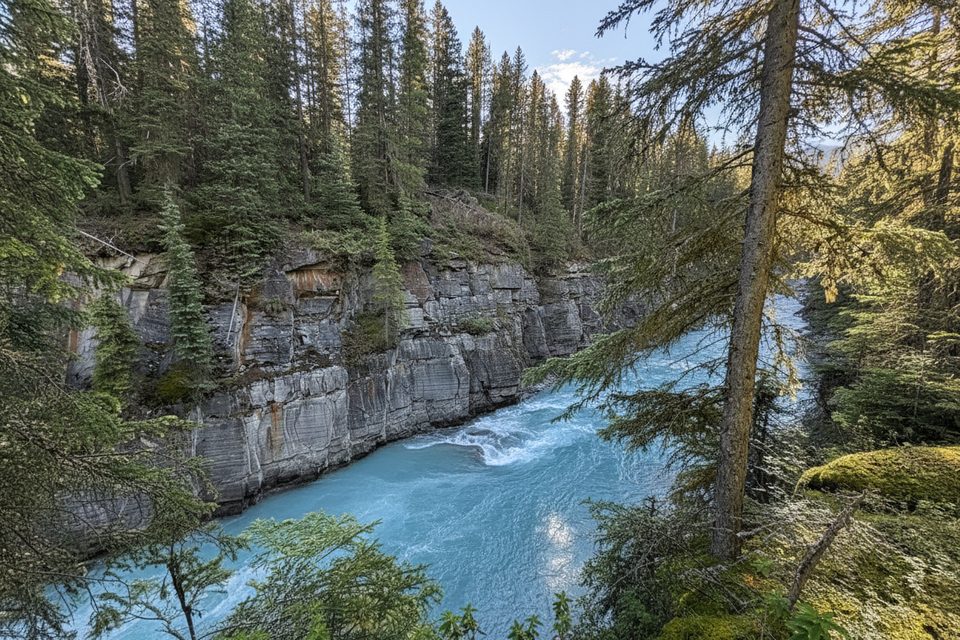
Kimpton Creek is a moderate forest walk that trades big views for cool shade and the sound of rushing water. It’s 4.6 km one way (about 9.2 km total out and back) with roughly 455–545 m of climbing and about 100 m of descent along the way. Most hikers take around 3 hours return. If you want a quiet, tree‑lined ramble that stays near a lively creek, this is a good pick; if you’re chasing sweeping vistas, this one underdelivers.
Park at the Kimpton Creek pullout 9 km east of Radium Hot Springs on Highway 93. From the pullout, walk about 100 m southwest along the highway to a small footbridge—the trail begins here. The path follows the creek through dense forest, climbing steadily with occasional glimpses of avalanche slopes across the valley. The turnaround is a pleasant spot by the water rather than a grand viewpoint.
Expect a mostly shaded, cool corridor that can feel wonderful on hot days. Parts of the tread can be narrow or partly crumbling, with brushy stretches and occasional deadfall to step over. Footing matters, especially when surfaces are wet or icy. Elevation numbers vary by source, so plan for a solid, sustained climb.
Bears are common in this valley—carry bear spray, make noise, and manage food carefully. The route passes below prominent avalanche slopes; while the trail stays in the forested valley bottom, adjacent terrain can be hazardous when snow is present. In shoulder and winter seasons, expect snow and ice on shaded sections and plan conservative turnaround times.
June through September generally offer the best footing and wildflowers. It’s also a great choice on hot summer days thanks to the shade and creek. Outside that window, travel slows with snow/ice and short daylight; traction and poles are smart. Crowds are typically light compared to the park’s headline hikes.
Parking is limited at the small pullout (only a few vehicles). Start early to secure a spot and to enjoy the quiet. There’s a brief roadside walk at the start—be alert. A valid Parks Canada entry pass is required when stopping in the park. Bring layers for variable mountain weather and enough water; the creek is handy, but treat if you plan to use it.
Kimpton Creek pullout 9 km east of Radium Hot Springs on Hwy 93; from the pullout walk ~100 m southwest along the highway to a small footbridge to start.
Bears are common; carry spray. Adjacent avalanche slopes and winter ice/snow increase risk. Some sections are narrow, partly crumbling, and brushy with deadfall. Brief highway walk from the pullout.
Place · 2.3 mi away
Place · 2.3 mi away
Place · 3.2 mi away
Place · 3.6 mi away
Easy · 3.6 mi away
Easy · 4.3 mi away
Easy · 4.8 mi away
Challenging · 4.9 mi away

Parkwolf Tour Guide
