Mlondozi Picnic Site in Kruger National Park

Picnic area · Kruger National Park

Mlondozi Picnic Site

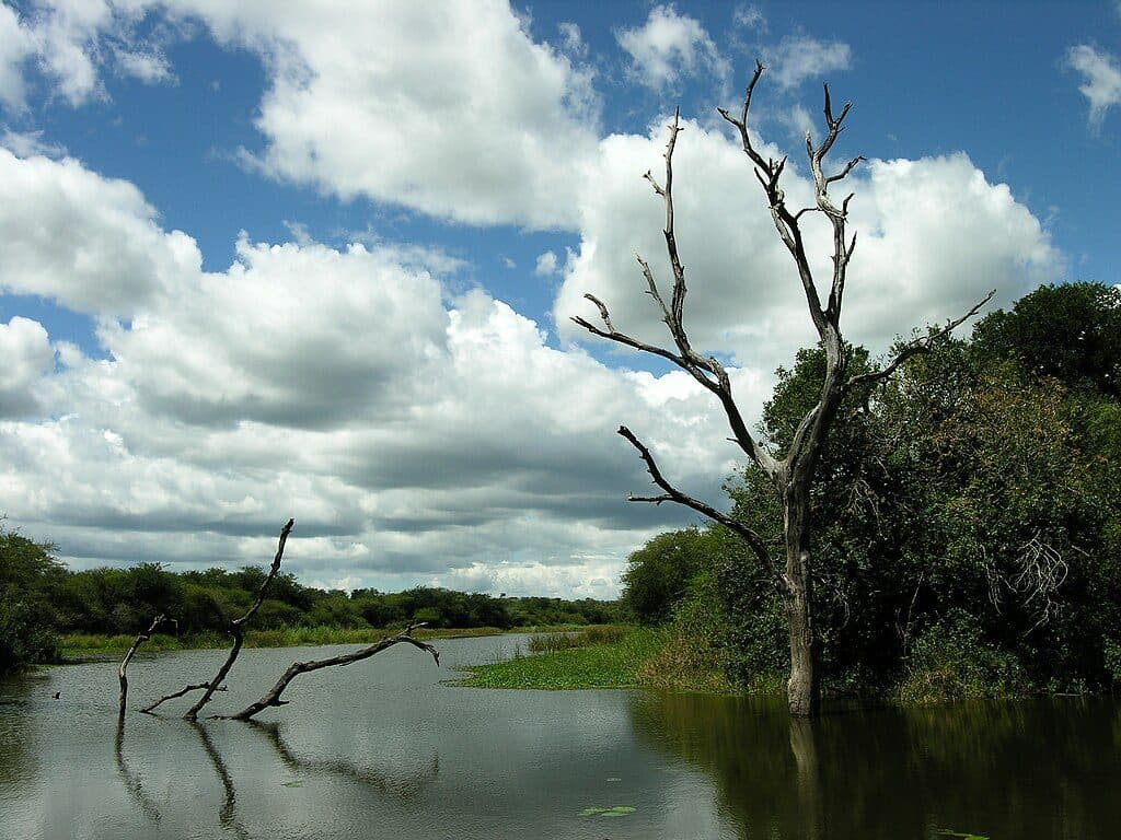
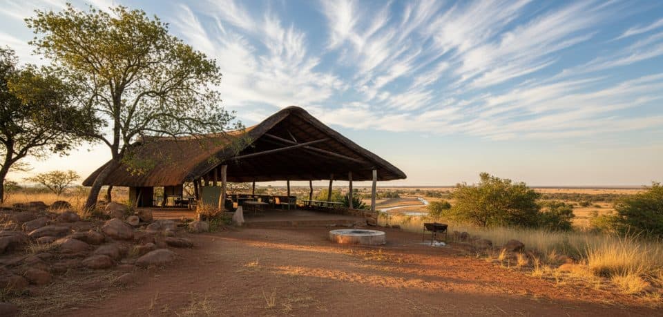
Hilltop picnic with big views over Mlondozi Dam

Type
Picnic area
Audio stories
2 nearby
  • Picnic tables
  • Restrooms
  • Parking
  • Scenic viewpoint

Hear the audio tour

H10 Drive: Muntshe Hill and Mlondozi Picnic Site

Overview

About Mlondozi Picnic Site

Perched on a koppie above Mlondozi Dam, this is one of the Lower Sabie area’s classic picnic stops. The elevation gives you a wide-screen view across the river, dam and distant Lebombo hills—perfect for a slow coffee while you scan for movement below.

Why stop

  • Sweeping hilltop views over Mlondozi Dam and plains
  • Hireable gas skottel braais for DIY breakfasts

Heads up

  • No food for sale; bring your own supplies
  • Gravel access and parking can be bumpy and narrow

Map

Where it is

Loading the Kruger map
Full map
Picnic areaMlondozi Picnic Site-25.03567, 31.93461
Keep this map with you offline in the Parkwolf app

Local know-how

Tips for visiting Mlondozi Picnic Site

  1. Arrive at opening to snag a shaded table and prime views.

  2. Bring all your own food and water; don’t count on a kiosk.

  3. Rent a skottel on site for an easy hot breakfast.

  4. Carry binoculars and a long lens to work the wide vistas.

  5. Drive slowly on the S29 and parking area—gravel can be rough.

Plan your stop

Before you go

Best time to visit

Aim for early morning: wildlife is most active at first light, the light is soft for photos, and you’ll beat the mid‑morning rush. Late mornings can get busy. Weekdays are generally a touch quieter than weekends. Midday can still deliver big herds at the water, especially elephants.

Facilities

Expect shaded, thatched picnic tables, toilets, and the option to rent a gas skottel to cook your own breakfast or brunch. It’s a bring-your-own food spot. Some visitors report a small kiosk for cold drinks, but others note no shop or that it isn’t reliably open—plan as if there’s no food for sale.

A park ranger sits on a dash-mounted phone, talking, as Parkwolf’s Tour Guide plays “Army Cutworm Moths: A Grizzly Bear Buffet” on Grand Loop Road below Dunraven Pass in Yellowstone
Parkwolf Tour GuideThe highest, rockiest slopes around here are a summer buffet for grizzly bears.

Kruger Tour Guide

Your drive to Mlondozi Picnic Site, narrated.

Parkwolf is a GPS audio tour guide for Kruger National Park. As you drive, it chimes in with what’s ahead: hidden gems, upcoming stops, history, geology, and wildlife, right through your car’s speakers.

See the Kruger audio tour

Recorded for this place

H10 Drive: Muntshe Hill and Mlondozi Picnic Site
Listen
“You're now driving along the H10, famous for being one of Kruger's best roads for big game. The open grasslands out here are prime cheetah and lion country.”

Plays as you drive up to Mlondozi Picnic Site in the Parkwolf Kruger Tour Guide.

More stories near here in the app

  • Matriarchs of the Night: Spotted Hyenas
  • Loskop Waterhole: A Patient Roadside Stop
  • Sunset Dam: Roadside Wildlife Stakeout
  • Lower Sabie Rest Camp: Riverside Wildlife Viewing
  • 202 audio storiesacross Kruger’s roads, triggered by GPS as you drive
  • Wildlife heatmapsfor Lion, Leopard, Elephant, and 13 more
  • Works offlinemaps, 2 trails, 183 places, and audio download before you lose signal
  • CarPlay readysimple controls built for the drive
★★★★★
“Fantastic app with many points of information… It’s great to just turn on while you’re driving and it gives you an audio tour of the national Park. We love it!!!!”
JMJamesApp Store review
Download Parkwolf on the App StoreGet Parkwolf on Google Play

4.7 from 8,600+ ratings

Guide

More about Mlondozi Picnic Site

What You’ll SeeElephants are regulars at the dam and surrounding plains, and the area has a reputation for…

Elephants are regulars at the dam and surrounding plains, and the area has a reputation for big-cat sightings. It’s also excellent for general game and birding from a comfortable vantage—binoculars (and a long lens) pay off here.

Getting ThereAbout 15 km north of Lower Sabie via the H10, with the turnoff on the S29.

About 15 km north of Lower Sabie via the H10, with the turnoff on the S29. The last stretch and parking area are gravel; it can be narrow, bumpy and dusty, so take it slow.

Make a Morning LoopPair a picnic here with nearby viewpoints and waterholes in the Lower Sabie region—start at…

Pair a picnic here with nearby viewpoints and waterholes in the Lower Sabie region—start at gate opening, breakfast at Mlondozi, then continue to other lookouts and dams while scanning riverlines and open plains before the heat sets in.

Practical NotesBring your own food and plenty of drinking water.
  • Bring your own food and plenty of drinking water.
  • Skottel rental is available on site for cooking.
  • Binoculars and a long camera lens make a big difference from this elevated viewpoint.
  • Arrive early if you want a table under the thatch.

Wildlife

Wildlife in Kruger

All Kruger wildlife maps

Sighting maps show where each species has been reported across Kruger. Wildlife moves, so no sighting is guaranteed.

Parkwolf’s Kruger ranking

Top sights in Kruger

All 183 places
  1. 1Lake Panic Bird HideSight
  2. 2Pafuri Fever Tree ForestSight
  3. 3Sunset DamScenic pullout
  4. 4Talamati Floodlit WaterholeSight
  5. 5Satara Floodlit WaterholeSight
  6. 6Elephant Hall of FameSight

Take Parkwolf to Kruger.

The audio tour guide for the drive, plus offline maps, trails, and wildlife heatmaps for when the signal drops.

4.7 from 8,600+ ratings

Download Parkwolf on the App StoreGet Parkwolf on Google Play