Nelson’s Landing in Lake Mead National Recreation Area

Sight · Lake Mead National Recreation Area

Nelson’s Landing

A historic river landing where two Lake Mohave water trails meet.

Photo: Wikimedia Commons
Type
Sight
Audio stories
1 nearby
  • Parking
  • Restrooms

Hear the audio tour

Nelson’s Landing: The Shore and the Lost Settlement

Overview

About Nelson’s Landing

Why stop

  • Water access at the junction of two paddling routes

Heads up

  • Rough, uneven approach to the shore

Map

Where it is

Loading the Lake Mead map
Full map
SightNelson’s Landing35.70742, -114.70746
Keep this map with you offline in the Parkwolf app

Plan your stop

Before you go

4 active Lake Mead alerts

  • CautionHarmful algae bloom at Nelson’s Landing and Cottonwood CoveMentions this placeA harmful algae bloom has been confirmed in recent samples from Nelson’s Landing and Cottonwood Cove; avoid contact with water where algae is visible.Official details
  • CautionArizona Hot Springs bacteria advisoryLimit body contact with Arizona Hot Springs water: fecal bacteria in samples frequently reach high levels and can transmit human diseases.Official details
See all 4 alerts
A park ranger sits on a dash-mounted phone, talking, as Parkwolf’s Tour Guide plays “Army Cutworm Moths: A Grizzly Bear Buffet” on Grand Loop Road below Dunraven Pass in Yellowstone
Parkwolf Tour GuideThe highest, rockiest slopes around here are a summer buffet for grizzly bears.

Lake Mead Tour Guide

Your drive to Nelson’s Landing, narrated.

Parkwolf is a GPS audio tour guide for Lake Mead National Recreation Area. As you drive, it chimes in with what’s ahead: hidden gems, upcoming stops, history, geology, and wildlife, right through your car’s speakers.

See the Lake Mead audio tour

Recorded for this place

Nelson’s Landing: The Shore and the Lost Settlement
0:00 / 0:33
“You're approaching Nelson's Landing, where Eldorado Canyon meets Lake Mohave. Come for informal shore access and the view across the water, with rough ground underfoot and no developed marina or launch ramp.”

Plays as you drive up to Nelson’s Landing in the Parkwolf Lake Mead Tour Guide.

More stories near here in the app

  • Freight Boats for the Gold Mines
  • A Cactus That Travels in Pieces
  • 153 audio storiesacross Lake Mead’s roads, triggered by GPS as you drive
  • Wildlife heatmapsfor Bighorn Sheep, Burro, Bald Eagle, and 13 more
  • Works offlinemaps, 42 trails, 70 places, and audio download before you lose signal
  • CarPlay readysimple controls built for the drive
★★★★★
“Fantastic app with many points of information… It’s great to just turn on while you’re driving and it gives you an audio tour of the national Park. We love it!!!!”
JMJamesApp Store review
Download Parkwolf on the App StoreGet Parkwolf on Google Play

4.7 from 8,600+ ratings

Guide

More about Nelson’s Landing

A shoreline stop with a purposeNelson’s Landing is an informal Lake Mohave access at the mouth of Eldorado Canyon, where the…

Nelson’s Landing is an informal Lake Mohave access at the mouth of Eldorado Canyon, where the rocky shoreline opens onto the water and desert ridges beyond. It is a practical stop for paddlers: the Black Canyon Water Trail ends at Eldorado Canyon, and the 76-mile Mohave Water Trail starts here. This is a natural access point, not a developed marina or ramp. For a Black Canyon take-out, plan on carrying your craft about a quarter mile up the wash to your vehicle.

Getting to the waterFrom Boulder City, follow U.S.

From Boulder City, follow U.S. 95 and Nevada 165 (Eldorado Canyon Road); the approach is paved until the final quarter mile on Lake Mead Road 47. Reaching the shore means crossing rough, rocky or sandy ground, so wear shoes for uneven footing. The exact public parking and shoreline footprint are not clearly marked; expect an informal landing, not a developed beach setup. Bring drinking water, shade and food, since potable water and food service are not confirmed here. Visitors report a basic outdoor toilet, but it is not listed in NPS access information; bring paper and hand-cleaning supplies if you plan to rely on it.

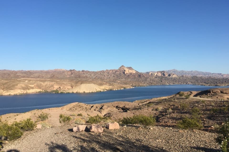
Lake and canyonFrom the water’s edge, Lake Mohave runs beneath broad, bare ridges and the jagged volcanic…

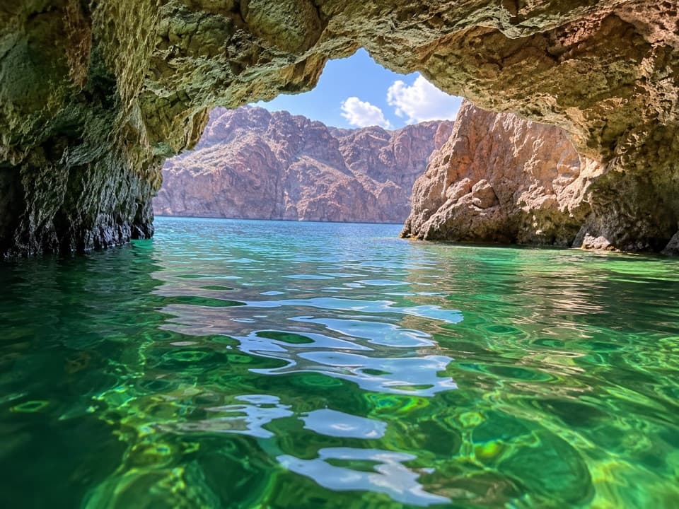
From the water’s edge, Lake Mohave runs beneath broad, bare ridges and the jagged volcanic slopes around Eldorado Canyon. For a photo, keep the rocky bank in the foreground and shoot across the water toward the higher ridge; it gives the lake and desert setting a sense of scale.

The landing before the lakeIn the 1920s, Nelson’s Landing became a Colorado River port, used to move illegal liquor across…

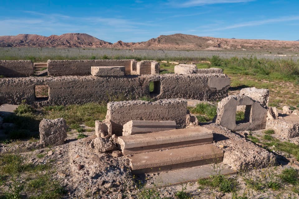
In the 1920s, Nelson’s Landing became a Colorado River port, used to move illegal liquor across the Arizona border during Prohibition. Survey boats also used it in early Hoover Dam work; later, fishermen and tourists came to the landing. A flash flood on September 14, 1974, destroyed the settlement and killed nine people. It was never rebuilt. The place today is shoreline access at the former settlement, not a preserved ghost town; Nelson Ghost Town and the Techatticup Mine are separate sites farther inland. The canyon mouth deserves care in storm weather: the 1974 flood came through fast enough to erase the resort.

Wildlife

Wildlife in Lake Mead

All Lake Mead wildlife maps

Sighting maps show where each species has been reported across Lake Mead. Wildlife moves, so no sighting is guaranteed.

Parkwolf’s Lake Mead ranking

Top sights in Lake Mead

All 70 places
  1. 1Hoover DamSight
  2. 2Emerald CaveSight
  3. 3Willow BeachBeach
  4. 4Boulder BeachBeach
  5. 5St. Thomas TownsiteSight
  6. 6Mike O’Callaghan–Pat Tillman Memorial BridgeSight

Take Parkwolf to Lake Mead.

The audio tour guide for the drive, plus offline maps, trails, and wildlife heatmaps for when the signal drops.

4.7 from 8,600+ ratings

Download Parkwolf on the App StoreGet Parkwolf on Google Play