Pros & cons
PROS
- Free pedestrian walkway with the best Hoover Dam vantage point
- Convenient Nevada-side parking and on-site restrooms
- Informative plaques about the bridge and bypass construction
CONS
- Very windy and fully exposed to sun with no shade
- Short but steep ramp from the parking area to the walkway
Overview
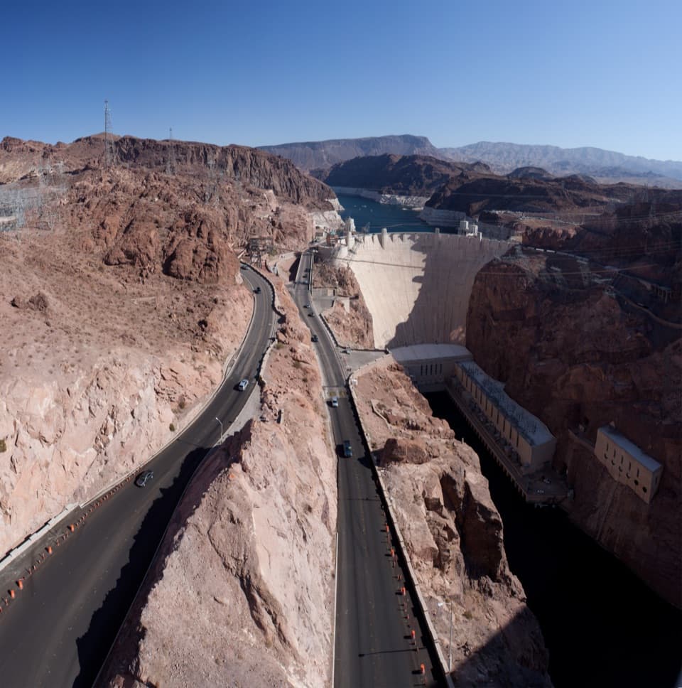
This soaring concrete arch carries US‑93 high above the Colorado River between Nevada and Arizona, offering a jaw‑dropping, side‑profile view of Hoover Dam and Black Canyon. Opened in 2010, it’s among the tallest bridges in the U.S. (about 890 feet above the river) and is widely celebrated as a modern engineering showpiece.
What You’ll See
From the pedestrian walkway, the dam’s curving face, intake towers, and the river far below line up perfectly for wide, dramatic photos—angles you simply can’t get from the dam’s top. On clear days, Lake Mead and the rugged canyon walls complete the panorama. Along the approach are interpretive signs that outline how the bypass was built.
Getting There & Parking
Set your GPS to 27953–28689 Great Basin Hwy, Boulder City, NV 89005. From I‑11/US‑93 take Exit 2 toward NV‑172 (Hoover Dam). After the security checkpoint, look for the signed turn for the “Bridge Scenic View” plaza on the Nevada side. Parking here is free, and there are restrooms at the lot.
The Walk
A long, steady ramp (with optional stairs) leads from the plaza up to the bridge walkway. Expect strong winds and a slight sway when trucks pass—normal for a structure this tall. The walkway is pedestrian‑only: no pets, bikes, skateboards, or rollerblades.
Best Time to Visit
Go early morning or late afternoon for softer light, cooler temps, and fewer tour crowds. Plan your visit for daylight; the bridge is all about the views and several guides list the plaza lot as daylight access only.
Background
Often called the Hoover Dam Bypass, the bridge was built to move traffic off the dam for safety and capacity, especially after 9/11. It spans roughly 1,900 feet with a main arch of about 1,060 feet and is recognized as the world’s highest concrete arch bridge. In short: a quick stop that overdelivers on scenery and engineering drama.
Pair It With
Combine the bridge walk with a Hoover Dam visit—tour the dam first, then swing up to the bridge for the sweeping, postcard‑worthy perspective.
Where it is
36.0115, -114.7392Tips for Mike O’Callaghan–Pat Tillman Memorial Bridge
- 01Use the free Nevada-side Bridge Scenic View lot just past the NV‑172 checkpoint.
- 02Secure hats and loose items—winds on the span can be fierce.
- 03Aim for early morning or late afternoon for softer light and cooler temperatures.
- 04Do the Hoover Dam tour first, then walk the bridge for the best photo angles.
- 05Bring water and expect a brief uphill on the ramp; no pets or bikes allowed.
Amenities
Near Mike O’Callaghan–Pat Tillman Memorial Bridge
All places →All trails →
0.3 mi awayHigh Scaler StatueStriking tribute to Hoover Dam’s daredevil wall scalersParking · Restroom
0.3 mi awayHigh Scaler CafeQuick cafe by the dam with views and a solid hot dogFood · Restaurant
0.3 mi awayHoover Dam Visitor CenterExhibits and tours with a 360-degree overlook of the damVisitor Center · Exhibit
0.3 mi awayExhibit BuildingCompact museum, helpful rangers, and a native plant gardenVisitor Center · Exhibit
1 mi awayKingman Wash Canyon TrailDesert wash to Lake Mead with burros, views, and a swim.Moderate · 6.5 mi · 3 hr
1.3 mi awayLakeview Overlook TrailEasy railbed hike to a sweeping Lake Mead overlook via historic tunnels.Easy · 6.4 mi · 3 hr
2 mi awayGoldstrike CanyonNarrow canyon scramble to riverside hot pools near Hoover DamChallenging · 5.3 mi · 5 hr
2.7 mi awaySpooky Canyon TrailShort cobblestone slot with arch, side forks, and a final dryfallEasy · 1 mi · 48 min