Pearce Ferry Rapid Trail in Lake Mead National Recreation Area

Lake Mead National Recreation Area, AZ · NV

Pearce Ferry Rapid Trail

An unmarked sandy path to a Colorado River rapid overlook

Length
1.5mi
Time
45min
Elev. change
59ft
Difficulty
Easy
  • Dogs allowed
  • High point 1,198 ft

Hear the audio tour

Pearce Ferry: River Takeout and Historic Crossing

Overview

About Pearce Ferry Rapid Trail

Why go

  • Short, nearly flat walk to whitewater and layered riverbanks.

Heads up

  • Unmarked sandy tread; public hiker parking is not clearly documented.

Map & elevation

The route

Loading the Lake Mead map
Full map
Elevation1,138–1,198 ft
TrailheadPearce Ferry Road footpath access, across from the ramp36.12485, -113.98294
Keep this map with you offline in the Parkwolf app

Plan your hike

Before you go

Parking

The footpath begins across Pearce Ferry Road from the boat-ramp area. A public hiker parking spot is not clearly documented, and the ramp and take-out serve permitted rafting operations; confirm parking before you drive out and keep the operating shoreline clear.

Safety

The route is unmarked and exposed to desert heat; carry water. Stay at the overlook and out of the swift river and restricted rafting take-out/re-rigging shoreline. Public hiker parking is unclear. Leash pets to six feet or shorter.

4 active Lake Mead alerts

  • CautionHarmful algae bloom at Nelson’s Landing and Cottonwood CoveA harmful algae bloom has been confirmed in recent samples from Nelson’s Landing and Cottonwood Cove; avoid contact with water where algae is visible.Official details
  • CautionArizona Hot Springs bacteria advisoryLimit body contact with Arizona Hot Springs water: fecal bacteria in samples frequently reach high levels and can transmit human diseases.Official details
See all 4 alerts
A park ranger sits on a dash-mounted phone, talking, as Parkwolf’s Tour Guide plays “Army Cutworm Moths: A Grizzly Bear Buffet” on Grand Loop Road below Dunraven Pass in Yellowstone
Parkwolf Tour GuideThe highest, rockiest slopes around here are a summer buffet for grizzly bears.

Lake Mead Tour Guide

Your drive to Pearce Ferry Rapid Trail, narrated.

Parkwolf is a GPS audio tour guide for Lake Mead National Recreation Area. As you drive, it chimes in with what’s ahead: hidden gems, upcoming stops, history, geology, and wildlife, right through your car’s speakers.

See the Lake Mead audio tour

Recorded for this trailhead

Pearce Ferry: River Takeout and Historic Crossing
0:00 / 0:31
“You're nearing Pearce Ferry, where permitted rafting trips finish their journeys down the Colorado River. The ramp is a working takeout, with no public boat launching, and the rafting shoreline isn't a swimming spot.”

Plays as you drive up to this trailhead in the Parkwolf Lake Mead Tour Guide.

More stories near here in the app

  • Who Would Look After the Visitors?
  • A Raven's Hidden Meal
  • Hoover Dam’s Date in the Stars
  • How Pearce Ferry Got a New Rapid
  • 153 audio storiesacross Lake Mead’s roads, triggered by GPS as you drive
  • Wildlife heatmapsfor Bighorn Sheep, Burro, Bald Eagle, and 13 more
  • Works offlinemaps, 42 trails, 70 places, and audio download before you lose signal
  • CarPlay readysimple controls built for the drive
★★★★★
“Fantastic app with many points of information… It’s great to just turn on while you’re driving and it gives you an audio tour of the national Park. We love it!!!!”
JMJamesApp Store review
Download Parkwolf on the App StoreGet Parkwolf on Google Play

4.7 from 8,600+ ratings

Trail guide

Hiking Pearce Ferry Rapid Trail

A short walk to the rapidThis is a 1.

This is a 1.5-mile out-and-back on a mostly flat, sandy, unmarked track to a perch above Pearce Ferry Rapid. Allow about 45 minutes. Follow the footpath from across Pearce Ferry Road, then return the same way. It is a small side walk, best if you are already making the drive to Pearce Ferry.

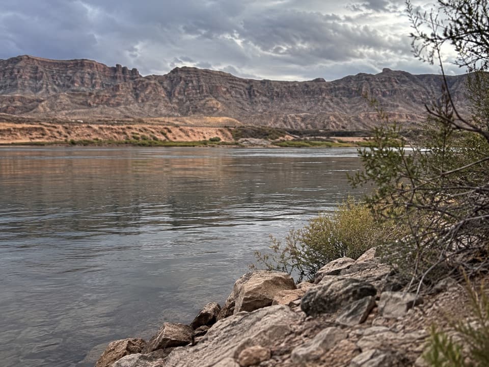
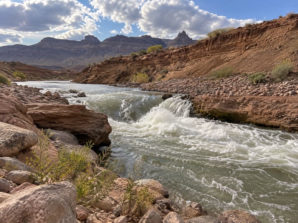
Keep the river at a distanceThe view is of whitewater cutting through broad sediment banks, with canyon ridges beyond.

The view is of whitewater cutting through broad sediment banks, with canyon ridges beyond. Stay at the overlook: the Colorado River is swift, and the take-out and re-rigging shoreline is restricted to permitted rafting operations. Do not descend to the water or wander into the operating area. The route is exposed to desert heat; carry drinking water.

A river that keeps changingPearce Ferry once sat at the edge of Lake Mead.

Pearce Ferry once sat at the edge of Lake Mead. As the reservoir fell, the Colorado River cut into the exposed lake sediment and formed this rapid. The riverbed has shifted over time, so older descriptions of its exact ledges and drops are only snapshots of a changing channel.

Access and petsThe footpath begins across the road from the Pearce Ferry ramp area, but public parking for…

The footpath begins across the road from the Pearce Ferry ramp area, but public parking for hikers is not clearly identified. The ramp is closed to public launches, so confirm where to park before driving out. Dogs are allowed on park hiking trails on a leash no longer than six feet. No drinking water or restrooms were confirmed at the route; bring what you need.

Wildlife

Wildlife in Lake Mead

All Lake Mead wildlife maps

Sighting maps show where each species has been reported across Lake Mead. Wildlife moves, so no sighting is guaranteed.

Parkwolf’s Lake Mead ranking

Top-rated trails in Lake Mead

All 42 trails
  1. 1Historic Railroad TrailEasy · 7.5 mi
  2. 2Anniversary Narrows TrailModerate · 5.8 mi
  3. 3Liberty Bell Arch TrailChallenging · 5.5 mi
  4. 4Arizona Hot Spring TrailChallenging · 5 mi
  5. 5Owl Canyon TrailModerate · 2.2 mi
  6. 6Fortification Hill TrailChallenging · 4 mi

Take Parkwolf to Lake Mead.

The audio tour guide for the drive, plus offline maps, trails, and wildlife heatmaps for when the signal drops.

4.7 from 8,600+ ratings

Download Parkwolf on the App StoreGet Parkwolf on Google Play