Anniversary Narrows Trail in Lake Mead National Recreation Area

#2 of 42 trails in Lake Mead

Lake Mead National Recreation Area, AZ · NV

Anniversary Narrows Trail

A twisting, colorful slot canyon on a sun-baked 5.8-mile loop.

Photo: Wikimedia Commons
Length
5.8mi
Time
3.5hr
Elev. change
420ft
Difficulty
Moderate
  • Loop
  • High point 2,090 ft

Hear the audio tour

Callville Wash North: Anniversary Narrows

Overview

About Anniversary Narrows Trail

Why go

  • A twisting 500-yard slot with water-polished, folded rock
  • Old ore-cart tunnels and 1920s mine remains along the approach

Heads up

  • Long, nearly sun-exposed approach before the narrow section
  • The customary route crosses private mine land with access unresolved

Map & elevation

The route

Loading the Lake Mead map
Full map
Elevation1,670–2,090 ft
TrailheadCallville Wash North 2WD Trailhead36.19691, -114.68730
Keep this map with you offline in the Parkwolf app

Plan your hike

Before you go

Parking

Use the small Callville Wash North 2WD lot on Northshore Road, near mile 16. The 5.8-mile distance starts at this lot and includes the road approach, the narrows, and the wash return. The road beyond the lot is rough and is not required for this route.

Safety

The customary route crosses a private mining parcel, and current public permission or an easement has not been verified. Confirm access before crossing; obey all posted signs and gates. Flash floods can be deadly in the narrows; stay out when rain threatens in the drainage. The route is almost entirely sun-exposed, has no verified water source, and passes hazardous mine openings. Pet rules were not established; check current land-manager regulations.

4 active Lake Mead alerts

  • CautionHarmful algae bloom at Nelson’s Landing and Cottonwood CoveA harmful algae bloom has been confirmed in recent samples from Nelson’s Landing and Cottonwood Cove; avoid contact with water where algae is visible.Official details
  • CautionArizona Hot Springs bacteria advisoryLimit body contact with Arizona Hot Springs water: fecal bacteria in samples frequently reach high levels and can transmit human diseases.Official details
See all 4 alerts
A park ranger sits on a dash-mounted phone, talking, as Parkwolf’s Tour Guide plays “Army Cutworm Moths: A Grizzly Bear Buffet” on Grand Loop Road below Dunraven Pass in Yellowstone
Parkwolf Tour GuideThe highest, rockiest slopes around here are a summer buffet for grizzly bears.

Lake Mead Tour Guide

Your drive to Anniversary Narrows Trail, narrated.

Parkwolf is a GPS audio tour guide for Lake Mead National Recreation Area. As you drive, it chimes in with what’s ahead: hidden gems, upcoming stops, history, geology, and wildlife, right through your car’s speakers.

See the Lake Mead audio tour

Recorded for this trailhead

Callville Wash North: Anniversary Narrows
0:00 / 0:33
“You're approaching Callville Wash North trailhead, the starting point for Anniversary Narrows. The usual approach crosses private mining land, so confirm lawful access with park rangers before setting out.”

Plays as you drive up to this trailhead in the Parkwolf Lake Mead Tour Guide.

More stories near here in the app

  • Before Boulder City Was Ready
  • How Mountains Build Fans
  • Mile 18.2: Hamblin Mountain
  • A Tortoise's Underground Life
  • 153 audio storiesacross Lake Mead’s roads, triggered by GPS as you drive
  • Wildlife heatmapsfor Bighorn Sheep, Burro, Bald Eagle, and 13 more
  • Works offlinemaps, 42 trails, 70 places, and audio download before you lose signal
  • CarPlay readysimple controls built for the drive
★★★★★
“Fantastic app with many points of information… It’s great to just turn on while you’re driving and it gives you an audio tour of the national Park. We love it!!!!”
JMJamesApp Store review
Download Parkwolf on the App StoreGet Parkwolf on Google Play

4.7 from 8,600+ ratings

Trail guide

Hiking Anniversary Narrows Trail

The 5.8-mile routeAnniversary Narrows Trail is a 5.

Anniversary Narrows Trail is a 5.8-mile stem-and-loop from the Callville Wash North 2WD lot on Northshore Road. Walk down into Callville Wash, follow the old mining-road approach to Lovell Wash, then head upstream through the slot. Turn around where the canyon opens at its upper end, retrace the narrow section, and return to Northshore Road by staying in Lovell Wash. The last stretch follows the highway shoulder back to the lot. The slot itself is an out-and-back spur within the loop, so the mileage includes the full approach and return, not five miles of canyon. Allow about three to four hours; a typical outing takes around three and a half.

Check access before crossingThe usual route crosses a private mining parcel between the Northshore Road access and the…

The usual route crosses a private mining parcel between the Northshore Road access and the public canyon. The narrows are on public land, but no current public easement or landowner permission for the customary southern approach has been confirmed. Older reports describe an access closure, while later hikers reported seeing no barrier; an open-looking road is not proof of permission. Confirm lawful access before setting out, and do not cross posted or gated land. The marked 2WD lot is the route’s starting point; farther mine roads are rough and are not needed for this itinerary.

What the walk feels likeMost of the mileage is on broad gravel washes and old mining tracks, with loose stones, sandy…

Most of the mileage is on broad gravel washes and old mining tracks, with loose stones, sandy patches, and uneven footing rather than a maintained path. The approach is mostly open and sunny, and the long walk comes before the tight canyon. The grade is not the main challenge; distance, heat, and keeping your footing in the wash matter more. There are short rocky steps in the canyon, but the named route is not a technical climb. If you want a quick slot-canyon stop, this is a bigger commitment than it first appears.

Inside the narrowsThe payoff is about 500 yards of twisting, water-polished canyon.

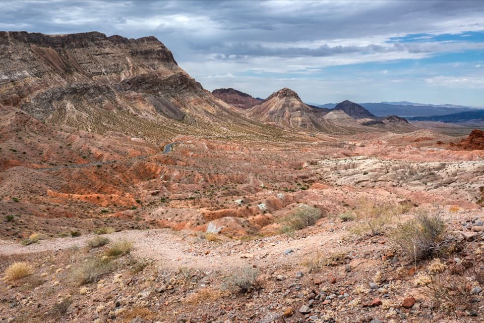
The payoff is about 500 yards of twisting, water-polished canyon. Layered walls in cream, orange, peach, red, and purple rise steeply around the wash, and the passage narrows to roughly four or five feet in places. The slot winds through several turns before opening suddenly into a wider valley; that upper opening is the sensible turnaround for this trail. A photo looking along one of the bends catches more of the folded walls than a close shot of the rock alone.

A mining route through an older landscapeThe approach passes old mine-road traces, short ore-cart tunnels cut through rock fins, and…

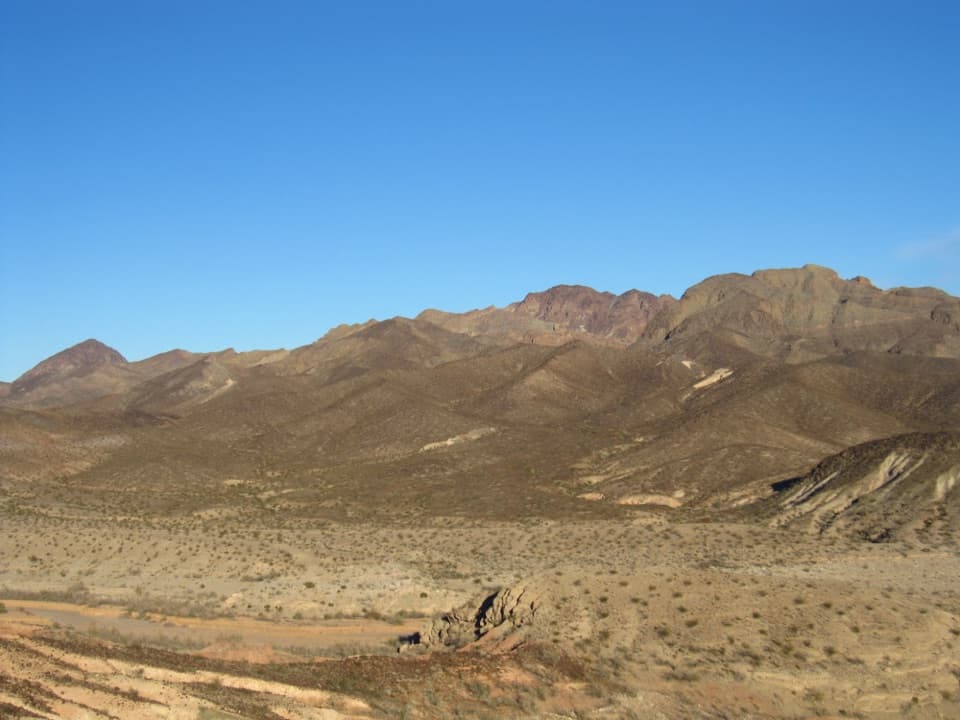
The approach passes old mine-road traces, short ore-cart tunnels cut through rock fins, and remnants of a dam and ore-loading works. Anniversary Mine produced borax, including colemanite, in the 1920s. These remains explain why the route follows a rough industrial corridor before reaching the narrows, but the mine openings are hazardous and are not part of the hike. The canyon walls expose tilted sedimentary layers deposited as mud in an ancient lakebed and later lifted and eroded into the ridges that Lovell Wash cuts through.

Heat and flash floodsThe route has little shade, so summer heat makes it a poor choice; cooler weather is much more…

The route has little shade, so summer heat makes it a poor choice; cooler weather is much more comfortable. Do not enter the narrows when rain threatens anywhere in the drainage. Flash floods can run through the confined slot, and pools in the wash change after floods, so water in the canyon is neither reliable nor a safe source. No dependable drinking-water stop is documented along the route. Stay out of every mine opening and keep to the wash rather than climbing onto fragile slopes.

Wildlife

Wildlife in Lake Mead

All Lake Mead wildlife maps

Sighting maps show where each species has been reported across Lake Mead. Wildlife moves, so no sighting is guaranteed.

Keep exploring

Near Anniversary Narrows Trail

See it all on the map

Trails that start nearby

Places near the trailhead

Parkwolf’s Lake Mead ranking

Top-rated trails in Lake Mead

All 42 trails
  1. 1Historic Railroad TrailEasy · 7.5 mi
  2. 3Liberty Bell Arch TrailChallenging · 5.5 mi
  3. 4Arizona Hot Spring TrailChallenging · 5 mi
  4. 5Owl Canyon TrailModerate · 2.2 mi
  5. 6Fortification Hill TrailChallenging · 4 mi
  6. 7Grapevine Canyon Petroglyph TrailEasy · 0.6 mi

Take Parkwolf to Lake Mead.

The audio tour guide for the drive, plus offline maps, trails, and wildlife heatmaps for when the signal drops.

4.7 from 8,600+ ratings

Download Parkwolf on the App StoreGet Parkwolf on Google Play