
Place · 0.9 mi away
Moderate
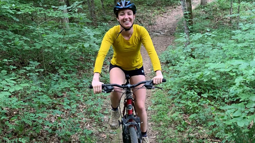
The North Loop is the mellower half of Mammoth Cave’s Big Hollow singletrack system—purpose-built for mountain biking but just as enjoyable on foot. It’s a 5.3-mile loop of dirt singletrack with gentle grades, plenty of shade, and a few playful features. Expect easy-to-moderate climbs, rolling ridgelines, and classic karst-country scenery: wooded hollows, sinkhole-dotted slopes, and seasonal drainages.
Plan for 5.3 miles on the loop itself. Most visitors access it from Maple Springs Trailhead via a 1-mile approach each way on the Maple Springs Trail to reach the Big Hollow junction. If you’re just sampling the system, the North Loop is the right call; a signed shortcut on the loop can trim roughly 1.1 miles if you’re short on time or energy.
Under tire or boot, the tread is mostly smooth dirt with embedded rocks and roots in spots. There’s a flat log bridge (with a clear bypass) and steady, easy-to-intermediate ups and downs. On the east side you’ll dip toward small drainages; on the west, expect rolling ridgeline travel. In fall, acorns can act like tiny marbles on corners—ride and hike accordingly.
This is a multi-use trail shared with mountain bikers (and the Maple Springs approach allows horses, though horses do not use Big Hollow). Be ready to yield appropriately and communicate at passes. The trail drains well but can get muddy after rain; skip it when soft or during freeze–thaw cycles unless the ground is fully frozen—using it then ruts the tread. You’ll find the loop generally well signed, but the shortcut junction can be confusing; stay alert if your goal is to complete the full loop clockwise.
Park at Maple Springs Trailhead on the north side of the Green River and take the signed approach. The Green River Ferry can be a time-saver when running; when it’s not, the detour drive is much longer, so check status before you go. For paper navigation, the detailed waterproof map sold at the Visitor Center is far more useful than the free brochure map if you’re linking loops.
Spring and fall offer the most comfortable temps and leaf-filtered light through the hardwoods—great for both hiking and riding. Summer is fully shaded but can be buggy and humid after rains; start early. In fall, mind those acorns on hardpack. After heavy rain or in shoulder-season freeze–thaw, give the trail a rest.
If you want more challenge, tack on the Connector to the South Loop for rockier sections, optional drops and B-lines, and steeper grades. If you prefer to keep it mellow, stick with the North Loop’s flow and use the shortcut to tailor mileage.
Park at Maple Springs Trailhead (north side of the Green River). Reach the loop via a 1-mile approach on the Maple Springs Trail. If the Green River Ferry is down, the drive around from the Visitor Center is much longer—check status before you go.
Multi-use trail with bikes; communicate and yield properly. Skip the trail when muddy or during freeze–thaw unless fully frozen. Watch for slick acorns in fall and a few narrow ridgeline sections where off-trail slips have consequences.
Place · 0.9 mi away
Place · 1 mi away
Place · 2.1 mi away
Place · 2.2 mi away
Moderate · 0.8 mi away
Moderate · 2.3 mi away
Moderate · 2.4 mi away
Easy · 2.5 mi away

Parkwolf Tour Guide
