Best time to go
November may bring interesting fall color in the canopy and the water vegetation, which pairs well with reflections off the swamp. Pair it with other Parkway stops rather than driving out for this alone.

#2 of 49 sights in Natchez Trace
Sight · Natchez Trace Parkway
Boardwalk loop through bald cypress, tupelo, and still water
Overview
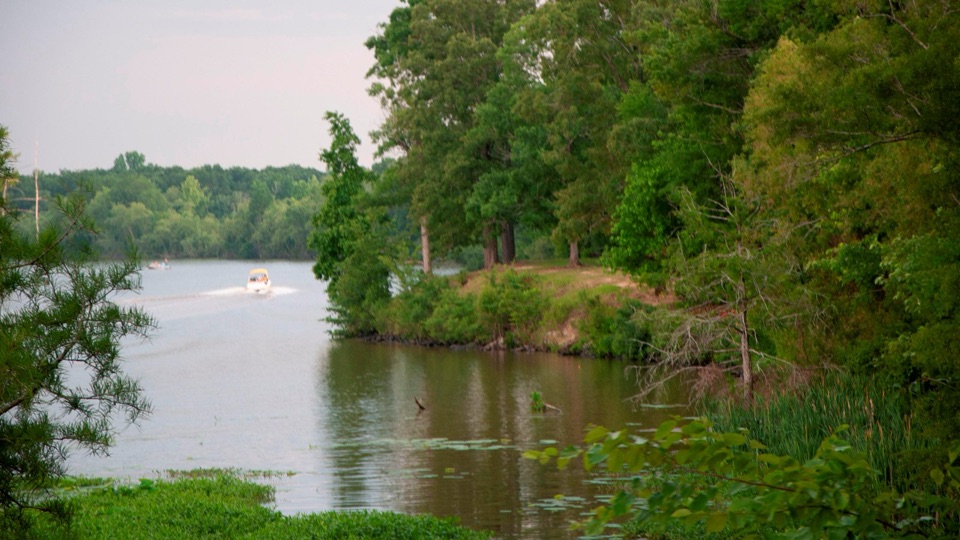
This is an abandoned channel of the Pearl River, left behind when the river shifted course and dropped sediment across its old bed. Shallow standing water let water tupelo and bald cypress take root, and a raised boardwalk carries you out over it.
 Parkwolf’s verdictWhy stop
Map
Plan your stop

The highest, rockiest slopes around here are a summer buffet for grizzly bears.
Natchez Trace Tour Guide
Parkwolf is a GPS audio tour guide for Natchez Trace Parkway. As you drive, it chimes in with what’s ahead: hidden gems, upcoming stops, history, geology, and wildlife, right through your car’s speakers.
Recorded for this place
Cypress Swamp and River Bend“You're coming up on Cypress Swamp, where a short boardwalk takes you into an old channel of the Pearl River. When the river shifted course, shallow water remained, and bald cypress and water tupelo took root.”
Plays as you drive up to Cypress Swamp in the Parkwolf Natchez Trace Tour Guide.
More stories near here in the app
“Fantastic app with many points of information… It’s great to just turn on while you’re driving and it gives you an audio tour of the national Park. We love it!!!!”


Guide
Directly across the paved Parkway is the trailhead for the Yockanookany Section of the Natchez Trace National Scenic Trail. That is a different hike from the swamp loop: 14.1 miles south to the West Florida Boundary, 8.9 miles north to the Yockanookany Trailhead, or any out-and-back distance you choose. Do not confuse the two if you only have a few minutes.
This is a brief read-and-walk stop, not a half-day destination. Some visitors find insects unpleasant, so carrying repellent is a reasonable precaution even though conditions vary.
Wildlife
 39 sightingsAmerican AlligatorMost seen around 6 PMSighting map
 35 sightingsWhite-tailed DeerMost seen around 7 AMSighting map
 53 sightingsWild TurkeyMost seen around 7 AMSighting map
 28 sightingsGreat Blue HeronMost seen around 6 PMSighting map
 29 sightingsRed-headed WoodpeckerMost seen around 7 AMSighting map
 32 sightingsTurkey VultureMost seen around noonSighting map
Sighting maps show where each species has been reported across Natchez Trace. Wildlife moves, so no sighting is guaranteed.
Parkwolf’s Natchez Trace ranking
The audio tour guide for the drive, plus offline maps, trails, and wildlife heatmaps for when the signal drops.