Glenrock Branch Picnic Area in Natchez Trace Parkway

Picnic area · Natchez Trace Parkway

Glenrock Branch Picnic Area

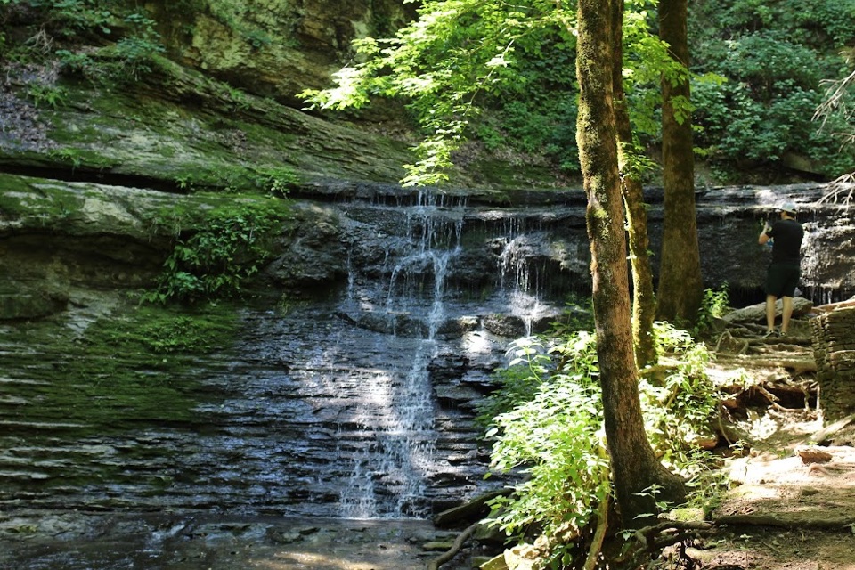
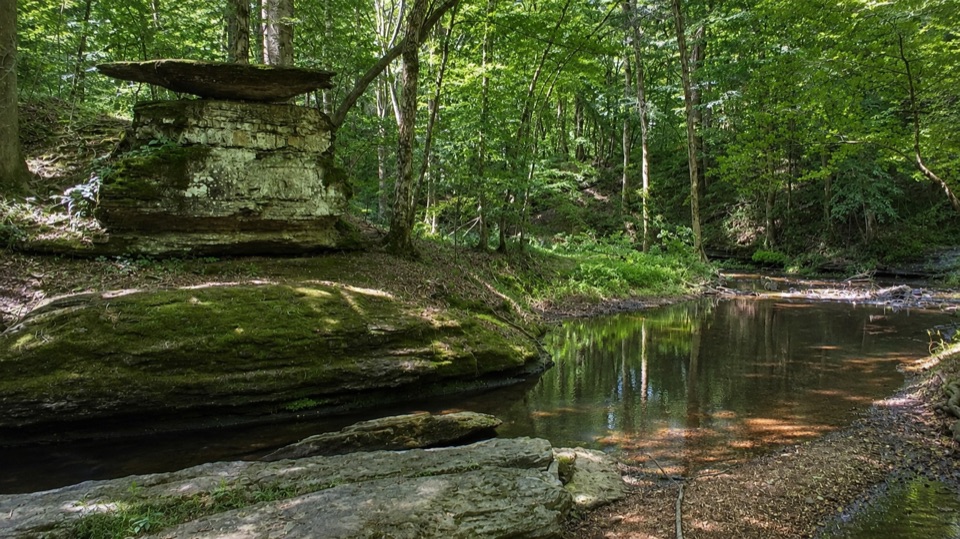
Shaded creekside picnic tables tucked beneath layered limestone ledges

Type
Picnic area
Audio stories
2 nearby
  • Picnic tables
  • Restrooms
  • Parking

Hear the audio tour

Who Cooks for You?

Overview

About Glenrock Branch Picnic Area

Why stop

  • Layered limestone ledges and a clear creek make a memorable picnic setting

Heads up

  • Steep descent to the best creekside tables
Glenrock Branch sits at milepost 364.5 and is one of the more pleasant short breaks on this stretch of the Parkway. A small stream runs through a shaded hardwood pocket, and a bluff of layered limestone ledges curves around the picnic area so the whole spot feels tucked in and separate from the road. It is a modest stop rather than a destination, and most people spend somewhere around 10 to 30 minutes here.
Parkwolf’s verdictWhy stop

Map

Where it is

Loading the Natchez Trace map
Full map
Picnic areaGlenrock Branch Picnic Area35.25458, -87.63194
Keep this map with you offline in the Parkwolf app

Plan your stop

Before you go

Best time to go

Visit in daylight. Late morning and late afternoon give softer light that works well in the shaded creek bed, when the canopy is not fighting harsh overhead sun. Midday can leave you with strong contrast between bright water and deep shade.

Access and safety

Take the walk down slowly, especially carrying a cooler or a bag. Once you are at the water, keep in mind that the boulders can be slippery, which matters most with kids or anyone in smooth-soled shoes. Restrooms are on site, with running water and accessible stalls in both the women's and men's buildings, but availability at this stop has often been unreliable, so it is worth having a backup plan for the next few miles.

4 active Natchez Trace alerts

  • ClosureParkway sections closed for bridge and road constructionTwo Natchez Trace Parkway sections are closed to through traffic; follow the signed detours.Official details
  • ClosureMount Locust historic stand closedThe historic stand at Mount Locust Inn & Plantation (MP 15.5) is closed because of structural concerns.Official details
See all 4 alerts
A park ranger sits on a dash-mounted phone, talking, as Parkwolf’s Tour Guide plays “Army Cutworm Moths: A Grizzly Bear Buffet” on Grand Loop Road below Dunraven Pass in Yellowstone
Parkwolf Tour GuideThe highest, rockiest slopes around here are a summer buffet for grizzly bears.

Natchez Trace Tour Guide

Your drive to Glenrock Branch Picnic Area, narrated.

Parkwolf is a GPS audio tour guide for Natchez Trace Parkway. As you drive, it chimes in with what’s ahead: hidden gems, upcoming stops, history, geology, and wildlife, right through your car’s speakers.

Recorded for this area

Who Cooks for You?
0:00 / 0:28
“An owl can be easier to hear than to see along the Trace. The barred owl's call sounds like, 'Who cooks for you? Who cooks for you all?”

Plays on the road 0.7 mi from Glenrock Branch Picnic Area in the Parkwolf Natchez Trace Tour Guide.

More stories near here in the app

  • Where Stone Becomes Sand
  • Three Shapes, One Tree
  • The Forest's Uneven Harvest
  • A Reply in the Grass
  • 272 audio storiesacross Natchez Trace’s roads, triggered by GPS as you drive
  • Wildlife heatmapsfor American Alligator, White-tailed Deer, Wild Turkey, and 9 more
  • Works offlinemaps, 26 trails, 62 places, and audio download before you lose signal
  • CarPlay readysimple controls built for the drive
★★★★★
“Fantastic app with many points of information… It’s great to just turn on while you’re driving and it gives you an audio tour of the national Park. We love it!!!!”
JMJamesApp Store review
Download Parkwolf on the App StoreGet Parkwolf on Google Play

4.7 from 8,600+ ratings

Guide

More about Glenrock Branch Picnic Area

What you will seeThe creek is clear and reflective, with rock shelves and boulders along its edge and a broad…

The creek is clear and reflective, with rock shelves and boulders along its edge and a broad slab of caprock standing out in the bluff. It is a quiet, low-key scene: water moving over stone under a canopy of trees. Come for the picnic and the creek itself, since that is what this stop is built around.

Upper area versus the lower tablesThe facilities are split by grade.

The facilities are split by grade. Up near the parking area there is a paved accessible picnic site with one standard table and a pedestal grill, right beside the restroom building. Parking is unstriped, but the space closest to the restrooms is marked with the International Symbol of Accessibility.

The better scenery is below. Five more tables and three pedestal grills sit down at the stream's edge, and the route to them is steep. Those lower tables are not an accessible option, so if grade is a concern, plan on using the paved site up top.

Honest drawbacksThis is a small roadside picnic area, not a waterfall, overlook, or major attraction.

This is a small roadside picnic area, not a waterfall, overlook, or major attraction. If you cannot manage the steep walk down, you are left with one table near the parking lot, and the view from up there is much plainer than the creekside setting people remember.

Wildlife

Wildlife in Natchez Trace

All Natchez Trace wildlife maps

Sighting maps show where each species has been reported across Natchez Trace. Wildlife moves, so no sighting is guaranteed.

Parkwolf’s Natchez Trace ranking

Top sights in Natchez Trace

All 62 places
  1. 1Double Arch Bridge at Birdsong HollowSight
  2. 2Cypress SwampSight
  3. 3Jackson FallsSight
  4. 4Emerald MoundSight
  5. 5Reservoir OverlookSight
  6. 6Mount Locust Historic HouseSight

Take Parkwolf to Natchez Trace.

The audio tour guide for the drive, plus offline maps, trails, and wildlife heatmaps for when the signal drops.

4.7 from 8,600+ ratings

Download Parkwolf on the App StoreGet Parkwolf on Google Play