Tennessee-Tombigbee Waterway Picnic Area in Natchez Trace Parkway

Picnic area · Natchez Trace Parkway

Tennessee-Tombigbee Waterway Picnic Area

Shaded tables beside a working shipping canal, with bridge views

Photo: National Park Service
Type
Picnic area
Nearest trail
Right here
Audio stories
3 nearby
  • Exhibit
  • Parking
  • Picnic tables
  • Scenic viewpoint

Hear the audio tour

Tennessee-Tombigbee Waterway

Overview

About Tennessee-Tombigbee Waterway Picnic Area

Why stop

  • Bridge, waterway, and quiet views feel distinctive on the Trace
  • Shaded setting works well for a short break

Heads up

  • Sharp drop at the water needs close supervision
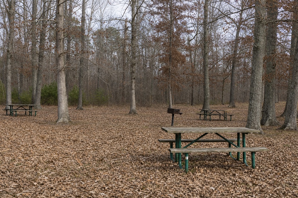
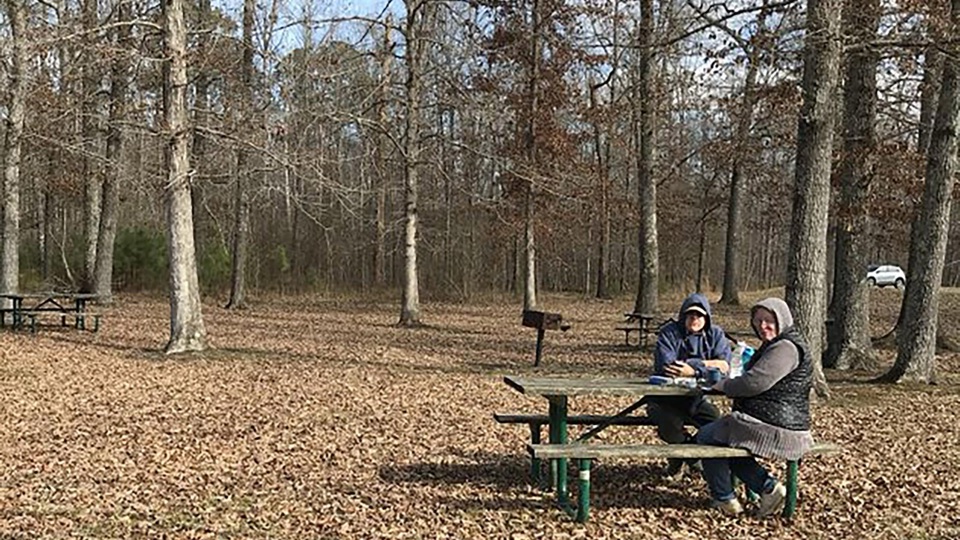
This is a quick, low-effort break at milepost 293.2 with a payoff most picnic pullouts can't match: you're parked on a short loop road with water on both sides, roughly a mile south of the Jamie Whitten Lock and Dam. Four tables sit in shade, there's one grill, and the view is a 234-mile navigation canal rather than a roadside lawn.
Parkwolf’s verdictWhy stop here

Map

Where it is

Loading the Natchez Trace map
Full map
Picnic areaTennessee-Tombigbee Waterway Picnic Area34.50547, -88.32180
Keep this map with you offline in the Parkwolf app

Plan your stop

Before you go

Best time to go

Morning and late afternoon are the friendlier hours for photos, when lower light works better on the water surface and gives the bridge some shape instead of flat midday glare. Allow enough time to walk out to the signs, read them, and see whether anything is moving through the channel.

Safety and access

  • There is a sharp drop to the water. Keep close hold of kids and stay back from the edge.
  • Dogs must be leashed.
  • The sidewalk has small hills at both ends, and the tables and trails do not meet ADA/ABA standards, so plan accordingly if mobility is a concern.
  • Parking handles cars as well as buses and RVs.
  • Treat this as a picnic and viewing stop. Bring whatever water and food you need with you.

4 active Natchez Trace alerts

  • ClosureParkway sections closed for bridge and road constructionTwo Natchez Trace Parkway sections are closed to through traffic; follow the signed detours.Official details
  • ClosureMount Locust historic stand closedThe historic stand at Mount Locust Inn & Plantation (MP 15.5) is closed because of structural concerns.Official details
See all 4 alerts
A park ranger sits on a dash-mounted phone, talking, as Parkwolf’s Tour Guide plays “Army Cutworm Moths: A Grizzly Bear Buffet” on Grand Loop Road below Dunraven Pass in Yellowstone
Parkwolf Tour GuideThe highest, rockiest slopes around here are a summer buffet for grizzly bears.

Natchez Trace Tour Guide

Your drive to Tennessee-Tombigbee Waterway Picnic Area, narrated.

Parkwolf is a GPS audio tour guide for Natchez Trace Parkway. As you drive, it chimes in with what’s ahead: hidden gems, upcoming stops, history, geology, and wildlife, right through your car’s speakers.

Recorded for this place

Tennessee-Tombigbee Waterway
0:00 / 0:28
“You're coming up on the Tennessee-Tombigbee Waterway picnic area, a shaded break beside a working shipping canal.”

Plays as you drive up to Tennessee-Tombigbee Waterway Picnic Area in the Parkwolf Natchez Trace Tour Guide.

More stories near here in the app

  • The Congressman at the Crossing
  • The Bridge in the Foreman's Album
  • The Eagle Without a White Head
  • The Forest Behind the Canal
  • 272 audio storiesacross Natchez Trace’s roads, triggered by GPS as you drive
  • Wildlife heatmapsfor American Alligator, White-tailed Deer, Wild Turkey, and 9 more
  • Works offlinemaps, 26 trails, 62 places, and audio download before you lose signal
  • CarPlay readysimple controls built for the drive
★★★★★
“Fantastic app with many points of information… It’s great to just turn on while you’re driving and it gives you an audio tour of the national Park. We love it!!!!”
JMJamesApp Store review
Download Parkwolf on the App StoreGet Parkwolf on Google Play

4.7 from 8,600+ ratings

Guide

More about Tennessee-Tombigbee Waterway Picnic Area

What you'll see and doEat in the shade at one of four picnic tables, with a single grill if you're cooking.
  • Eat in the shade at one of four picnic tables, with a single grill if you're cooking.
  • Walk the 475-foot paved sidewalk out to interpretive signs that explain how the waterway works and why it was built.
  • Watch the channel. Visitors often mention barge traffic and long, quiet water views from the bank.
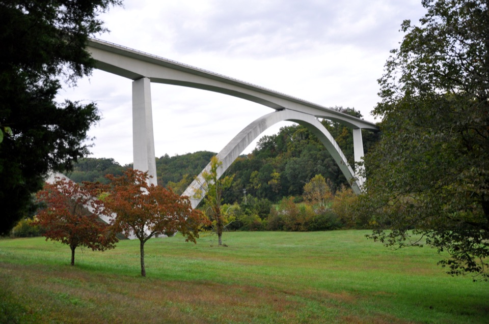
  • Look up at the bridge. The Parkway crosses here on the Jamie L. Whitten Bridge, which frames the water in both directions.
The canal behind the viewEverything you're looking at is engineered.

Everything you're looking at is engineered. The Tennessee-Tombigbee Waterway links the Tennessee River near Pickwick Lake with the Tombigbee and Black Warrior system at Demopolis, Alabama, opening a water route from middle Tennessee all the way to the Gulf of Mexico. Proposals circulated for generations before construction finally began in 1972, and the waterway opened in 1985 after 13 years of work. Jamie L. Whitten, whose name is on the bridge and the lock and dam, was instrumental in pushing through both this canal and the Parkway itself.

Knowing that changes the stop. The still water, the straight banks, and the scale of the crossing are the point.

Wildlife

Wildlife in Natchez Trace

All Natchez Trace wildlife maps

Sighting maps show where each species has been reported across Natchez Trace. Wildlife moves, so no sighting is guaranteed.

Parkwolf’s Natchez Trace ranking

Top sights in Natchez Trace

All 62 places
  1. 1Double Arch Bridge at Birdsong HollowSight
  2. 2Cypress SwampSight
  3. 3Jackson FallsSight
  4. 4Emerald MoundSight
  5. 5Reservoir OverlookSight
  6. 6Mount Locust Historic HouseSight

Take Parkwolf to Natchez Trace.

The audio tour guide for the drive, plus offline maps, trails, and wildlife heatmaps for when the signal drops.

4.7 from 8,600+ ratings

Download Parkwolf on the App StoreGet Parkwolf on Google Play